Estimated Value: $174,000 - $218,000
3
Beds
1
Bath
1,147
Sq Ft
$173/Sq Ft
Est. Value
About This Home
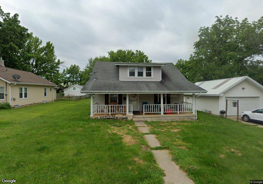
This home is located at 105 5th St, Troy, MO 63379 and is currently estimated at $198,958, approximately $173 per square foot. 105 5th St is a home located in Lincoln County with nearby schools including Main Street Elementary School, Troy Middle School, and Troy Buchanan High School.
Ownership History
Date
Name
Owned For
Owner Type
Purchase Details
Closed on
Sep 6, 2017
Sold by
Wilhoit Ronnie G and Wilhoit Rebecca S
Bought by
Wilhoit Robert
Current Estimated Value
Home Financials for this Owner
Home Financials are based on the most recent Mortgage that was taken out on this home.
Original Mortgage
$84,000
Outstanding Balance
$70,184
Interest Rate
3.92%
Mortgage Type
New Conventional
Estimated Equity
$128,774
Purchase Details
Closed on
Feb 17, 2012
Sold by
Fannie Mae
Bought by
Wilhoit Ronnie G and Wilhoit Rebecca S
Purchase Details
Closed on
Apr 20, 2007
Sold by
Deutsche Bank National Trust
Bought by
Lakas Richard C and Lakes Melissa A
Purchase Details
Closed on
Jan 8, 2007
Sold by
Lakes Richard C and Lakes Melissa A
Bought by
Baugh Eric
Create a Home Valuation Report for This Property
The Home Valuation Report is an in-depth analysis detailing your home's value as well as a comparison with similar homes in the area
Home Values in the Area
Average Home Value in this Area
Purchase History
| Date | Buyer | Sale Price | Title Company |
|---|---|---|---|
| Wilhoit Robert | -- | Meyer Title Company | |
| Wilhoit Ronnie G | -- | None Available | |
| Lakas Richard C | -- | First American Title Insuran | |
| Baugh Eric | -- | None Available |
Source: Public Records
Mortgage History
| Date | Status | Borrower | Loan Amount |
|---|---|---|---|
| Open | Wilhoit Robert | $84,000 |
Source: Public Records
Tax History
| Year | Tax Paid | Tax Assessment Tax Assessment Total Assessment is a certain percentage of the fair market value that is determined by local assessors to be the total taxable value of land and additions on the property. | Land | Improvement |
|---|---|---|---|---|
| 2025 | $1,049 | $16,700 | $2,802 | $13,898 |
| 2024 | $924 | $14,440 | $1,723 | $12,717 |
| 2023 | $919 | $14,440 | $1,723 | $12,717 |
| 2022 | $871 | $13,623 | $1,723 | $11,900 |
| 2021 | $862 | $70,630 | $0 | $0 |
| 2020 | $778 | $63,600 | $0 | $0 |
| 2019 | $779 | $63,600 | $0 | $0 |
| 2018 | $813 | $12,460 | $0 | $0 |
| 2017 | $815 | $12,460 | $0 | $0 |
| 2016 | $691 | $10,283 | $0 | $0 |
| 2015 | $693 | $10,283 | $0 | $0 |
| 2014 | $705 | $10,446 | $0 | $0 |
| 2013 | -- | $9,489 | $0 | $0 |
Source: Public Records
Map
Nearby Homes
- 218 John St
- 971 Boone St
- 1091 Boone St
- 340 Kemper St
- 904 2nd St
- 151 Colonial Ln
- 701 Cap Au Gris St
- 2489 Oak Forest Dr
- 0 Penn Unit 16017625
- N Lincoln Dr ( 52+ - Acres)
- 996 Huntington Dr
- 896 E Cherry St
- 105 Hickory Dr
- 0 Merlin Dr Unit xx 21006708
- 158 Hickory Dr
- 0 Turnbull Trail (1-3+ - Acres)
- 0 Mac Unit MIS26002263
- 101 Kensington Palace Dr
- 0 Turnbull Trail (4-7+ - Acres)
- 157 Sweetgum Dr