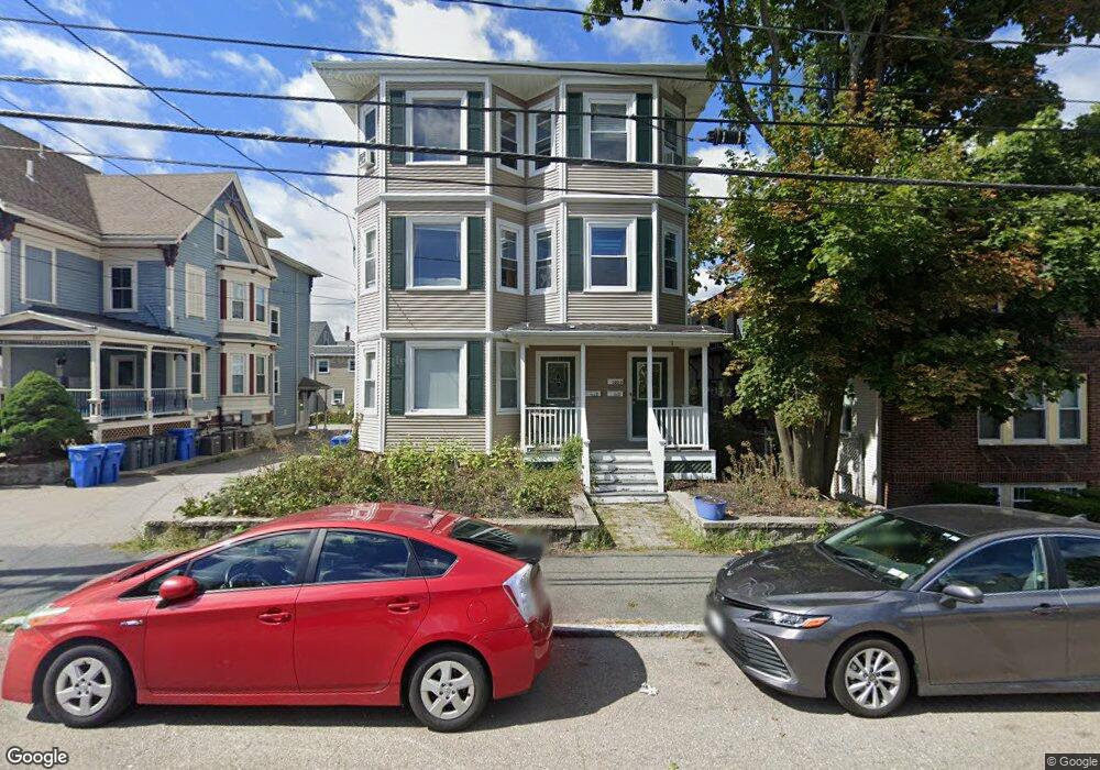
105 Adams St Unit 2 Waltham, MA 02453
South Side NeighborhoodEstimated Value: $605,446 - $681,000
3
Beds
1
Bath
1,300
Sq Ft
$490/Sq Ft
Est. Value
About This Home
This home is located at 105 Adams St Unit 2, Waltham, MA 02453 and is currently estimated at $636,862, approximately $489 per square foot. 105 Adams St Unit 2 is a home located in Middlesex County with nearby schools including Henry Whittemore Elementary School, John W. Mcdevitt Middle School, and Waltham Sr High School.
Ownership History
Date
Name
Owned For
Owner Type
Purchase Details
Closed on
Jun 25, 2004
Sold by
Scheufele Eric and Scheufele Kristine A
Bought by
Goodall Brendan C
Current Estimated Value
Home Financials for this Owner
Home Financials are based on the most recent Mortgage that was taken out on this home.
Original Mortgage
$252,000
Outstanding Balance
$126,718
Interest Rate
6.32%
Mortgage Type
Purchase Money Mortgage
Estimated Equity
$510,144
Create a Home Valuation Report for This Property
The Home Valuation Report is an in-depth analysis detailing your home's value as well as a comparison with similar homes in the area
Home Values in the Area
Average Home Value in this Area
Purchase History
| Date | Buyer | Sale Price | Title Company |
|---|---|---|---|
| Goodall Brendan C | $315,000 | -- |
Source: Public Records
Mortgage History
| Date | Status | Borrower | Loan Amount |
|---|---|---|---|
| Open | Goodall Brendan C | $252,000 |
Source: Public Records
Tax History Compared to Growth
Tax History
| Year | Tax Paid | Tax Assessment Tax Assessment Total Assessment is a certain percentage of the fair market value that is determined by local assessors to be the total taxable value of land and additions on the property. | Land | Improvement |
|---|---|---|---|---|
| 2025 | $4,401 | $448,200 | $0 | $448,200 |
| 2024 | $4,269 | $442,800 | $0 | $442,800 |
| 2023 | $4,379 | $424,300 | $0 | $424,300 |
| 2022 | $4,596 | $412,600 | $0 | $412,600 |
| 2021 | $4,597 | $406,100 | $0 | $406,100 |
| 2020 | $5,387 | $450,800 | $0 | $450,800 |
| 2019 | $4,051 | $320,000 | $0 | $320,000 |
| 2018 | $4,035 | $320,000 | $0 | $320,000 |
| 2017 | $4,019 | $320,000 | $0 | $320,000 |
| 2016 | $3,437 | $280,800 | $0 | $280,800 |
| 2015 | $3,682 | $280,400 | $0 | $280,400 |
Source: Public Records
Map
Nearby Homes
- 29 Cherry St Unit 2
- 15 Alder St Unit 1
- 659 Moody St Unit 2
- 85 Crescent St
- 6 Cushing St Unit 1
- 55-57 Crescent St
- 40 Myrtle St Unit 9
- 61 Hall St Unit 9
- 61 Hall St Unit 7
- 42 Alder St
- 73 Orange St Unit 2
- 5-7 Chester Ave
- 81 Alder St
- 31-37 Washington Ave
- 25 Tolman St Unit 2
- 24 Tolman St Unit A
- 39 Floyd St Unit 2
- 308 Newton St Unit 1
- 138 Myrtle St Unit 2
- 7-11.5 Felton
- 105 Adams St Unit 3
- 105 Adams St Unit 1
- 105 Adams St Unit 14
- 105 Adams St Unit 2
- 105 Adams St Unit 95-02
- 105 Adams St Unit 95-2
- 105 Adams St
- 105 Adams St Unit 6
- 105 Adams St Unit 8
- 103 Adams St Unit 1
- 95 Adams St
- 95 Adams St Unit 3
- 95 Adams St Unit 95-12
- 95 Adams St Unit 3
- 95 Adams St Unit 8
- 95 Adams St Unit 6
- 95 Adams St Unit 14
- 95 Adams St Unit 9
- 95 Adams St Unit 5
- 95 Adams St Unit 17