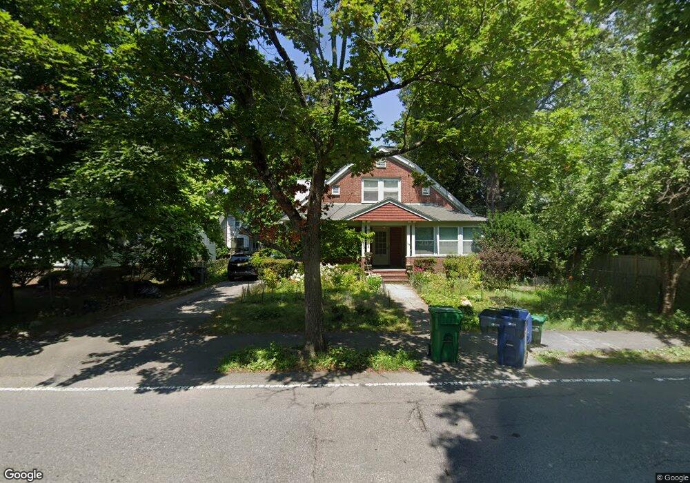
105 Auburn St Auburndale, MA 02466
West Newton NeighborhoodEstimated Value: $1,454,000 - $1,533,000
3
Beds
3
Baths
2,446
Sq Ft
$610/Sq Ft
Est. Value
About This Home
This home is located at 105 Auburn St, Auburndale, MA 02466 and is currently estimated at $1,491,683, approximately $609 per square foot. 105 Auburn St is a home located in Middlesex County with nearby schools including Williams Elementary School, Charles E Brown Middle School, and Newton South High School.
Ownership History
Date
Name
Owned For
Owner Type
Purchase Details
Closed on
Feb 25, 2000
Sold by
Uttaro Ann C
Bought by
Shifrin Victor I and Apekina Yekaterina
Current Estimated Value
Create a Home Valuation Report for This Property
The Home Valuation Report is an in-depth analysis detailing your home's value as well as a comparison with similar homes in the area
Home Values in the Area
Average Home Value in this Area
Purchase History
| Date | Buyer | Sale Price | Title Company |
|---|---|---|---|
| Shifrin Victor I | $401,000 | -- |
Source: Public Records
Mortgage History
| Date | Status | Borrower | Loan Amount |
|---|---|---|---|
| Open | Shifrin Victor I | $319,000 |
Source: Public Records
Tax History Compared to Growth
Tax History
| Year | Tax Paid | Tax Assessment Tax Assessment Total Assessment is a certain percentage of the fair market value that is determined by local assessors to be the total taxable value of land and additions on the property. | Land | Improvement |
|---|---|---|---|---|
| 2025 | $10,304 | $1,051,400 | $878,100 | $173,300 |
| 2024 | $9,332 | $956,100 | $852,500 | $103,600 |
| 2023 | $8,652 | $849,900 | $653,200 | $196,700 |
| 2022 | $8,278 | $786,900 | $604,800 | $182,100 |
| 2021 | $3,559 | $742,400 | $570,600 | $171,800 |
| 2020 | $15,341 | $742,400 | $570,600 | $171,800 |
| 2019 | $14,320 | $720,800 | $554,000 | $166,800 |
| 2018 | $3,221 | $642,700 | $502,000 | $140,700 |
| 2017 | $6,742 | $606,300 | $473,600 | $132,700 |
| 2016 | $6,448 | $566,600 | $442,600 | $124,000 |
| 2015 | $6,147 | $529,500 | $413,600 | $115,900 |
Source: Public Records
Map
Nearby Homes
- 13 Weir St
- 51 Bourne St
- 17 Gilbert St
- 1639 Washington St
- 0 Duncan Rd Unit 72925240
- 62-64 Rowe St Unit B
- 17 Crescent St
- 10 Crescent St Unit 1
- 10 Crescent St Unit 2
- 226 Auburn St Unit 226
- 224 Auburn St Unit 224
- 224 Auburn St Unit A
- 283 Woodland Rd
- 1488 Washington St Unit 1488
- 1754 Washington St
- 160 Pine St Unit 12
- 283 Melrose St
- 17 Lasell St
- 90 Auburndale Ave
- 40 Sewall St
- 99
- 109 Auburn St Unit 1
- 11 Normandy Rd
- 97 Auburn St
- 15 Normandy Rd
- 121 Crescent St
- 106 Auburn St
- 117 Crescent St
- 19 Normandy Rd
- 92 Auburn St
- 92 Auburn St Unit 92
- 94 Auburn St
- 94 Auburn St Unit 94
- 12 Normandy Rd
- 20 Greenough St Unit 22
- 123 Auburn St
- 123 Auburn St Unit A
- 123 Auburn St Unit 1
- 85 Auburn St
- 22 Greenough St Unit 1