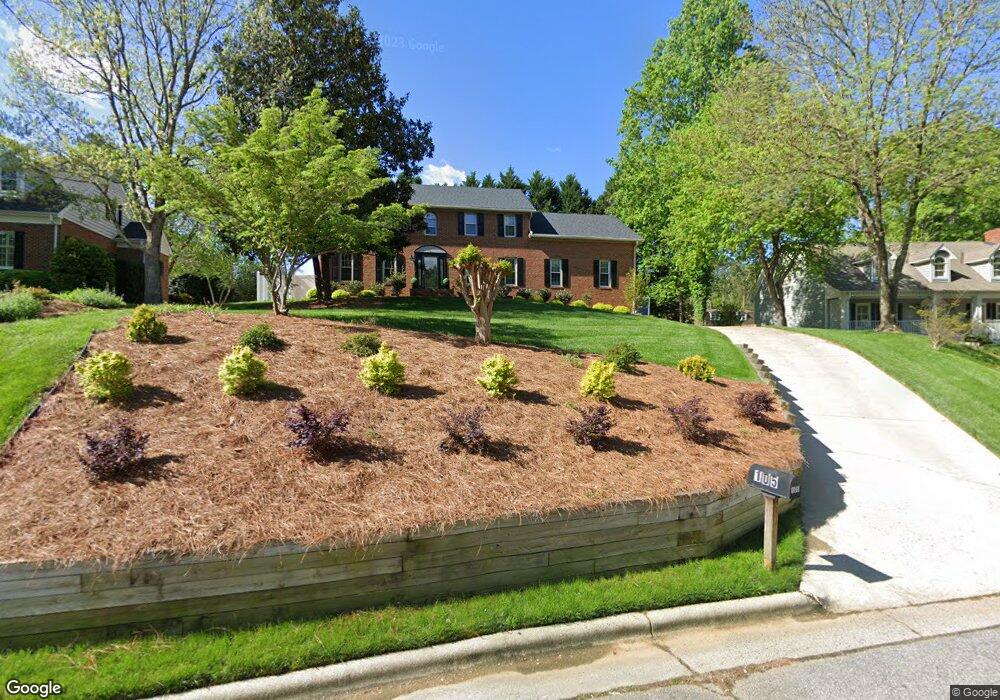
105 Brantmere Ct Jamestown, NC 27282
Estimated Value: $416,424 - $448,000
3
Beds
3
Baths
2,296
Sq Ft
$189/Sq Ft
Est. Value
About This Home
This home is located at 105 Brantmere Ct, Jamestown, NC 27282 and is currently estimated at $433,356, approximately $188 per square foot. 105 Brantmere Ct is a home located in Guilford County with nearby schools including Florence Elementary School, Southwest Guilford Middle School, and Southwest Guilford High School.
Ownership History
Date
Name
Owned For
Owner Type
Purchase Details
Closed on
Oct 14, 1999
Sold by
Hunnicutt John M and Hunnicutt Cindy C
Bought by
Odom George Allen and Odom Valosha M
Current Estimated Value
Home Financials for this Owner
Home Financials are based on the most recent Mortgage that was taken out on this home.
Original Mortgage
$203,300
Outstanding Balance
$59,839
Interest Rate
7.5%
Estimated Equity
$373,517
Create a Home Valuation Report for This Property
The Home Valuation Report is an in-depth analysis detailing your home's value as well as a comparison with similar homes in the area
Home Values in the Area
Average Home Value in this Area
Purchase History
| Date | Buyer | Sale Price | Title Company |
|---|---|---|---|
| Odom George Allen | $214,000 | -- |
Source: Public Records
Mortgage History
| Date | Status | Borrower | Loan Amount |
|---|---|---|---|
| Open | Odom George Allen | $203,300 |
Source: Public Records
Tax History Compared to Growth
Tax History
| Year | Tax Paid | Tax Assessment Tax Assessment Total Assessment is a certain percentage of the fair market value that is determined by local assessors to be the total taxable value of land and additions on the property. | Land | Improvement |
|---|---|---|---|---|
| 2025 | $3,877 | $286,000 | $60,000 | $226,000 |
| 2024 | $3,877 | $286,000 | $60,000 | $226,000 |
| 2023 | $3,877 | $286,000 | $60,000 | $226,000 |
| 2022 | $3,476 | $286,000 | $60,000 | $226,000 |
| 2021 | $2,988 | $245,800 | $60,000 | $185,800 |
| 2020 | $2,988 | $245,800 | $60,000 | $185,800 |
| 2019 | $2,946 | $245,800 | $0 | $0 |
| 2018 | $2,931 | $245,800 | $0 | $0 |
| 2017 | $2,946 | $245,800 | $0 | $0 |
| 2016 | $2,672 | $220,800 | $0 | $0 |
| 2015 | $2,711 | $220,800 | $0 | $0 |
| 2014 | $2,735 | $220,800 | $0 | $0 |
Source: Public Records
Map
Nearby Homes
- 101 Byrnwood Dr
- 312 Quarterpath Ln
- 107 Brookberry Dr
- 120 Brookberry Dr
- 602 Oneil Dr
- 205 Tangle Dr
- 104 Ragsdale Rd
- 201 Ragsdale Rd
- 207 Forestdale Dr
- LINVILLE Plan at Kinsley - The Meadows
- BRISTOL Plan at Kinsley - The Villas
- DOVER Plan at Kinsley - The Villas
- SAVANNAH Plan at Kinsley - The Meadows
- WINSTON Plan at Kinsley - The Preserve
- WILMINGTON Plan at Kinsley - The Preserve
- CLIFTON Plan at Kinsley - The Villas
- COLUMBIA Plan at Kinsley - The Preserve
- HAYDEN Plan at Kinsley - The Preserve
- PENWELL Plan at Kinsley - The Preserve
- AZALEA Plan at Kinsley - The Villas
- 103 Brantmere Ct
- 107 Brantmere Ct
- 100 Brantmere Ct
- 109 Brantmere Ct
- 109 Stafford Oak Dr
- 111 Stafford Oak Dr
- 107 Stafford Oak Dr
- 104 Brantmere Ct
- 106 E Fork Rd
- 100 E Fork Rd
- 100 Burrows Rd
- 102 Burrows Rd
- 105 Stafford Oak Dr
- 107 Burrows Rd
- 200 Quarterpath Ln
- 112 Stafford Oak Dr
- 110 Stafford Oak Dr
- 202 Quarterpath Ln
- 204 Quarterpath Ln
- 104 Burrows Rd