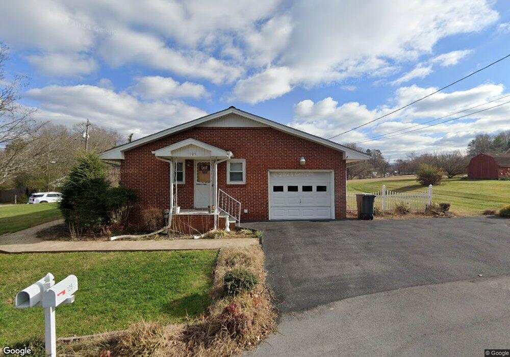
105 Brookdale Dr Johnson City, TN 37601
Estimated Value: $233,000 - $301,000
3
Beds
1
Bath
1,488
Sq Ft
$179/Sq Ft
Est. Value
About This Home
This home is located at 105 Brookdale Dr, Johnson City, TN 37601 and is currently estimated at $266,571, approximately $179 per square foot. 105 Brookdale Dr is a home with nearby schools including Elizabethton High School, Munsey Kindergarten, and Central Baptist Preschool & Kindergarten.
Ownership History
Date
Name
Owned For
Owner Type
Purchase Details
Closed on
Dec 13, 2024
Sold by
Lane Karen Elaine
Bought by
Boyd Ryan T and Vance Lillian R
Current Estimated Value
Home Financials for this Owner
Home Financials are based on the most recent Mortgage that was taken out on this home.
Original Mortgage
$193,500
Outstanding Balance
$191,958
Interest Rate
6.72%
Mortgage Type
New Conventional
Estimated Equity
$74,613
Purchase Details
Closed on
Sep 11, 2008
Sold by
Parks Glenda V
Bought by
Hutsell Glen
Purchase Details
Closed on
Nov 30, 1995
Bought by
Parks Robert L and Parks Glenda V
Purchase Details
Closed on
Aug 6, 1974
Bought by
Mckinney Orpha M L and Mckinney E
Create a Home Valuation Report for This Property
The Home Valuation Report is an in-depth analysis detailing your home's value as well as a comparison with similar homes in the area
Home Values in the Area
Average Home Value in this Area
Purchase History
| Date | Buyer | Sale Price | Title Company |
|---|---|---|---|
| Boyd Ryan T | $215,000 | None Listed On Document | |
| Boyd Ryan T | $215,000 | None Listed On Document | |
| Hutsell Glen | $140,000 | -- | |
| Parks Robert L | $65,500 | -- | |
| Mckinney Orpha M L | -- | -- |
Source: Public Records
Mortgage History
| Date | Status | Borrower | Loan Amount |
|---|---|---|---|
| Open | Boyd Ryan T | $193,500 | |
| Closed | Boyd Ryan T | $193,500 |
Source: Public Records
Tax History Compared to Growth
Tax History
| Year | Tax Paid | Tax Assessment Tax Assessment Total Assessment is a certain percentage of the fair market value that is determined by local assessors to be the total taxable value of land and additions on the property. | Land | Improvement |
|---|---|---|---|---|
| 2024 | $1,168 | $35,400 | $6,800 | $28,600 |
| 2023 | $1,168 | $35,400 | $0 | $0 |
| 2022 | $1,275 | $35,400 | $6,800 | $28,600 |
| 2021 | $719 | $35,400 | $6,800 | $28,600 |
| 2020 | $1,343 | $35,400 | $6,800 | $28,600 |
| 2019 | $1,343 | $31,100 | $8,000 | $23,100 |
| 2018 | $1,325 | $31,100 | $8,000 | $23,100 |
| 2017 | $1,325 | $31,100 | $8,000 | $23,100 |
| 2016 | $1,319 | $31,100 | $8,000 | $23,100 |
| 2015 | $1,322 | $31,100 | $8,000 | $23,100 |
| 2014 | $1,365 | $31,975 | $8,000 | $23,975 |
Source: Public Records
Map
Nearby Homes
- 197 Woodland Dr
- Tbd Swadley Rd
- 188 Arlington Dr
- 907 Cedar Grove Rd
- 515 Pilgrim Ct Unit D
- 515 Pilgrim Ct Unit B
- 0000 Plymouth Rd
- 518 Pilgrim Ct Unit D
- 506 Pilgrim Ct Unit B
- 504 Pilgrim Ct Unit D
- 500 Pilgrim Ct Unit B
- 1012 Kingston Ct
- 1704 Orlando Dr
- 322 Preservation Cir
- 137 Unaka View Rd
- 9 Lynn Terrace Ct
- 212 Mayflower Rd
- 805 E Maple St
- 3303 Martin Farm Rd
- 101 Glaze Farm Way
- 104/104A Brookdale Dr
- 104 Brookdale Dr
- 1233 Milligan Hwy
- 1225 Milligan Hwy
- 101 Shenandoah Dr
- 13 Woodland Rd Unit 13
- 116 Brookdale Dr
- 100 Park Ct
- 109 Woodland Rd
- 102 Shenandoah Dr
- 103 Park Ct
- 105 Woodland Rd
- 109 Woodland Dr
- 102 Park Ct
- 1209 Milligan Hwy
- 105 Park Ct
- 1210 Milligan Hwy
- 111 Woodland Rd
- 110 Shenandoah Dr
- 1253 Milligan Hwy