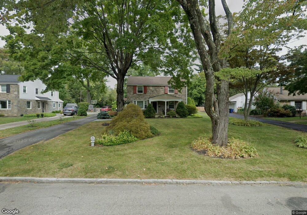
105 Browning Ln Bryn Mawr, PA 19010
Estimated Value: $1,212,000 - $1,633,000
4
Beds
4
Baths
2,716
Sq Ft
$521/Sq Ft
Est. Value
About This Home
This home is located at 105 Browning Ln, Bryn Mawr, PA 19010 and is currently estimated at $1,414,315, approximately $520 per square foot. 105 Browning Ln is a home located in Delaware County with nearby schools including Radnor El School, Radnor Middle School, and Radnor Senior High School.
Ownership History
Date
Name
Owned For
Owner Type
Purchase Details
Closed on
Jun 3, 2025
Sold by
Womer Constance G and Womer Terese R
Bought by
Womer Constance G and Womer Terese R
Current Estimated Value
Purchase Details
Closed on
Nov 23, 2002
Sold by
Womer William H and Womer Terese R
Bought by
Womer Constance G and Womer Terese R
Purchase Details
Closed on
Dec 24, 2001
Sold by
The Katharine R Womer Family Trust
Bought by
Womer William H and Womer Terese R
Purchase Details
Closed on
May 13, 1997
Sold by
Womer Katharine R
Bought by
The Katharine R Womer Family Trust
Create a Home Valuation Report for This Property
The Home Valuation Report is an in-depth analysis detailing your home's value as well as a comparison with similar homes in the area
Home Values in the Area
Average Home Value in this Area
Purchase History
| Date | Buyer | Sale Price | Title Company |
|---|---|---|---|
| Womer Constance G | -- | None Listed On Document | |
| Womer Constance G | -- | -- | |
| Womer William H | -- | -- | |
| The Katharine R Womer Family Trust | -- | -- |
Source: Public Records
Tax History Compared to Growth
Tax History
| Year | Tax Paid | Tax Assessment Tax Assessment Total Assessment is a certain percentage of the fair market value that is determined by local assessors to be the total taxable value of land and additions on the property. | Land | Improvement |
|---|---|---|---|---|
| 2025 | $12,516 | $619,060 | $221,760 | $397,300 |
| 2024 | $12,516 | $619,060 | $221,760 | $397,300 |
| 2023 | $12,020 | $619,060 | $221,760 | $397,300 |
| 2022 | $11,889 | $619,060 | $221,760 | $397,300 |
| 2021 | $19,097 | $619,060 | $221,760 | $397,300 |
| 2020 | $12,037 | $346,030 | $125,950 | $220,080 |
| 2019 | $11,698 | $346,030 | $125,950 | $220,080 |
| 2018 | $11,468 | $346,030 | $0 | $0 |
| 2017 | $11,228 | $346,030 | $0 | $0 |
| 2016 | $1,899 | $346,030 | $0 | $0 |
| 2015 | $1,938 | $346,030 | $0 | $0 |
| 2014 | $1,938 | $346,030 | $0 | $0 |
Source: Public Records
Map
Nearby Homes
- 219 S Ithan Ave
- 7 Lockwood Ln
- 4 Lockwood Ln
- 3 Lockwood Ln
- 200 S Ithan Ave
- 12 Lockwood Ln
- 12 Chalous Ln
- 15 Lockwood Ln
- 131 Fairfax Rd
- 189 Meredith Ave
- 406 Barclay Rd
- 68 Garrett Ave
- 1030 E Lancaster Ave Unit 216
- 1030 E Lancaster Ave Unit 702
- 1030 E Lancaster Ave Unit 923
- 101 Highfield Rd
- 100 Radnor Ave
- 253 Ithan Creek Rd
- 215 Cornell Dr
- 1962 Montgomery Ave
- 107 Browning Ln
- 103 Browning Ln
- 109 Browning Ln
- 27 Meadowood Rd
- 25 Meadowood Rd
- 29 Meadowood Rd
- 108 Browning Ln
- 106 Browning Ln
- 23 Meadowood Rd
- 111 Browning Ln
- 110 Browning Ln
- 104 Browning Ln
- 217 S Ithan Ave
- 21 Meadowood Rd
- 221 S Ithan Ave
- 112 Browning Ln
- 102 Browning Ln
- 207 S Ithan Ave
- 113 Browning Ln
- 231 S Ithan Ave