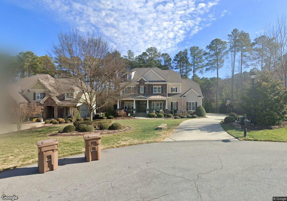
105 Colt Bridge Ct Unit Lt80 Cary, NC 27519
Green Level NeighborhoodEstimated Value: $1,648,000 - $1,779,000
5
Beds
5
Baths
4,340
Sq Ft
$396/Sq Ft
Est. Value
About This Home
This home is located at 105 Colt Bridge Ct Unit Lt80, Cary, NC 27519 and is currently estimated at $1,718,673, approximately $396 per square foot. 105 Colt Bridge Ct Unit Lt80 is a home located in Wake County with nearby schools including White Oak Elementary School, Mills Park Middle School, and Green Level High School.
Ownership History
Date
Name
Owned For
Owner Type
Purchase Details
Closed on
Jun 26, 2019
Sold by
Castro Ronald and Alvarado Rodriguez Sherry A
Bought by
Mcmillan Michael and Mcmillan Katie E
Current Estimated Value
Home Financials for this Owner
Home Financials are based on the most recent Mortgage that was taken out on this home.
Original Mortgage
$776,000
Outstanding Balance
$682,341
Interest Rate
4%
Mortgage Type
New Conventional
Estimated Equity
$1,036,332
Purchase Details
Closed on
Aug 9, 2013
Sold by
Woodard Builders Inc
Bought by
Castro Ronald and Rodriguez Sherry A Alvarado
Home Financials for this Owner
Home Financials are based on the most recent Mortgage that was taken out on this home.
Original Mortgage
$633,500
Interest Rate
4.48%
Mortgage Type
New Conventional
Purchase Details
Closed on
Jun 7, 2012
Sold by
Copperleaf Investors Llc
Bought by
Woodard Builders Inc
Create a Home Valuation Report for This Property
The Home Valuation Report is an in-depth analysis detailing your home's value as well as a comparison with similar homes in the area
Home Values in the Area
Average Home Value in this Area
Purchase History
| Date | Buyer | Sale Price | Title Company |
|---|---|---|---|
| Mcmillan Michael | $970,000 | None Available | |
| Castro Ronald | $853,500 | None Available | |
| Woodard Builders Inc | $175,000 | None Available |
Source: Public Records
Mortgage History
| Date | Status | Borrower | Loan Amount |
|---|---|---|---|
| Open | Mcmillan Michael | $776,000 | |
| Previous Owner | Castro Ronald | $633,500 |
Source: Public Records
Tax History Compared to Growth
Tax History
| Year | Tax Paid | Tax Assessment Tax Assessment Total Assessment is a certain percentage of the fair market value that is determined by local assessors to be the total taxable value of land and additions on the property. | Land | Improvement |
|---|---|---|---|---|
| 2025 | $13,179 | $1,535,295 | $340,000 | $1,195,295 |
| 2024 | $12,893 | $1,535,295 | $340,000 | $1,195,295 |
| 2023 | $9,598 | $955,875 | $250,000 | $705,875 |
| 2022 | $9,239 | $955,875 | $250,000 | $705,875 |
| 2021 | $9,053 | $955,875 | $250,000 | $705,875 |
| 2020 | $9,101 | $955,875 | $250,000 | $705,875 |
| 2019 | $9,175 | $855,078 | $170,000 | $685,078 |
| 2018 | $8,608 | $855,078 | $170,000 | $685,078 |
| 2017 | $8,272 | $855,078 | $170,000 | $685,078 |
| 2016 | $8,148 | $855,078 | $170,000 | $685,078 |
| 2015 | $7,984 | $808,959 | $156,000 | $652,959 |
| 2014 | $7,527 | $156,000 | $156,000 | $0 |
Source: Public Records
Map
Nearby Homes
- 1001 Overdrift Ln
- 7208 Ryehill Dr
- 4109 Piney Gap Dr
- 500 Windboard St
- 6017 Mentmore Place
- Ashdale Plan at Millstone
- Stoneridge Plan at Millstone
- Dunmore Plan at Millstone
- Halstead Plan at Millstone
- 105 Jessfield Place
- 512 Windboard St
- 525 Windboard St
- 1021 Ferson Rd
- 1012 Holland Bend Dr
- 301 Crayton Oak Dr
- 1020 Holland Bend Dr
- 841 Money Island Place
- 424 Powers Ferry Rd
- 2125 Princeville Dr
- 2013 Austin Pond Dr
- 105 Colt Bridge Ct
- 109 Colt Bridge Ct Unit LT79
- 109 Colt Bridge Ct
- 6857 Palaver Ln Unit Lt81
- 6857 Palaver Ln
- 108 Colt Bridge Ct
- 6853 Palaver Ln
- 6901 Palaver Ln
- 6849 Palaver Ln Unit LT83
- 6858 Palaver Ln
- 6905 Palaver Ln Unit LT76
- 6848 Palaver Ln Unit LT100
- 6848 Palaver Ln
- 6845 Palaver Ln
- 6845 Palaver Ln Unit Lot84
- 6909 Palaver Ln
- 6904 Palaver Ln
- 6904 Palaver Ln Unit Lt102
- 6836 Palaver Ln Unit LT99
- 6836 Palaver Ln