Estimated Value: $224,427 - $280,000
3
Beds
2
Baths
1,616
Sq Ft
$156/Sq Ft
Est. Value
About This Home
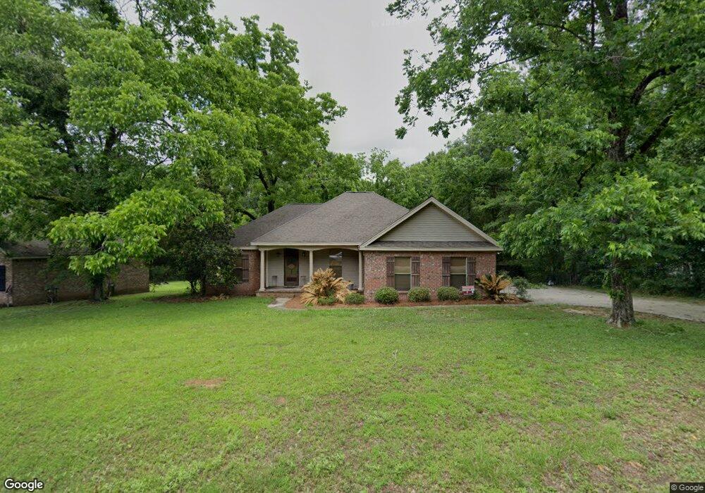
This home is located at 105 Corinth Rd, Petal, MS 39465 and is currently estimated at $251,357, approximately $155 per square foot. 105 Corinth Rd is a home located in Forrest County with nearby schools including Petal Primary School, Petal Elementary School, and Petal Upper Elementary School.
Ownership History
Date
Name
Owned For
Owner Type
Purchase Details
Closed on
Oct 3, 2025
Sold by
Polk James E and Polk Bertie S
Bought by
Polk James E and Polk Bertie S
Current Estimated Value
Purchase Details
Closed on
Mar 15, 2022
Sold by
Meagan Polk
Bought by
Polk Meagan and Polk Bertie Sue
Home Financials for this Owner
Home Financials are based on the most recent Mortgage that was taken out on this home.
Original Mortgage
$147,000
Interest Rate
3.85%
Mortgage Type
Balloon
Purchase Details
Closed on
Dec 21, 2017
Sold by
Polk Meagan
Bought by
Polk Meagan
Purchase Details
Closed on
Nov 30, 2016
Sold by
Polk Meagan
Bought by
Polk Meagan and Toussaint Chase
Purchase Details
Closed on
Dec 4, 2013
Sold by
Polk Meagan and Polk Bertie S
Bought by
Polk Meagan
Purchase Details
Closed on
Apr 9, 2009
Sold by
Sanford Samuel Kevin and Sanford Holly Elizabeth
Bought by
Pace Ann M
Home Financials for this Owner
Home Financials are based on the most recent Mortgage that was taken out on this home.
Original Mortgage
$149,737
Interest Rate
5.05%
Create a Home Valuation Report for This Property
The Home Valuation Report is an in-depth analysis detailing your home's value as well as a comparison with similar homes in the area
Home Values in the Area
Average Home Value in this Area
Purchase History
| Date | Buyer | Sale Price | Title Company |
|---|---|---|---|
| Polk James E | -- | None Listed On Document | |
| Polk Meagan | -- | Bc Law Firm Pa | |
| Polk Meagan | -- | -- | |
| Polk Meagan | -- | -- | |
| Polk Meagan | -- | -- | |
| Pace Ann M | -- | -- |
Source: Public Records
Mortgage History
| Date | Status | Borrower | Loan Amount |
|---|---|---|---|
| Previous Owner | Polk Meagan | $147,000 | |
| Previous Owner | Pace Ann M | $149,737 |
Source: Public Records
Tax History
| Year | Tax Paid | Tax Assessment Tax Assessment Total Assessment is a certain percentage of the fair market value that is determined by local assessors to be the total taxable value of land and additions on the property. | Land | Improvement |
|---|---|---|---|---|
| 2024 | $2,176 | $14,034 | $0 | $0 |
| 2023 | $2,439 | $140,340 | $0 | $0 |
| 2022 | $2,105 | $14,034 | $0 | $0 |
| 2021 | $2,117 | $14,034 | $0 | $0 |
| 2020 | $2,052 | $13,583 | $0 | $0 |
| 2019 | $2,048 | $13,583 | $0 | $0 |
| 2018 | $2,052 | $13,583 | $0 | $0 |
| 2017 | $2,077 | $13,583 | $0 | $0 |
| 2016 | $1,976 | $13,127 | $0 | $0 |
| 2015 | $1,943 | $131,274 | $0 | $0 |
| 2014 | $1,925 | $13,127 | $0 | $0 |
Source: Public Records
Map
Nearby Homes
- Lot 29 Clinton Dr
- 304 Margaret Ave
- 135 Meadowood St
- 144 Corinth Rd
- 000 Dawson Cut Off
- 113 Sun Cir
- 207 E 8th Ave
- 34 Country Park Cir
- 902 S Main St
- 1101 S Main St
- 201 Smith St
- 303 Petal Dr
- Lot 254 Petal Dr
- 211 Waller St
- 115 Smith St
- 102 Smith St
- 1408 Carterville Rd
- 118 van Slyke Ln
- 54 Pinewood Dr
- 1424 Carterville Rd
Your Personal Tour Guide
Ask me questions while you tour the home.