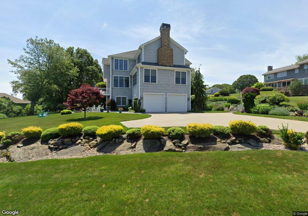
105 Crosswynds Dr Saunderstown, RI 02874
Estimated Value: $2,437,000 - $2,786,000
4
Beds
4
Baths
4,877
Sq Ft
$530/Sq Ft
Est. Value
About This Home
This home is located at 105 Crosswynds Dr, Saunderstown, RI 02874 and is currently estimated at $2,587,103, approximately $530 per square foot. 105 Crosswynds Dr is a home located in Washington County with nearby schools including Narragansett Elementary School, Narragansett Pier Middle School, and Narragansett High School.
Ownership History
Date
Name
Owned For
Owner Type
Purchase Details
Closed on
May 4, 2007
Sold by
Williams Bret D and Williams Lisa G
Bought by
Jackman Earl F and Jackson Barbara A
Current Estimated Value
Purchase Details
Closed on
Jan 21, 2005
Sold by
Perry Roger M
Bought by
Williams Bret D and Williams Lisa G
Home Financials for this Owner
Home Financials are based on the most recent Mortgage that was taken out on this home.
Original Mortgage
$350,000
Interest Rate
5.71%
Mortgage Type
Purchase Money Mortgage
Create a Home Valuation Report for This Property
The Home Valuation Report is an in-depth analysis detailing your home's value as well as a comparison with similar homes in the area
Home Values in the Area
Average Home Value in this Area
Purchase History
| Date | Buyer | Sale Price | Title Company |
|---|---|---|---|
| Jackman Earl F | $590,000 | -- | |
| Williams Bret D | $535,000 | -- |
Source: Public Records
Mortgage History
| Date | Status | Borrower | Loan Amount |
|---|---|---|---|
| Previous Owner | Williams Bret D | $350,000 |
Source: Public Records
Tax History Compared to Growth
Tax History
| Year | Tax Paid | Tax Assessment Tax Assessment Total Assessment is a certain percentage of the fair market value that is determined by local assessors to be the total taxable value of land and additions on the property. | Land | Improvement |
|---|---|---|---|---|
| 2025 | $13,799 | $2,032,200 | $867,400 | $1,164,800 |
| 2024 | $13,311 | $2,032,200 | $867,400 | $1,164,800 |
| 2023 | $13,418 | $1,441,200 | $619,700 | $821,500 |
| 2022 | $12,971 | $1,441,200 | $619,700 | $821,500 |
| 2021 | $12,769 | $1,441,200 | $619,700 | $821,500 |
| 2020 | $12,237 | $1,167,700 | $558,800 | $608,900 |
| 2019 | $11,946 | $1,167,700 | $558,800 | $608,900 |
| 2018 | $11,619 | $1,167,700 | $558,800 | $608,900 |
| 2017 | $11,503 | $1,089,300 | $550,800 | $538,500 |
| 2016 | $10,980 | $1,089,300 | $550,800 | $538,500 |
| 2015 | $10,828 | $1,089,300 | $550,800 | $538,500 |
| 2014 | $11,433 | $1,138,700 | $605,900 | $532,800 |
Source: Public Records
Map
Nearby Homes
- 18 Anawan Ave
- 49 Meadow Sweet Trail
- 137 Bonnet Shores Rd
- 20 Anchorage Rd
- 55 Bonnet Shores Rd
- 47 Wake Robin Trail
- 12 Overlook Rd
- 53 Bonnet Shores Rd
- 51 Bonnet Shores Rd
- 51 Osceola Ave
- 91 Bonnet Point Rd
- 18 Lakeview Dr
- 297 Walmsley Ln
- 0 Betty Dr
- 64 Juniper Trail
- 74 Bayberry Rd
- 45 Leonard Bodwell Rd
- 10 Highland Rd
- 80 Old Pine Rd
- 416 Bridgetown Rd
- 95 Crosswynds Dr
- 115 Crosswynds Dr
- 52 Horizon Dr
- 60 Horizon Dr
- 42 Horizon Dr
- 100 Crosswynds Dr
- 85 Crosswynds Dr
- 0 Seaside Ave Unit 934580
- 0 Seaside Ave Unit 934582
- 90 Crosswynds Dr
- 110 Crosswynds Dr
- 36 Horizon Dr
- 19 Sea Ridge Dr
- 80 Crosswynds Dr
- 51 Sea Ridge Dr
- 75 Crosswynds Dr
- 0 Horizon Dr
- 22 Horizon Dr
- 61 Horizon Dr
- 70 Crosswynds Dr