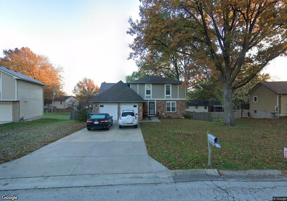
105 Daisy St Lansing, KS 66043
Estimated Value: $301,658 - $571,000
4
Beds
3
Baths
1,836
Sq Ft
$207/Sq Ft
Est. Value
About This Home
This home is located at 105 Daisy St, Lansing, KS 66043 and is currently estimated at $379,415, approximately $206 per square foot. 105 Daisy St is a home located in Leavenworth County with nearby schools including Lansing Elementary School, Lansing Middle 6-8, and Lansing High 9-12.
Ownership History
Date
Name
Owned For
Owner Type
Purchase Details
Closed on
May 15, 2015
Sold by
Jbmckee Properties Llc
Bought by
Ernzen Jared R and Ernzen Emilia K
Current Estimated Value
Home Financials for this Owner
Home Financials are based on the most recent Mortgage that was taken out on this home.
Original Mortgage
$174,325
Outstanding Balance
$134,537
Interest Rate
3.73%
Mortgage Type
New Conventional
Estimated Equity
$244,878
Create a Home Valuation Report for This Property
The Home Valuation Report is an in-depth analysis detailing your home's value as well as a comparison with similar homes in the area
Home Values in the Area
Average Home Value in this Area
Purchase History
| Date | Buyer | Sale Price | Title Company |
|---|---|---|---|
| Ernzen Jared R | $218,006 | Kansas Secured Title |
Source: Public Records
Mortgage History
| Date | Status | Borrower | Loan Amount |
|---|---|---|---|
| Open | Ernzen Jared R | $174,325 |
Source: Public Records
Tax History
| Year | Tax Paid | Tax Assessment Tax Assessment Total Assessment is a certain percentage of the fair market value that is determined by local assessors to be the total taxable value of land and additions on the property. | Land | Improvement |
|---|---|---|---|---|
| 2025 | $4,238 | $32,522 | $4,930 | $27,592 |
| 2024 | $3,943 | $31,693 | $3,907 | $27,786 |
| 2023 | $3,943 | $30,474 | $3,907 | $26,567 |
| 2022 | $3,791 | $27,704 | $3,012 | $24,692 |
| 2021 | $3,465 | $24,127 | $3,012 | $21,115 |
| 2020 | $3,339 | $22,885 | $3,012 | $19,873 |
| 2019 | $3,501 | $21,766 | $3,012 | $18,754 |
| 2018 | $2,974 | $20,401 | $2,497 | $17,904 |
| 2017 | $2,847 | $19,502 | $2,497 | $17,005 |
| 2016 | $2,820 | $19,309 | $2,497 | $16,812 |
| 2015 | $1,707 | $15,008 | $2,497 | $12,511 |
| 2014 | $2,130 | $15,008 | $2,497 | $12,511 |
Source: Public Records
Map
Nearby Homes
- 00000 Brookwood St
- 20958 Ida St
- 530 Holiday Ct
- 950 Holiday Dr
- 124 S Main St
- 1017 Pebble Beach Dr
- 202 S Main St
- 1101 Pebble Beach Dr
- 114 Emile St
- 26731 147th St
- 134 Debra St
- Lot 2 Eisenhower Rd
- 503 S 1st St
- 1102 N Main St
- 4 Eisenhower Rd
- 218 E Kay St
- 728 Eisenhower Rd
- 1100 N 4th St
- 215 E Mary St
- 1102 N 4th St
- 107 Daisy St
- 103 Daisy St
- 124 Brookridge St
- 122 Brookridge St
- 700 Englewood St
- 702 Englewood St
- 101 Daisy St
- 102 Daisy St
- 104 Daisy St
- 126 Brookridge St
- 106 Daisy St
- 100 Daisy St
- 123 Brookridge St
- 127 Brookridge St
- 704 Englewood St
- 121 Brookridge St
- 129 Brookridge St
- 121 Ferncliff St
- 119 Ferncliff St
- 701 Englewood St
Your Personal Tour Guide
Ask me questions while you tour the home.