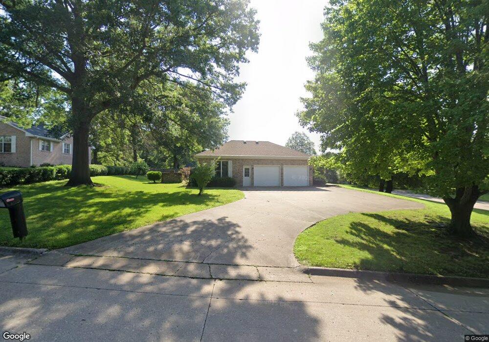
105 Deerpath Ln Muscatine, IA 52761
Estimated Value: $334,000 - $400,000
3
Beds
4
Baths
2,472
Sq Ft
$144/Sq Ft
Est. Value
About This Home
This home is located at 105 Deerpath Ln, Muscatine, IA 52761 and is currently estimated at $355,275, approximately $143 per square foot. 105 Deerpath Ln is a home located in Muscatine County with nearby schools including Grant Elementary School, Central Middle School, and Muscatine High School.
Ownership History
Date
Name
Owned For
Owner Type
Purchase Details
Closed on
Jul 16, 2025
Sold by
Goedken Brian
Bought by
Bruns Rebecca N and Bruns Lucas W
Current Estimated Value
Home Financials for this Owner
Home Financials are based on the most recent Mortgage that was taken out on this home.
Original Mortgage
$147,000
Outstanding Balance
$146,747
Interest Rate
6.77%
Mortgage Type
New Conventional
Estimated Equity
$208,528
Create a Home Valuation Report for This Property
The Home Valuation Report is an in-depth analysis detailing your home's value as well as a comparison with similar homes in the area
Home Values in the Area
Average Home Value in this Area
Purchase History
| Date | Buyer | Sale Price | Title Company |
|---|---|---|---|
| Bruns Rebecca N | $330,000 | None Listed On Document |
Source: Public Records
Mortgage History
| Date | Status | Borrower | Loan Amount |
|---|---|---|---|
| Open | Bruns Rebecca N | $147,000 |
Source: Public Records
Tax History Compared to Growth
Tax History
| Year | Tax Paid | Tax Assessment Tax Assessment Total Assessment is a certain percentage of the fair market value that is determined by local assessors to be the total taxable value of land and additions on the property. | Land | Improvement |
|---|---|---|---|---|
| 2025 | $6,964 | $386,940 | $62,170 | $324,770 |
| 2024 | $6,964 | $384,110 | $62,170 | $321,940 |
| 2023 | $6,230 | $368,435 | $62,169 | $306,266 |
| 2022 | $5,754 | $327,670 | $58,650 | $269,020 |
| 2021 | $5,754 | $290,920 | $58,650 | $232,270 |
| 2020 | $6,050 | $296,710 | $58,980 | $237,730 |
| 2019 | $6,136 | $286,310 | $0 | $0 |
| 2018 | $6,050 | $286,310 | $0 | $0 |
| 2017 | $6,274 | $286,310 | $0 | $0 |
| 2016 | $6,278 | $286,310 | $0 | $0 |
| 2015 | $6,278 | $270,220 | $0 | $0 |
| 2014 | $5,954 | $270,220 | $0 | $0 |
Source: Public Records
Map
Nearby Homes
- 3 Wilson Dr
- 35 Colony Dr
- 297 Burnside Ave
- 108 Middle Rd
- 205 Amherst Ave
- 2106 Clarabek St
- 2108 Clarabek St
- 709 Leroy St
- 606 Leroy St
- 310 Wood Creek Ln
- 603 Aspen Trail
- 601 Aspen Trail
- 0 Aspen Trail
- 2018 W Bay Dr
- 1807 Mulberry Ave
- 1014 Wier St
- LOT 6 Fridley Subdivision
- CEDAR Plaza Parcel
- 602 W Fulliam Ave
- 241 Dillaway St
- 2806 Termini Dr
- 109 Deerpath Ln
- 2801 Termini Dr
- 2803 Termini Dr
- 104 Deer Path Ln
- 104 Deerpath Ln
- 2809 Termini Dr
- 2617 Termini Dr
- 2805 Termini Dr
- 2807 Termini Dr
- 113 Deerpath Ln
- 2811 Termini Dr
- 2615 Termini Dr
- 2902 Termini Dr Unit 203
- 2902 Termini Dr Unit 101
- 2902 Termini Dr Unit 104
- 2902 Termini Dr Unit 102
- 2902 Termini Dr Unit 103
- 2902 Termini Dr Unit 202
- 2813 Termini Dr