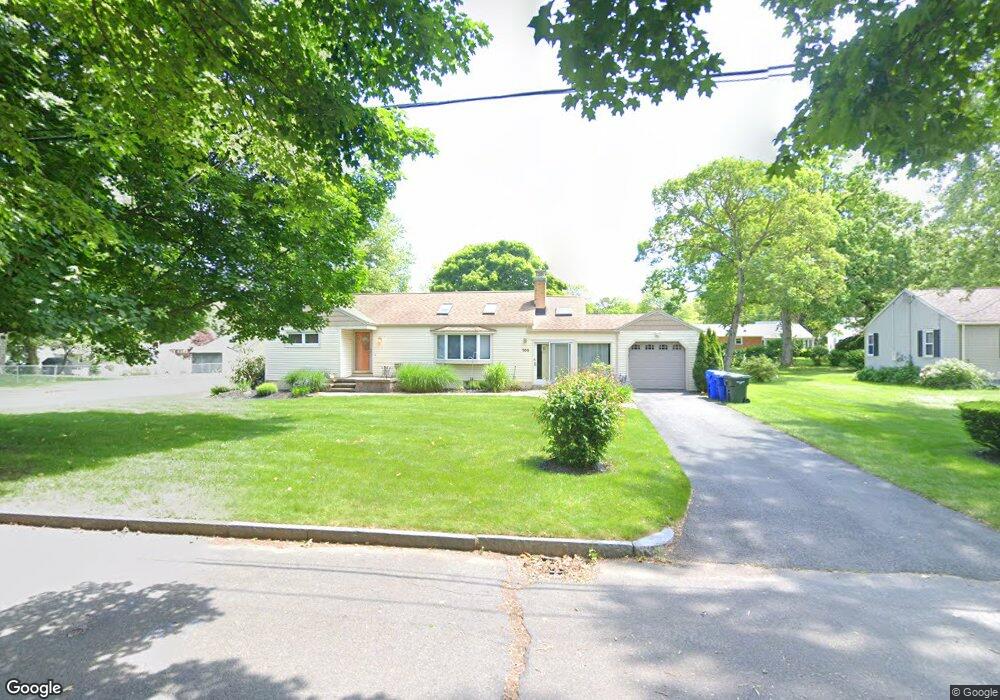
105 Fox Hill Rd Springfield, MA 01118
Sixteen Acres NeighborhoodEstimated Value: $343,000 - $362,000
3
Beds
1
Bath
1,312
Sq Ft
$269/Sq Ft
Est. Value
About This Home
This home is located at 105 Fox Hill Rd, Springfield, MA 01118 and is currently estimated at $353,370, approximately $269 per square foot. 105 Fox Hill Rd is a home located in Hampden County with nearby schools including Arthur T Talmadge Elementary School, M Marcus Kiley Middle, and Springfield High School of Science and Technology.
Ownership History
Date
Name
Owned For
Owner Type
Purchase Details
Closed on
Jan 12, 2026
Sold by
Nichols Barbara A
Bought by
Barbara A Nichols Irt and Nichols
Current Estimated Value
Purchase Details
Closed on
Jul 12, 1999
Sold by
Poe-Heineman Marian
Bought by
Nichols Barbara A
Home Financials for this Owner
Home Financials are based on the most recent Mortgage that was taken out on this home.
Original Mortgage
$64,250
Interest Rate
7.19%
Mortgage Type
Purchase Money Mortgage
Purchase Details
Closed on
Feb 26, 1988
Sold by
Larose Earl L
Bought by
Stead Marian E
Create a Home Valuation Report for This Property
The Home Valuation Report is an in-depth analysis detailing your home's value as well as a comparison with similar homes in the area
Home Values in the Area
Average Home Value in this Area
Purchase History
| Date | Buyer | Sale Price | Title Company |
|---|---|---|---|
| Barbara A Nichols Irt | -- | -- | |
| Nichols Barbara A | $115,000 | -- | |
| Stead Marian E | $122,000 | -- |
Source: Public Records
Mortgage History
| Date | Status | Borrower | Loan Amount |
|---|---|---|---|
| Previous Owner | Stead Marian E | $64,250 | |
| Previous Owner | Stead Marian E | $18,000 | |
| Previous Owner | Stead Marian E | $79,500 |
Source: Public Records
Tax History
| Year | Tax Paid | Tax Assessment Tax Assessment Total Assessment is a certain percentage of the fair market value that is determined by local assessors to be the total taxable value of land and additions on the property. | Land | Improvement |
|---|---|---|---|---|
| 2025 | $5,395 | $344,100 | $62,600 | $281,500 |
| 2024 | $5,334 | $332,100 | $62,600 | $269,500 |
| 2023 | $5,313 | $311,600 | $59,600 | $252,000 |
| 2022 | $4,807 | $255,400 | $62,800 | $192,600 |
| 2021 | $4,612 | $244,000 | $57,100 | $186,900 |
| 2020 | $4,410 | $225,800 | $57,100 | $168,700 |
| 2019 | $4,373 | $222,200 | $57,100 | $165,100 |
| 2018 | $4,330 | $220,000 | $57,100 | $162,900 |
| 2017 | $4,077 | $207,400 | $57,100 | $150,300 |
| 2016 | $3,879 | $197,300 | $57,100 | $140,200 |
| 2015 | $3,853 | $195,900 | $57,100 | $138,800 |
Source: Public Records
Map
Nearby Homes
- 81 W Crystal Brook Dr
- 86 Wildwood Ave
- 120 Bridle Path Rd
- 865 S Branch Pkwy
- 42 Talmadge Dr
- 24 Wands St
- 85 Talmadge Dr
- 86 Talmadge Dr
- 82 Louis Rd
- 41 Hillside Dr
- 1201 Allen St
- 17 Pebble Mill Rd
- 55 Allen St
- 101 Regal St
- 25 Laurelwood Ln
- 27 Regal St
- 19 Manor Ct Unit 19
- 125 Manor Ct Unit 125
- 206 Treetop Ave
- 231 Dayton St
- 115 Fox Hill Rd
- 94 W Crystal Brook Dr
- 92 W Crystal Brook Dr
- 100 W Crystal Brook Dr
- 89 Fox Hill Rd
- 104 W Crystal Brook Dr
- 82 W Crystal Brook Dr
- 104 Fox Hill Rd
- 6 Heather Ln
- 123 Fox Hill Rd
- 112 W Crystal Brook Dr
- 130 Fox Hill Rd
- 94 Fox Hill Rd
- 130 W Crystal Brook Dr
- 138 W Crystal Brook Dr
- 74 W Crystal Brook Dr
- 79 Fox Hill Rd
- 72 W Crystal Brook Dr
- 84 Fox Hill Rd
- 122 W Crystal Brook Dr
Your Personal Tour Guide
Ask me questions while you tour the home.