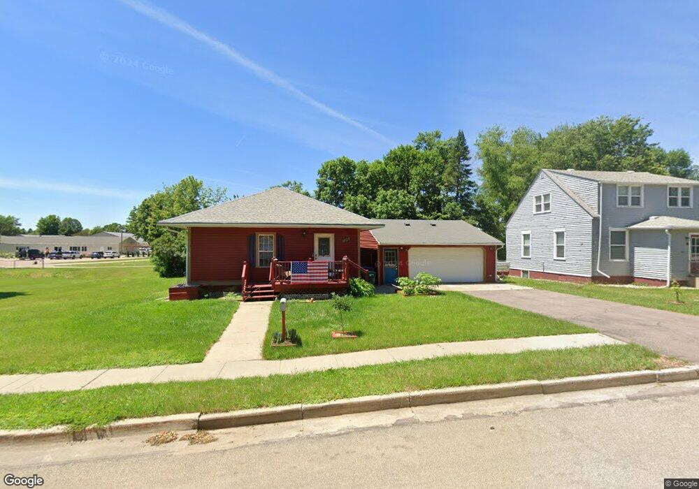
105 N Davidson St Luverne, MN 56156
Estimated Value: $136,000 - $170,460
2
Beds
2
Baths
1,638
Sq Ft
$92/Sq Ft
Est. Value
About This Home
This home is located at 105 N Davidson St, Luverne, MN 56156 and is currently estimated at $151,115, approximately $92 per square foot. 105 N Davidson St is a home located in Rock County with nearby schools including Luverne Elementary School and Luverne Senior High School.
Ownership History
Date
Name
Owned For
Owner Type
Purchase Details
Closed on
Oct 12, 2023
Sold by
Hilcom Enterprise Limited Liability Comp
Bought by
Vonderheide Jamie
Current Estimated Value
Home Financials for this Owner
Home Financials are based on the most recent Mortgage that was taken out on this home.
Original Mortgage
$125,190
Outstanding Balance
$121,498
Interest Rate
7.18%
Mortgage Type
FHA
Estimated Equity
$29,617
Purchase Details
Closed on
Sep 3, 2010
Sold by
Scmuck Viola Marie and Scmuck Donald W
Bought by
Schmuck Donald W
Create a Home Valuation Report for This Property
The Home Valuation Report is an in-depth analysis detailing your home's value as well as a comparison with similar homes in the area
Home Values in the Area
Average Home Value in this Area
Purchase History
| Date | Buyer | Sale Price | Title Company |
|---|---|---|---|
| Vonderheide Jamie | $127,500 | None Listed On Document | |
| Schmuck Donald W | -- | None Available |
Source: Public Records
Mortgage History
| Date | Status | Borrower | Loan Amount |
|---|---|---|---|
| Open | Vonderheide Jamie | $125,190 |
Source: Public Records
Tax History Compared to Growth
Tax History
| Year | Tax Paid | Tax Assessment Tax Assessment Total Assessment is a certain percentage of the fair market value that is determined by local assessors to be the total taxable value of land and additions on the property. | Land | Improvement |
|---|---|---|---|---|
| 2025 | $868 | $114,400 | $15,800 | $98,600 |
| 2024 | $868 | $104,400 | $13,200 | $91,200 |
| 2023 | $948 | $85,600 | $13,200 | $72,400 |
| 2022 | $900 | $71,600 | $6,800 | $64,800 |
| 2021 | $864 | $67,700 | $6,800 | $60,900 |
| 2020 | $790 | $65,700 | $6,800 | $58,900 |
| 2019 | $776 | $59,900 | $6,800 | $53,100 |
| 2018 | $542 | $59,900 | $6,800 | $53,100 |
| 2017 | $490 | $59,900 | $6,800 | $53,100 |
| 2016 | $480 | $56,300 | $6,100 | $50,200 |
| 2015 | $466 | $0 | $0 | $0 |
| 2014 | -- | $0 | $0 | $0 |
Source: Public Records
Map
Nearby Homes
- 102 S Walnut Ave
- 604 W Warren St
- 111 S Donaldson St
- 511 W Crawford St
- 323 W Lincoln St
- 717 Tallgrass Cir
- 320 SW Park St
- 719 Tallgrass Cir
- 207 N Kniss Ave
- 518 NE Park St
- 200 S Freeman Ave Unit 206
- 614 N Estey St
- 109 E Luverne St Unit 337
- 109 E Luverne St Unit 220
- 414 N Freeman Ave
- 613 N Cedar St
- 501 Central Ln
- 742 N Freeman Ave
- 201 E Adams Ave
- 109 N Davidson St
- 111 N Davidson St
- 720 W Main St
- 113 N Davidson St
- 117 N Davidson St
- 716 W Main St
- 619 W Lincoln St
- 713 W Main St
- 714 W Main St
- 617 W Lincoln St
- 711 W Main St
- 201 N Davidson St
- 615 W Lincoln St
- 710 W Main St
- 709 W Main St
- 714 W Lawn Park Ave
- 712 W Lawn Park Ave
- 609 W Lincoln St
- 707 W Main St
- 205 N Davidson St