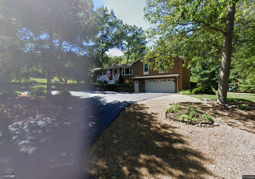
105 Ridge Rd Smithfield, RI 02917
Estimated Value: $507,000 - $557,000
3
Beds
1
Bath
1,548
Sq Ft
$342/Sq Ft
Est. Value
About This Home
This home is located at 105 Ridge Rd, Smithfield, RI 02917 and is currently estimated at $529,067, approximately $341 per square foot. 105 Ridge Rd is a home located in Providence County with nearby schools including Raymond Laperche School, Vincent J. Gallagher Middle School, and Smithfield High School.
Ownership History
Date
Name
Owned For
Owner Type
Purchase Details
Closed on
Apr 6, 2020
Sold by
Colantonio Emilio A and Colantonio Susan R
Bought by
Colantonio Ft and Colantonio
Current Estimated Value
Purchase Details
Closed on
Sep 26, 2017
Sold by
Michael J Sangermano
Bought by
Colantonio Susan and Colantonio Emilio
Home Financials for this Owner
Home Financials are based on the most recent Mortgage that was taken out on this home.
Original Mortgage
$50,000
Interest Rate
3.83%
Purchase Details
Closed on
Oct 5, 1992
Sold by
Saravo Bros Constr Co
Bought by
M R Broker Inc
Home Financials for this Owner
Home Financials are based on the most recent Mortgage that was taken out on this home.
Original Mortgage
$100,000
Interest Rate
7.83%
Mortgage Type
Purchase Money Mortgage
Create a Home Valuation Report for This Property
The Home Valuation Report is an in-depth analysis detailing your home's value as well as a comparison with similar homes in the area
Home Values in the Area
Average Home Value in this Area
Purchase History
| Date | Buyer | Sale Price | Title Company |
|---|---|---|---|
| Colantonio Ft | -- | None Available | |
| Colantonio Ft | -- | None Available | |
| Colantonio Ft | -- | None Available | |
| Colantonio Susan | $175,000 | -- | |
| M R Broker Inc | $35,000 | -- | |
| M R Broker Inc | $35,000 | -- |
Source: Public Records
Mortgage History
| Date | Status | Borrower | Loan Amount |
|---|---|---|---|
| Previous Owner | M R Broker Inc | $50,000 | |
| Previous Owner | M R Broker Inc | -- | |
| Previous Owner | M R Broker Inc | $100,000 |
Source: Public Records
Tax History Compared to Growth
Tax History
| Year | Tax Paid | Tax Assessment Tax Assessment Total Assessment is a certain percentage of the fair market value that is determined by local assessors to be the total taxable value of land and additions on the property. | Land | Improvement |
|---|---|---|---|---|
| 2025 | $5,655 | $456,400 | $173,400 | $283,000 |
| 2024 | $5,041 | $349,100 | $147,500 | $201,600 |
| 2023 | $4,790 | $349,100 | $147,500 | $201,600 |
| 2022 | $4,664 | $349,100 | $147,500 | $201,600 |
| 2021 | $4,384 | $255,900 | $110,000 | $145,900 |
| 2020 | $4,302 | $255,900 | $110,000 | $145,900 |
| 2019 | $4,302 | $255,900 | $110,000 | $145,900 |
| 2018 | $4,304 | $245,100 | $110,000 | $135,100 |
| 2017 | $4,304 | $245,100 | $110,000 | $135,100 |
| 2016 | $4,101 | $245,100 | $110,000 | $135,100 |
| 2015 | $4,006 | $228,000 | $101,300 | $126,700 |
| 2012 | $4,151 | $259,100 | $118,500 | $140,600 |
Source: Public Records
Map
Nearby Homes
- 24 Whipple Rd
- 48 Pheasant Run Unit A
- 23 Maureen Dr
- 15 Higgins St Unit 123
- 18 Homestead Ave
- 16 Louise Ann Dr
- 14 Domin Ave
- 117 Farnum Pike
- 1 Old County Village Way Unit E
- 8 Sunset Dr
- 1 Victoria Dr
- 2 Old County Village Way Unit A
- 4 Old County Village Way Unit B
- 3 Old County Village Way
- 302 Waterman Ave
- 12 Wadsworth Ave
- 6 Wadsworth Ave
- 61 Harris Rd
- 38 Clark Rd
- 1 W Farm Rd