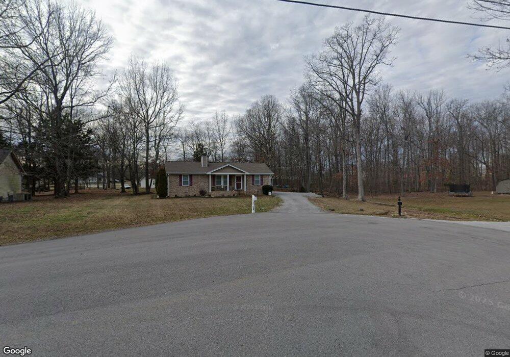
105 Rolling Forrest Ct White House, TN 37188
Estimated Value: $273,923 - $316,000
--
Bed
2
Baths
1,225
Sq Ft
$240/Sq Ft
Est. Value
About This Home
This home is located at 105 Rolling Forrest Ct, White House, TN 37188 and is currently estimated at $294,231, approximately $240 per square foot. 105 Rolling Forrest Ct is a home located in Sumner County with nearby schools including Harold B. Williams Elementary School, White House Middle School, and White House High School.
Ownership History
Date
Name
Owned For
Owner Type
Purchase Details
Closed on
Jun 16, 2006
Sold by
Burkeen Terry L
Bought by
Cook Louise
Current Estimated Value
Purchase Details
Closed on
Mar 31, 1997
Sold by
Patterson James R and Patterson Kimberly S
Bought by
Burkeen Terry L
Home Financials for this Owner
Home Financials are based on the most recent Mortgage that was taken out on this home.
Original Mortgage
$86,823
Interest Rate
8.25%
Mortgage Type
VA
Create a Home Valuation Report for This Property
The Home Valuation Report is an in-depth analysis detailing your home's value as well as a comparison with similar homes in the area
Home Values in the Area
Average Home Value in this Area
Purchase History
| Date | Buyer | Sale Price | Title Company |
|---|---|---|---|
| Cook Louise | $120,000 | Title Escrow Robertson Count | |
| Burkeen Terry L | $84,500 | -- |
Source: Public Records
Mortgage History
| Date | Status | Borrower | Loan Amount |
|---|---|---|---|
| Previous Owner | Burkeen Terry L | $86,823 |
Source: Public Records
Tax History Compared to Growth
Tax History
| Year | Tax Paid | Tax Assessment Tax Assessment Total Assessment is a certain percentage of the fair market value that is determined by local assessors to be the total taxable value of land and additions on the property. | Land | Improvement |
|---|---|---|---|---|
| 2024 | $980 | $69,000 | $23,750 | $45,250 |
| 2023 | $1,421 | $39,600 | $15,350 | $24,250 |
| 2022 | $1,405 | $39,600 | $15,350 | $24,250 |
| 2021 | $1,405 | $39,600 | $15,350 | $24,250 |
| 2020 | $1,306 | $39,600 | $15,350 | $24,250 |
| 2019 | $1,306 | $0 | $0 | $0 |
| 2018 | $1,069 | $0 | $0 | $0 |
| 2017 | $1,069 | $0 | $0 | $0 |
| 2016 | $716 | $0 | $0 | $0 |
| 2015 | -- | $0 | $0 | $0 |
| 2014 | -- | $0 | $0 | $0 |
Source: Public Records
Map
Nearby Homes
- 100 Rolling Acres Dr
- 110 Sycamore Dr
- 103 Cypress Ct
- 2724 Highway 31 W
- 202 Hunterwood Dr
- 125 Sycamore Dr
- 109 Chalone Dr
- 101 Chalone Dr
- 101 Laura Dr
- 405 Hunterwood Dr
- 1112 Southerlynn Dr
- 1128 Southerlynn Dr
- 1124 Southerlynn Dr
- 1136 Southerlynn Dr
- The Caldwell Plan at Marlin Pointe
- The Phoenix Plan at Marlin Pointe
- The Pearson Plan at Marlin Pointe
- The Braselton II Plan at Marlin Pointe
- 2360 Highway 31 W Unit 208
- 2360 Highway 31 W Unit 707
- 106 Rolling Forrest Ct
- 103 Rolling Forrest Ct
- 104 Forrest Ln
- 106 Forrest Ln
- 102 Forrest Ln
- 104 Rolling Forrest Ct
- 302 Rolling Acres Dr
- 102 Rolling Forrest Ct
- 300 Rolling Acres Dr
- 400 Rolling Acres Dr
- 108 Forrest Ln
- 402 Rolling Acres Dr
- 103 Forrest Ln
- 220 Rolling Acres Dr
- 305 Rolling Acres Dr
- 303 Rolling Acres Dr
- 109 Forrest Ln
- 307 Rolling Acres Dr
- 105 Forrest Ln
- 301 Rolling Acres Dr