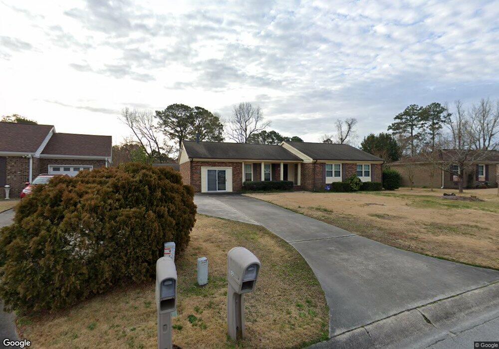
105 Ronny Ct Jacksonville, NC 28546
Estimated Value: $243,000 - $265,074
3
Beds
2
Baths
1,965
Sq Ft
$130/Sq Ft
Est. Value
About This Home
This home is located at 105 Ronny Ct, Jacksonville, NC 28546 and is currently estimated at $255,269, approximately $129 per square foot. 105 Ronny Ct is a home located in Onslow County with nearby schools including Bell Fork Elementary School, Jacksonville Commons Middle School, and Jacksonville High School.
Ownership History
Date
Name
Owned For
Owner Type
Purchase Details
Closed on
Oct 31, 2005
Sold by
C & N Developers Inc
Bought by
Sullivan John and Sullivan Vera
Current Estimated Value
Home Financials for this Owner
Home Financials are based on the most recent Mortgage that was taken out on this home.
Original Mortgage
$73,800
Outstanding Balance
$39,458
Interest Rate
5.84%
Mortgage Type
Unknown
Estimated Equity
$215,811
Purchase Details
Closed on
Nov 21, 1979
Bought by
Sullivan John A and Sullivan Vera F
Create a Home Valuation Report for This Property
The Home Valuation Report is an in-depth analysis detailing your home's value as well as a comparison with similar homes in the area
Home Values in the Area
Average Home Value in this Area
Purchase History
| Date | Buyer | Sale Price | Title Company |
|---|---|---|---|
| Sullivan John | $82,000 | None Available | |
| Sullivan John A | $7,500 | -- |
Source: Public Records
Mortgage History
| Date | Status | Borrower | Loan Amount |
|---|---|---|---|
| Open | Sullivan John | $73,800 | |
| Closed | Sullivan John | $60,000 |
Source: Public Records
Tax History Compared to Growth
Tax History
| Year | Tax Paid | Tax Assessment Tax Assessment Total Assessment is a certain percentage of the fair market value that is determined by local assessors to be the total taxable value of land and additions on the property. | Land | Improvement |
|---|---|---|---|---|
| 2025 | $1,711 | $181,373 | $30,000 | $151,373 |
| 2024 | $1,711 | $181,373 | $30,000 | $151,373 |
| 2023 | $1,711 | $181,373 | $30,000 | $151,373 |
| 2022 | $1,711 | $181,373 | $30,000 | $151,373 |
| 2021 | $1,380 | $147,450 | $30,000 | $117,450 |
| 2020 | $1,380 | $147,450 | $30,000 | $117,450 |
| 2019 | $1,380 | $147,450 | $30,000 | $117,450 |
| 2018 | $1,380 | $147,450 | $30,000 | $117,450 |
| 2017 | $1,381 | $149,880 | $30,000 | $119,880 |
| 2016 | $1,974 | $149,880 | $0 | $0 |
| 2015 | $1,974 | $149,880 | $0 | $0 |
| 2014 | $1,974 | $149,880 | $0 | $0 |
Source: Public Records
Map
Nearby Homes
- 625 Winchester Rd
- 106 Ronny Ct
- 600 Oakwood Ave
- 504 Oakwood Ave
- 405 Thomas Dr
- 125 Linda Loop
- 402 Huff Dr
- 103 Huff Ct
- 110 King George Ct
- 129 Suffolk Cir
- 422 Pine Valley Rd
- 111 Bedford Green
- 405 Hampshire Place
- 104 Dundee Ct
- 404 Hampshire Place
- 2002 Colony Plaza
- 852 Bell Fork
- 103 Dunhill Ct
- 108 Villa Dr
- 105 Woodside Ct
- 103 Ronny Ct
- 107 Ronny Ct
- 104 Allen Place
- 109 Ronny Ct
- 617 Winchester Rd
- 619 Winchester Rd
- 102 Allen Place
- 615 Winchester Rd
- 102 Ronny Ct
- 104 Ronny Ct
- 603 Winchester Rd
- 108 Allen Place
- 100 Allen Place
- 605 Winchester Rd
- 627 Winchester Rd
- 110 Allen Place
- 113 Ronny Ct
- 108 Ronny Ct
- 521 Winchester Rd
- 620 Winchester Rd