Estimated Value: $288,561 - $810,000
3
Beds
--
Bath
2,054
Sq Ft
$316/Sq Ft
Est. Value
About This Home
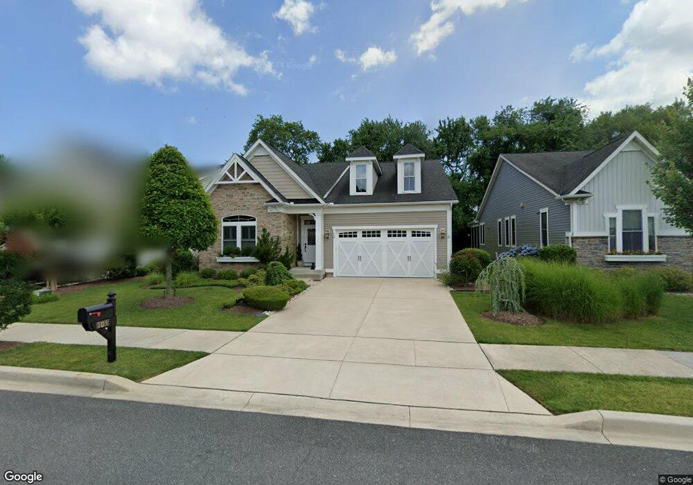
This home is located at 105 Samantha Dr, Lewes, DE 19958 and is currently estimated at $649,890, approximately $316 per square foot. 105 Samantha Dr is a home with nearby schools including Lewes Elementary School, Mariner Middle School, and Cape Henlopen High School.
Ownership History
Date
Name
Owned For
Owner Type
Purchase Details
Closed on
Jun 8, 2012
Bought by
Swarmer Ii Richard M and Reign Howard L
Current Estimated Value
Home Financials for this Owner
Home Financials are based on the most recent Mortgage that was taken out on this home.
Original Mortgage
$295,200
Outstanding Balance
$204,680
Interest Rate
3.84%
Mortgage Type
Unknown
Estimated Equity
$445,210
Create a Home Valuation Report for This Property
The Home Valuation Report is an in-depth analysis detailing your home's value as well as a comparison with similar homes in the area
Home Values in the Area
Average Home Value in this Area
Purchase History
| Date | Buyer | Sale Price | Title Company |
|---|---|---|---|
| Swarmer Ii Richard M | $369,105 | -- |
Source: Public Records
Mortgage History
| Date | Status | Borrower | Loan Amount |
|---|---|---|---|
| Open | Swarmer Ii Richard M | $295,200 |
Source: Public Records
Tax History Compared to Growth
Tax History
| Year | Tax Paid | Tax Assessment Tax Assessment Total Assessment is a certain percentage of the fair market value that is determined by local assessors to be the total taxable value of land and additions on the property. | Land | Improvement |
|---|---|---|---|---|
| 2025 | $1,374 | $34,600 | $7,500 | $27,100 |
| 2024 | $1,705 | $34,600 | $7,500 | $27,100 |
| 2023 | $1,704 | $34,600 | $7,500 | $27,100 |
| 2022 | $1,645 | $34,600 | $7,500 | $27,100 |
| 2021 | $1,629 | $34,600 | $7,500 | $27,100 |
| 2020 | $1,624 | $34,600 | $7,500 | $27,100 |
| 2019 | $1,627 | $34,600 | $7,500 | $27,100 |
| 2018 | $1,519 | $34,600 | $0 | $0 |
| 2017 | $1,455 | $34,600 | $0 | $0 |
| 2016 | $1,382 | $34,600 | $0 | $0 |
| 2015 | $1,298 | $34,600 | $0 | $0 |
| 2014 | $1,288 | $34,000 | $0 | $0 |
Source: Public Records
Map
Nearby Homes
- 322 Captains Cir
- 18321 Alpine Loop
- 325 Captains Cir
- 305 Seagull Dr
- 306 Bayberry Dr
- 131 New Rd
- Lot 79 New Rd
- 149 Jacks Way Unit 18
- 157 Tyler's Cir Unit 15
- The Bethany Plan at Fisher's Cove
- Cassidy Plan at Fisher's Cove
- 159 Tylers Cir Unit 14
- 165 Tyler's Cir
- 179 Tyler's Cir Unit 6
- 113 New Rd
- 33819 Joel Ln
- 33821 Joel Ln
- 15424 Solomon Way
- 33830 Joel Ln
- 15407 Solomon Way
- 103 Samantha Dr
- 107 Samantha Dr
- 421 Samantha Dr
- 111 Samantha Dr
- 419 Samantha Dr
- 113 Samantha Dr
- 113 Samantha Dr
- 436 Samantha Dr
- 434 Samantha Dr
- 432 Samantha Dr Unit 45
- 115 Samantha Dr
- 430 Samantha Dr
- 415 Samantha Dr
- 417 Samantha Dr
- 426 Samantha Dr
- 428 Samantha Dr
- 117 Samantha Dr
- 100 Carter Way
- 413 Samantha Dr
- 422 Samantha Dr