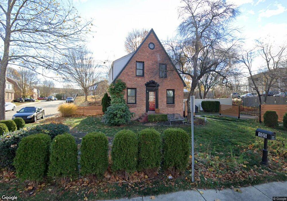
105 Saratoga Way Portsmouth, NH 03801
North Waterfront NeighborhoodEstimated Value: $420,019 - $449,000
1
Bed
1
Bath
684
Sq Ft
$640/Sq Ft
Est. Value
About This Home
This home is located at 105 Saratoga Way, Portsmouth, NH 03801 and is currently estimated at $437,755, approximately $639 per square foot. 105 Saratoga Way is a home located in Rockingham County with nearby schools including New Franklin School, Portsmouth Middle School, and Portsmouth High School.
Ownership History
Date
Name
Owned For
Owner Type
Purchase Details
Closed on
Feb 16, 2016
Sold by
Power Michael
Bought by
Power Michael and Power Leanne L
Current Estimated Value
Purchase Details
Closed on
Nov 1, 2004
Sold by
Clews Christiane E and Clews Tanna E
Bought by
Power Michael
Home Financials for this Owner
Home Financials are based on the most recent Mortgage that was taken out on this home.
Original Mortgage
$171,120
Interest Rate
5.74%
Mortgage Type
Purchase Money Mortgage
Create a Home Valuation Report for This Property
The Home Valuation Report is an in-depth analysis detailing your home's value as well as a comparison with similar homes in the area
Home Values in the Area
Average Home Value in this Area
Purchase History
| Date | Buyer | Sale Price | Title Company |
|---|---|---|---|
| Power Michael | -- | -- | |
| Power Michael | $213,900 | -- |
Source: Public Records
Mortgage History
| Date | Status | Borrower | Loan Amount |
|---|---|---|---|
| Previous Owner | Power Michael | $153,000 | |
| Previous Owner | Power Michael | $171,120 |
Source: Public Records
Tax History Compared to Growth
Tax History
| Year | Tax Paid | Tax Assessment Tax Assessment Total Assessment is a certain percentage of the fair market value that is determined by local assessors to be the total taxable value of land and additions on the property. | Land | Improvement |
|---|---|---|---|---|
| 2024 | $4,127 | $369,100 | $217,900 | $151,200 |
| 2023 | $4,655 | $288,600 | $166,000 | $122,600 |
| 2022 | $4,387 | $288,600 | $166,000 | $122,600 |
| 2021 | $4,338 | $288,600 | $166,000 | $122,600 |
| 2020 | $4,242 | $288,600 | $166,000 | $122,600 |
| 2019 | $4,289 | $288,600 | $166,000 | $122,600 |
| 2018 | $4,107 | $259,300 | $150,900 | $108,400 |
| 2017 | $3,783 | $246,000 | $138,400 | $107,600 |
| 2016 | $3,607 | $211,700 | $110,000 | $101,700 |
| 2015 | $3,554 | $211,700 | $110,000 | $101,700 |
| 2014 | $3,638 | $201,000 | $113,600 | $87,400 |
| 2013 | $3,600 | $201,000 | $113,600 | $87,400 |
| 2012 | $3,552 | $202,400 | $113,600 | $88,800 |
Source: Public Records
Map
Nearby Homes
- 124 Spinnaker Way
- 201 Kearsarge Way
- 25 Mangrove St
- 14 Birch St
- 3 Shearwater Dr Unit 1900
- 19 Shearwater Dr Unit 1903
- 15 Shearwater Dr Unit 1902
- 37 Shearwater Dr Unit 1906
- 25 Oak Terrace
- 27 Oak Terrace
- 27 Eden Ln Unit 4
- 19 Eden Ln Unit 2
- 15 Eden Ln Unit 1
- 31 Eden Ln Unit 5
- 493 Main St
- 9 Prospect St Unit 1
- 1338 Woodbury Ave Unit 10
- 281 Dennett St
- 20 Mendum Ave
- 5 Spinney Way Unit 9
- 155 Raleigh Way
- 145 Raleigh Way
- 175 Raleigh Way
- 139 Raleigh Way
- 144 Raleigh Way
- 95 Saratoga Way
- 174 Raleigh Way
- 185 Raleigh Way
- 187 Raleigh Way
- 106 Saratoga Way
- 129 Raleigh Way
- 3 Albacore Way Unit 2
- 132 Raleigh Way
- 93 Saratoga Way
- 195 Raleigh Way
- 182 Raleigh Way
- 182 Raleigh Way Unit 2
- 184 Raleigh Way
- 121 Raleigh Way
- 124 Raleigh Way