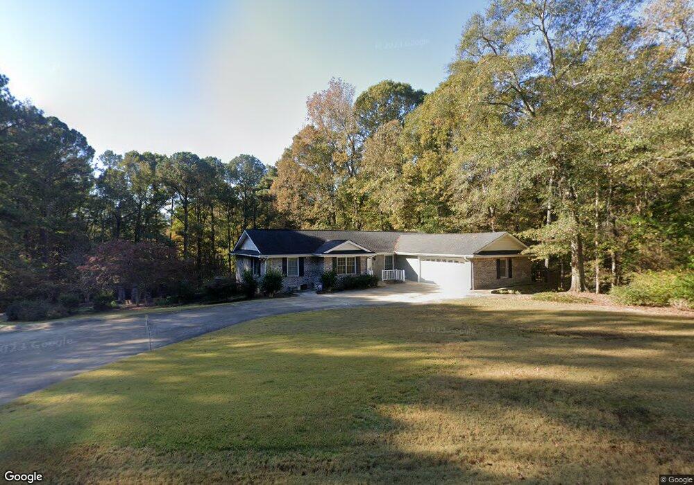
105 Shawnee Dr Lagrange, GA 30240
Estimated Value: $315,044 - $437,000
4
Beds
3
Baths
1,927
Sq Ft
$189/Sq Ft
Est. Value
About This Home
This home is located at 105 Shawnee Dr, Lagrange, GA 30240 and is currently estimated at $363,261, approximately $188 per square foot. 105 Shawnee Dr is a home located in Troup County with nearby schools including Ethel W. Kight Elementary School, Hollis Hand Elementary School, and Franklin Forest Elementary School.
Ownership History
Date
Name
Owned For
Owner Type
Purchase Details
Closed on
Jul 13, 2015
Sold by
Morgan Bradford N
Bought by
Morgan Bradford N and Morgan Robyn M
Current Estimated Value
Home Financials for this Owner
Home Financials are based on the most recent Mortgage that was taken out on this home.
Original Mortgage
$95,000
Outstanding Balance
$74,640
Interest Rate
4.08%
Mortgage Type
New Conventional
Estimated Equity
$288,621
Purchase Details
Closed on
Oct 6, 1998
Sold by
Robert Morgan
Bought by
Morgan Bradford N
Purchase Details
Closed on
Dec 11, 1992
Sold by
Morgan Robert A and Morgan Theresa B
Bought by
Robert Morgan
Purchase Details
Closed on
Aug 13, 1977
Bought by
Morgan Robert A and Morgan Theresa B
Create a Home Valuation Report for This Property
The Home Valuation Report is an in-depth analysis detailing your home's value as well as a comparison with similar homes in the area
Home Values in the Area
Average Home Value in this Area
Purchase History
| Date | Buyer | Sale Price | Title Company |
|---|---|---|---|
| Morgan Bradford N | -- | -- | |
| Morgan Bradford N | $90,000 | -- | |
| Robert Morgan | -- | -- | |
| Morgan Robert A | -- | -- |
Source: Public Records
Mortgage History
| Date | Status | Borrower | Loan Amount |
|---|---|---|---|
| Open | Morgan Bradford N | $95,000 |
Source: Public Records
Tax History Compared to Growth
Tax History
| Year | Tax Paid | Tax Assessment Tax Assessment Total Assessment is a certain percentage of the fair market value that is determined by local assessors to be the total taxable value of land and additions on the property. | Land | Improvement |
|---|---|---|---|---|
| 2024 | $3,363 | $125,280 | $14,000 | $111,280 |
| 2023 | $2,899 | $108,280 | $10,000 | $98,280 |
| 2022 | $2,859 | $104,440 | $10,000 | $94,440 |
| 2021 | $2,786 | $94,360 | $10,000 | $84,360 |
| 2020 | $2,665 | $90,360 | $6,000 | $84,360 |
| 2019 | $2,279 | $77,560 | $6,920 | $70,640 |
| 2018 | $2,147 | $71,184 | $6,944 | $64,240 |
| 2017 | $2,087 | $71,184 | $6,944 | $64,240 |
Source: Public Records
Map
Nearby Homes
- 200 Cheyenne Dr
- 108 Spring Valley Dr
- 104 Spring Valley Dr
- 641 Whitaker Rd
- 208 Highland Trail
- 117 Brookwood Dr
- 223 Pinehaven Dr
- 146 Whitaker Rd
- E Angela Dr
- LOT 4 Angela Dr
- 102 Willowcrest Way
- 0 Cameron Mill Rd Unit 10640133
- 243 Oak Dr
- 4004 White Oak Ln
- 654 Cameron Mill Rd
- 0 Deming St Unit 10550189
- 114 Morgan Dr
- 709 Vernon Ferry Rd
- 116 Morgan Dr
- 114-116 Morgan Dr
- 141 Shoshoni Dr
- 103 Shawnee Dr
- 200 Shawnee Dr
- 103 Shoshoni Dr
- 100 Shawnee Dr
- 100 Shoshoni Dr
- 105 Chickasaw Dr
- 101 Shawnee Dr
- 102 Iroquois Dr
- 104 Shoshoni Dr
- 104 Cheyenne Dr
- 102 Cheyenne Dr
- 102 Cheyenne Dr Unit 6
- 103 Iroquois Dr
- 203 Shawnee Dr
- 607 Seminole Rd
- 605 Seminole Rd
- 100 Cheyenne Dr
- 104 Iroquois Dr
- 102 Chickasaw Dr