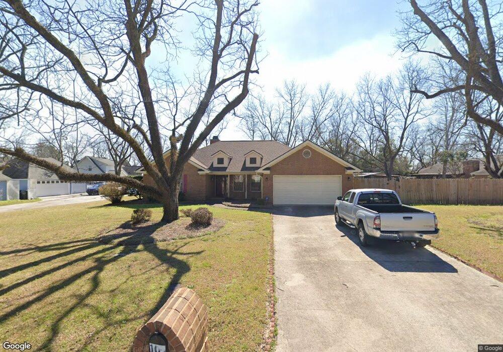
105 Silver Cir Warner Robins, GA 31093
Estimated Value: $261,139 - $286,000
3
Beds
3
Baths
1,913
Sq Ft
$144/Sq Ft
Est. Value
About This Home
This home is located at 105 Silver Cir, Warner Robins, GA 31093 and is currently estimated at $274,535, approximately $143 per square foot. 105 Silver Cir is a home located in Houston County with nearby schools including Northside Elementary School, Thomson Middle School, and Northside High School.
Ownership History
Date
Name
Owned For
Owner Type
Purchase Details
Closed on
Apr 28, 1995
Sold by
Walker Weasley W and Walker Anne L
Bought by
Carter Robert E and Carter Josie J
Current Estimated Value
Purchase Details
Closed on
May 22, 1990
Sold by
Harley Construction Co
Bought by
Walker Weasley W and Walker Anne L
Purchase Details
Closed on
Feb 1, 1990
Sold by
Antebellum South Inc
Bought by
Harley Construction Co
Create a Home Valuation Report for This Property
The Home Valuation Report is an in-depth analysis detailing your home's value as well as a comparison with similar homes in the area
Home Values in the Area
Average Home Value in this Area
Purchase History
| Date | Buyer | Sale Price | Title Company |
|---|---|---|---|
| Carter Robert E | $118,000 | -- | |
| Walker Weasley W | -- | -- | |
| Harley Construction Co | -- | -- |
Source: Public Records
Tax History
| Year | Tax Paid | Tax Assessment Tax Assessment Total Assessment is a certain percentage of the fair market value that is determined by local assessors to be the total taxable value of land and additions on the property. | Land | Improvement |
|---|---|---|---|---|
| 2025 | $1,894 | $90,760 | $12,800 | $77,960 |
| 2024 | $2,018 | $86,360 | $11,000 | $75,360 |
| 2023 | $1,788 | $75,960 | $11,000 | $64,960 |
| 2022 | $1,495 | $63,840 | $8,200 | $55,640 |
| 2021 | $1,321 | $56,360 | $8,200 | $48,160 |
| 2020 | $1,285 | $54,640 | $8,200 | $46,440 |
| 2019 | $1,285 | $54,640 | $8,200 | $46,440 |
| 2018 | $1,285 | $54,640 | $8,200 | $46,440 |
| 2017 | $1,286 | $54,640 | $8,200 | $46,440 |
| 2016 | $1,288 | $54,640 | $8,200 | $46,440 |
| 2015 | $1,291 | $54,640 | $8,200 | $46,440 |
| 2014 | -- | $54,640 | $8,200 | $46,440 |
| 2013 | -- | $54,640 | $8,200 | $46,440 |
Source: Public Records
Map
Nearby Homes
- 106 John Ct
- 4001 U S 41 Unit LOT 65
- 116 Majestic Trail
- 223 River Birch Way
- 113 Calpurnia St
- 205 River Birch Way
- 226 River Birch Way
- 106 Winged Elm Grove
- 203 River Birch Way
- 312 Air View Dr Unit 7
- 310 Air View Dr Unit 6
- 304 Air View Dr Unit 3
- 304 Air View Dr
- 312 Air View Dr
- 310 Air View Dr
- 362 Peach Rd
- 133 Peach Rd
- 308 Air View Dr Unit 5
- 324 Air View Dr Unit 13
- 322 Air View Dr Unit 12
- 103 Kathy Ln
- 101 Silver Cir
- 107 Silver Cir
- 1705 N Houston Lake Blvd
- 102 Silver Cir
- 105 Kathy Ln
- 104 Silver Cir
- 100 Silver Cir
- 106 Silver Cir
- 104 Kathy Ln
- 102 Kathy Ln
- 201 Silver Cir
- 1617 N Houston Lake Blvd
- 107 John Ct
- 106 Kathy Ln
- 109 John Ct
- 108 Silver Cir
- 137 Wellston Cir
- 205 Silver Cir
- 202 Silver Cir
Your Personal Tour Guide
Ask me questions while you tour the home.