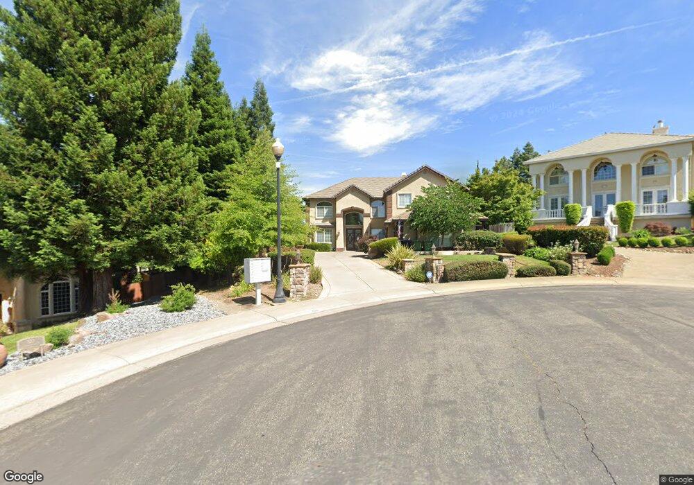
105 Soukup Ct Folsom, CA 95630
Prairie Oaks NeighborhoodEstimated Value: $946,000 - $1,346,000
4
Beds
3
Baths
3,714
Sq Ft
$311/Sq Ft
Est. Value
About This Home
This home is located at 105 Soukup Ct, Folsom, CA 95630 and is currently estimated at $1,155,343, approximately $311 per square foot. 105 Soukup Ct is a home located in Sacramento County with nearby schools including Sandra J. Gallardo Elementary School, Sutter Middle School, and Folsom High School.
Ownership History
Date
Name
Owned For
Owner Type
Purchase Details
Closed on
Nov 7, 2017
Sold by
Johnson Larry D and Johnson Joyce C
Bought by
Johnson Larry D and Johnson Joyce C
Current Estimated Value
Purchase Details
Closed on
Nov 18, 1997
Sold by
Norris William J and Norris Phyllis D
Bought by
Johnson Larry D and Johnson Joyce C
Home Financials for this Owner
Home Financials are based on the most recent Mortgage that was taken out on this home.
Original Mortgage
$288,000
Outstanding Balance
$47,057
Interest Rate
7.23%
Mortgage Type
Construction
Estimated Equity
$1,108,286
Purchase Details
Closed on
Mar 20, 1997
Sold by
Morrison Homes
Bought by
Norris William J and Norris Phyllis J
Create a Home Valuation Report for This Property
The Home Valuation Report is an in-depth analysis detailing your home's value as well as a comparison with similar homes in the area
Home Values in the Area
Average Home Value in this Area
Purchase History
| Date | Buyer | Sale Price | Title Company |
|---|---|---|---|
| Johnson Larry D | -- | None Available | |
| Johnson Larry D | $81,000 | Golden California Title Co | |
| Norris William J | $54,000 | Old Republic Title Company |
Source: Public Records
Mortgage History
| Date | Status | Borrower | Loan Amount |
|---|---|---|---|
| Open | Johnson Larry D | $288,000 |
Source: Public Records
Tax History
| Year | Tax Paid | Tax Assessment Tax Assessment Total Assessment is a certain percentage of the fair market value that is determined by local assessors to be the total taxable value of land and additions on the property. | Land | Improvement |
|---|---|---|---|---|
| 2025 | $7,432 | $691,510 | $129,321 | $562,189 |
| 2024 | $7,432 | $677,952 | $126,786 | $551,166 |
| 2023 | $7,301 | $664,659 | $124,300 | $540,359 |
| 2022 | $7,195 | $651,627 | $121,863 | $529,764 |
| 2021 | $7,099 | $638,851 | $119,474 | $519,377 |
| 2020 | $7,012 | $632,301 | $118,249 | $514,052 |
| 2019 | $6,896 | $619,904 | $115,931 | $503,973 |
| 2018 | $6,726 | $607,750 | $113,658 | $494,092 |
| 2017 | $6,280 | $595,834 | $111,430 | $484,404 |
| 2016 | $6,555 | $584,152 | $109,246 | $474,906 |
| 2015 | $6,338 | $575,379 | $107,606 | $467,773 |
| 2014 | $6,020 | $564,109 | $105,499 | $458,610 |
Source: Public Records
Map
Nearby Homes
- 1054 Ledgestone Dr
- 102 Black Gold Ln
- 0 Figueroa St Unit 225034113
- 743 Moylegrove Ct
- 753 Rodmartin Ct
- 757 Hatherden Ct
- 110 Northolt Ct
- 104 Hesser Ct
- 631 Rogers Cir
- 136 Penaranda Dr
- 101 Duxbury Way
- 968 Carter St
- 205 Briarcliff Dr
- 113 Grenoble Way
- 260 Flower Dr
- 1121 Elderberry Cir
- 110 Fargo Way
- 919 Sterling Cir
- 692 Humbert St
- 101 Kerr Ct
- 102 Soukup Ct
- 760 Bluestone Cir
- 103 Soukup Ct
- 756 Bluestone Cir
- 764 Bluestone Cir
- 752 Bluestone Cir
- 768 Bluestone Cir
- 113 Woodsmoke Way
- 748 Bluestone Cir
- 772 Bluestone Cir
- 115 Woodsmoke Way
- 103 Pestle Ct
- 1071 Limestone Dr
- 744 Bluestone Cir
- 776 Bluestone Cir
- 111 Woodsmoke Way
- 1070 Limestone Dr
- 104 Pestle Ct
- 1060 Cornerstone Dr
- 117 Woodsmoke Way
Your Personal Tour Guide
Ask me questions while you tour the home.