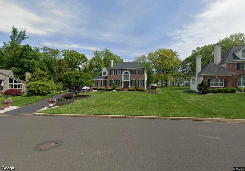
105 Upland Dr Southampton, PA 18966
Estimated Value: $887,000 - $985,000
4
Beds
3
Baths
3,310
Sq Ft
$284/Sq Ft
Est. Value
About This Home
This home is located at 105 Upland Dr, Southampton, PA 18966 and is currently estimated at $938,697, approximately $283 per square foot. 105 Upland Dr is a home located in Bucks County with nearby schools including Maureen M. Welch Elementary School, Richboro Middle School, and Council Rock High School - South.
Ownership History
Date
Name
Owned For
Owner Type
Purchase Details
Closed on
Dec 10, 2004
Sold by
Arcidiacono John B and Arcidiacono Donna M
Bought by
Bell Michael K and Bell Sharon
Current Estimated Value
Home Financials for this Owner
Home Financials are based on the most recent Mortgage that was taken out on this home.
Original Mortgage
$333,000
Outstanding Balance
$166,878
Interest Rate
5.74%
Mortgage Type
Fannie Mae Freddie Mac
Estimated Equity
$771,819
Purchase Details
Closed on
Jan 7, 1992
Bought by
Arcidiacono John B and Arcidiacono Donna M
Create a Home Valuation Report for This Property
The Home Valuation Report is an in-depth analysis detailing your home's value as well as a comparison with similar homes in the area
Home Values in the Area
Average Home Value in this Area
Purchase History
| Date | Buyer | Sale Price | Title Company |
|---|---|---|---|
| Bell Michael K | $633,000 | -- | |
| Arcidiacono John B | -- | -- |
Source: Public Records
Mortgage History
| Date | Status | Borrower | Loan Amount |
|---|---|---|---|
| Open | Bell Michael K | $333,000 |
Source: Public Records
Tax History Compared to Growth
Tax History
| Year | Tax Paid | Tax Assessment Tax Assessment Total Assessment is a certain percentage of the fair market value that is determined by local assessors to be the total taxable value of land and additions on the property. | Land | Improvement |
|---|---|---|---|---|
| 2025 | $10,616 | $55,120 | $5,480 | $49,640 |
| 2024 | $10,616 | $55,120 | $5,480 | $49,640 |
| 2023 | $10,006 | $55,120 | $5,480 | $49,640 |
| 2022 | $9,914 | $55,120 | $5,480 | $49,640 |
| 2021 | $9,601 | $55,120 | $5,480 | $49,640 |
| 2020 | $9,385 | $55,120 | $5,480 | $49,640 |
| 2019 | $8,983 | $55,120 | $5,480 | $49,640 |
| 2018 | $8,823 | $55,120 | $5,480 | $49,640 |
| 2017 | $8,483 | $55,120 | $5,480 | $49,640 |
| 2016 | $6,491 | $55,120 | $5,480 | $49,640 |
| 2015 | -- | $55,120 | $5,480 | $49,640 |
| 2014 | -- | $55,120 | $5,480 | $49,640 |
Source: Public Records
Map
Nearby Homes
- 448 W Bristol Rd
- 29 Devon Rd
- 1310 Dennis Rd
- 215 Surrey Rd
- 225 Green Dr
- 559 Maple Ave
- 249 New Rd
- 18 Daffodil Dr
- 800 New Rd
- 955 Bristol Rd
- 371 N 2nd Street Pike
- 1495 Estate Ln
- 161 New Rd
- 67 Woodland Dr
- 1031 Willopenn Dr
- 1020 Pennsylvania Ave
- 968 Willopenn Dr
- 290 Hatboro Rd
- 1081 Cherry Ln
- 148 Laurel Rd