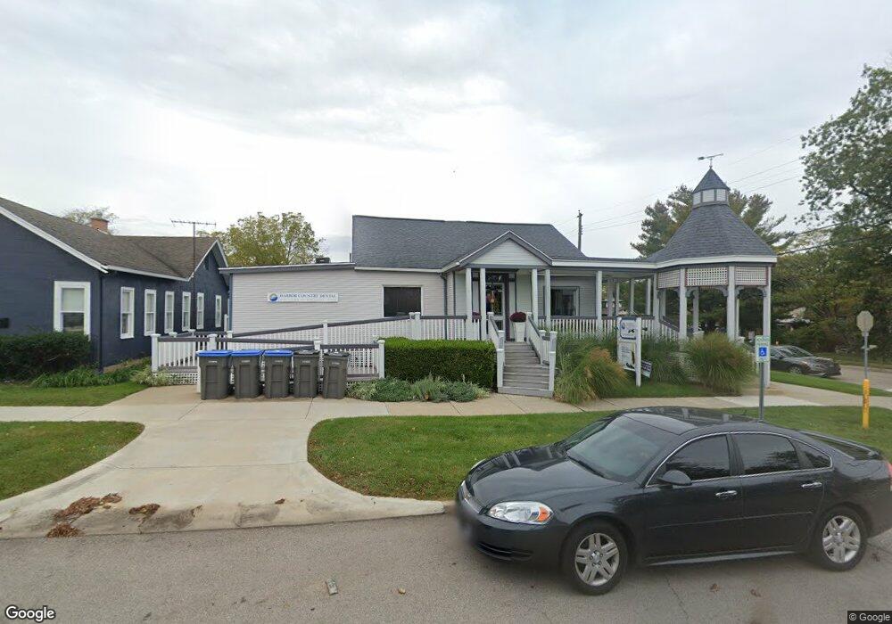
105 W Merchant St New Buffalo, MI 49117
Estimated Value: $881,901
--
Bed
--
Bath
4,226
Sq Ft
$209/Sq Ft
Est. Value
About This Home
This home is located at 105 W Merchant St, New Buffalo, MI 49117 and is currently estimated at $881,901, approximately $208 per square foot. 105 W Merchant St is a home located in Berrien County with nearby schools including New Buffalo Elementary School, New Buffalo Middle School, and New Buffalo Senior High School.
Ownership History
Date
Name
Owned For
Owner Type
Purchase Details
Closed on
May 24, 2013
Sold by
Sima Frankle Partnership
Bought by
Harbor Property Services Llc
Current Estimated Value
Home Financials for this Owner
Home Financials are based on the most recent Mortgage that was taken out on this home.
Original Mortgage
$244,000
Outstanding Balance
$172,121
Interest Rate
3.38%
Mortgage Type
Commercial
Estimated Equity
$709,780
Purchase Details
Closed on
Jun 1, 1989
Create a Home Valuation Report for This Property
The Home Valuation Report is an in-depth analysis detailing your home's value as well as a comparison with similar homes in the area
Home Values in the Area
Average Home Value in this Area
Purchase History
| Date | Buyer | Sale Price | Title Company |
|---|---|---|---|
| Harbor Property Services Llc | -- | Fat | |
| -- | -- | -- |
Source: Public Records
Mortgage History
| Date | Status | Borrower | Loan Amount |
|---|---|---|---|
| Open | Harbor Property Services Llc | $244,000 |
Source: Public Records
Tax History Compared to Growth
Tax History
| Year | Tax Paid | Tax Assessment Tax Assessment Total Assessment is a certain percentage of the fair market value that is determined by local assessors to be the total taxable value of land and additions on the property. | Land | Improvement |
|---|---|---|---|---|
| 2025 | $8,268 | $429,100 | $0 | $0 |
| 2024 | $5,456 | $458,900 | $0 | $0 |
| 2023 | $5,242 | $357,600 | $0 | $0 |
| 2022 | $4,992 | $339,700 | $0 | $0 |
| 2021 | $7,344 | $158,400 | $6,500 | $151,900 |
| 2020 | $7,411 | $159,600 | $0 | $0 |
| 2019 | $7,464 | $167,100 | $19,300 | $147,800 |
| 2018 | $7,425 | $167,100 | $0 | $0 |
| 2017 | $7,506 | $155,600 | $0 | $0 |
| 2016 | $7,416 | $156,700 | $0 | $0 |
| 2015 | $7,396 | $154,800 | $0 | $0 |
| 2014 | $4,995 | $156,100 | $0 | $0 |
Source: Public Records
Map
Nearby Homes
- 19175 U S 12
- Lots 7 & 8 N Whittaker
- 116 N Smith St
- Lots 3 & 4 N Thompson St
- Lots 5 & 6 N Thompson
- 22 S Smith St
- Lot 9 & 10 N Whittaker St
- 121 S Barker St
- 10 Pond Path
- 121 E Michigan St
- 221 N Townsend St
- 90 Harbor Landing
- 425 S Barker St
- 300 E Buffalo St
- 210 E Water St
- 310 W Detroit St
- 312 S Whittaker St
- 118 S Harrison St
- 313 S Barton St
- 306 E Indiana St
- 30 N Barton St
- 28 N Barton St
- 102 N Barton St
- 121 W Merchant St
- 22 N Barton St
- 25 N Barker St
- 108 N Barton St
- 33 N Barton St
- 21 N Barker St
- 27 N Barton St
- 103 N Barker St
- 109 N Barker St
- 0 N Barker St
- 15 N Barker St
- 15 N Barker St Unit A
- 15 N Barker St Unit B
- 15 N Barker St Unit R
- 18 W Merchant St
- 109 N Barton St
- 114 N Barton St