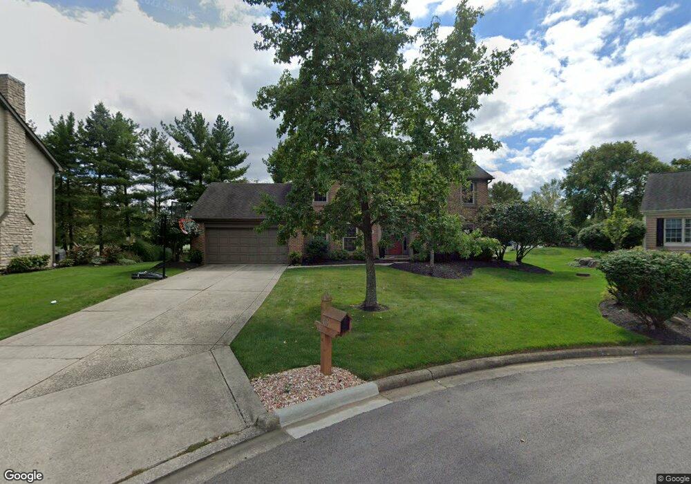
105 Wallsend Ct Powell, OH 43065
Estimated Value: $513,000 - $585,000
4
Beds
3
Baths
2,274
Sq Ft
$241/Sq Ft
Est. Value
About This Home
This home is located at 105 Wallsend Ct, Powell, OH 43065 and is currently estimated at $547,552, approximately $240 per square foot. 105 Wallsend Ct is a home located in Delaware County with nearby schools including Tyler Run Elementary School, Olentangy Liberty Middle School, and Olentangy Liberty High School.
Ownership History
Date
Name
Owned For
Owner Type
Purchase Details
Closed on
Feb 6, 2017
Sold by
Forster Karl R
Bought by
Forster Karl R and Forster Samantha L
Current Estimated Value
Purchase Details
Closed on
Aug 22, 2002
Sold by
Wooster Paul L
Bought by
Forster Karl R
Home Financials for this Owner
Home Financials are based on the most recent Mortgage that was taken out on this home.
Original Mortgage
$195,500
Outstanding Balance
$83,199
Interest Rate
6.63%
Mortgage Type
New Conventional
Estimated Equity
$464,353
Purchase Details
Closed on
Nov 3, 1995
Sold by
Ray Christopher S
Bought by
Wooser Paul L and Wooser Karen A
Home Financials for this Owner
Home Financials are based on the most recent Mortgage that was taken out on this home.
Original Mortgage
$168,300
Interest Rate
6.88%
Mortgage Type
New Conventional
Create a Home Valuation Report for This Property
The Home Valuation Report is an in-depth analysis detailing your home's value as well as a comparison with similar homes in the area
Home Values in the Area
Average Home Value in this Area
Purchase History
| Date | Buyer | Sale Price | Title Company |
|---|---|---|---|
| Forster Karl R | -- | None Available | |
| Forster Karl R | $230,000 | -- | |
| Wooser Paul L | $187,000 | -- |
Source: Public Records
Mortgage History
| Date | Status | Borrower | Loan Amount |
|---|---|---|---|
| Open | Forster Karl R | $195,500 | |
| Previous Owner | Wooser Paul L | $168,300 |
Source: Public Records
Tax History
| Year | Tax Paid | Tax Assessment Tax Assessment Total Assessment is a certain percentage of the fair market value that is determined by local assessors to be the total taxable value of land and additions on the property. | Land | Improvement |
|---|---|---|---|---|
| 2024 | $7,598 | $145,010 | $38,400 | $106,610 |
| 2023 | $7,628 | $145,010 | $38,400 | $106,610 |
| 2022 | $7,273 | $109,630 | $25,730 | $83,900 |
| 2021 | $7,398 | $109,630 | $25,730 | $83,900 |
| 2020 | $7,425 | $109,630 | $25,730 | $83,900 |
| 2019 | $6,443 | $98,670 | $25,730 | $72,940 |
| 2018 | $6,518 | $98,670 | $25,730 | $72,940 |
| 2017 | $6,080 | $86,770 | $21,390 | $65,380 |
| 2016 | $6,150 | $86,770 | $21,390 | $65,380 |
| 2015 | $5,596 | $86,770 | $21,390 | $65,380 |
| 2014 | $5,671 | $86,770 | $21,390 | $65,380 |
| 2013 | $5,677 | $84,880 | $21,390 | $63,490 |
Source: Public Records
Map
Nearby Homes
- 1937 Liberty St
- 120 S Liberty St
- 92 Barrington Place
- 18 Murphys View Place Unit I18
- 170 Barrington Place
- Irving Plan at Encore Park of Powell - Uptown Collection
- Oakley Plan at Encore Park of Powell - Uptown Collection
- 255 Winter Hill Place
- 156 Meadow Ridge Ct
- 471 Commons Dr Unit 471
- 149 Trail Edge Cir
- 86 Cressingham Ln
- 22 Brookehill Dr
- 22 Liberty Ridge Ave
- 2288 Benning Dr
- 8741 Jamey Ct
- 9406 Cadogan Ct
- 144 Valley Run Place
- 2672 Sawmill Reserve Dr Unit 2672
- 1960 Barnard Dr
- 115 Wallsend Ct
- 95 Wallsend Ct
- 125 Wallsend Ct
- 100 Wallsend Ct
- 110 Wallsend Ct
- 90 Wallsend Ct
- 135 Wallsend Ct
- 120 Wallsend Ct
- 286 S Liberty St
- 143 Wallsend Ct
- 130 Wallsend Ct
- 1164 Wallsend Ct
- 142 Wallsend Ct
- 155 Wallsend Ct
- 264 S Liberty St
- 152 Wallsend Ct
- 285 S Liberty St Unit G
- 285 S Liberty St Unit H
- 285 S Liberty St
- 285 S Liberty St Unit B