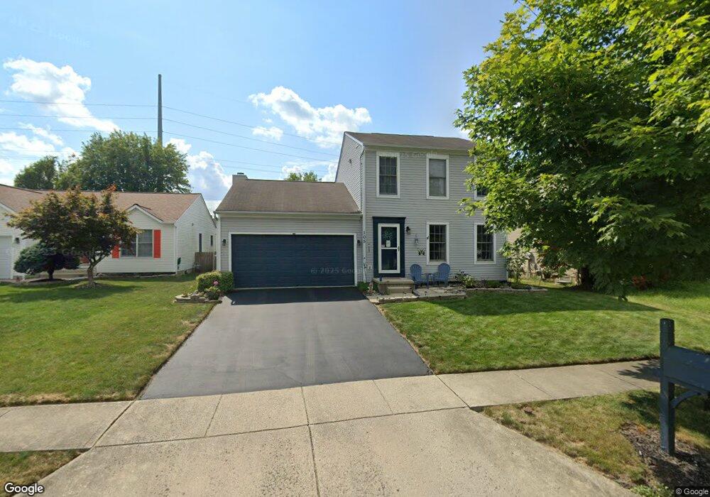
105 Welshmore Dr Galloway, OH 43119
Galloway Ridge NeighborhoodEstimated Value: $291,000 - $367,000
3
Beds
3
Baths
1,630
Sq Ft
$203/Sq Ft
Est. Value
About This Home
This home is located at 105 Welshmore Dr, Galloway, OH 43119 and is currently estimated at $331,002, approximately $203 per square foot. 105 Welshmore Dr is a home located in Franklin County with nearby schools including Galloway Ridge Intermediate School, Darby Woods Elementary School, and Norton Middle School.
Ownership History
Date
Name
Owned For
Owner Type
Purchase Details
Closed on
Nov 14, 2005
Sold by
Citifinancial Mortgage Co Inc
Bought by
Adams Wendy M
Current Estimated Value
Home Financials for this Owner
Home Financials are based on the most recent Mortgage that was taken out on this home.
Original Mortgage
$100,720
Outstanding Balance
$54,164
Interest Rate
6.13%
Mortgage Type
Fannie Mae Freddie Mac
Estimated Equity
$276,838
Purchase Details
Closed on
Apr 5, 2005
Sold by
Ward Samuel N and Ward Samuel
Bought by
Citifinancial Mortgage Co Inc
Purchase Details
Closed on
May 28, 1998
Sold by
Dominion Homes Inc
Bought by
Ward Samuel N and Ward Eva Marie
Home Financials for this Owner
Home Financials are based on the most recent Mortgage that was taken out on this home.
Original Mortgage
$128,426
Interest Rate
7.27%
Mortgage Type
FHA
Create a Home Valuation Report for This Property
The Home Valuation Report is an in-depth analysis detailing your home's value as well as a comparison with similar homes in the area
Home Values in the Area
Average Home Value in this Area
Purchase History
We collect this data history from publicly available records. To have your information removed, we recommend requesting removal directly through your county’s website.
| Date | Buyer | Sale Price | Title Company |
|---|---|---|---|
| Adams Wendy M | $125,900 | Sovereign | |
| Citifinancial Mortgage Co Inc | $121,000 | Sovereign | |
| Ward Samuel N | $139,600 | Alliance Title |
Source: Public Records
Mortgage History
We collect this data history from publicly available records. To have your information removed, we recommend requesting removal directly through your county’s website.
| Date | Status | Borrower | Loan Amount |
|---|---|---|---|
| Open | Adams Wendy M | $100,720 | |
| Previous Owner | Ward Samuel N | $128,426 |
Source: Public Records
Tax History
| Year | Tax Paid | Tax Assessment Tax Assessment Total Assessment is a certain percentage of the fair market value that is determined by local assessors to be the total taxable value of land and additions on the property. | Land | Improvement |
|---|---|---|---|---|
| 2025 | $3,525 | $96,670 | $29,050 | $67,620 |
| 2024 | $3,525 | $96,670 | $29,050 | $67,620 |
| 2023 | $3,462 | $96,670 | $29,050 | $67,620 |
| 2022 | $3,118 | $63,880 | $10,920 | $52,960 |
| 2021 | $3,180 | $63,880 | $10,920 | $52,960 |
| 2020 | $3,162 | $63,880 | $10,920 | $52,960 |
| 2019 | $2,992 | $53,340 | $9,100 | $44,240 |
| 2018 | $2,867 | $53,340 | $9,100 | $44,240 |
| 2017 | $2,965 | $53,340 | $9,100 | $44,240 |
| 2016 | $2,755 | $45,540 | $7,110 | $38,430 |
| 2015 | $2,755 | $45,540 | $7,110 | $38,430 |
| 2014 | $2,758 | $45,540 | $7,110 | $38,430 |
| 2013 | $2,880 | $47,950 | $7,490 | $40,460 |
Source: Public Records
Map
Nearby Homes
- 5906 Westbend Dr
- 311 Galloway Ridge Dr
- 277 Rainswept Dr
- 285 Rainswept Dr
- 5529 Longworth Dr
- 363 Belfair Dr
- 5910 Wellbrid Dr
- 5945 Annsborough Dr
- 5515 Glenchester Dr
- 5947 Ballydugan Dr
- 368 Mogul Dr
- 5447 Inglecrest Place
- 5933 Kilbeggan St
- 493 Lilyfield Ln
- 89 Alton Darby Creek Rd
- 150 Lennox Ave
- 6110 Federalist Dr Unit 151
- 5978 Carrbridge Ct
- 5579 Coral Ct
- 272-274 Hilliard Rome Rd
- 113 Welshmore Dr
- 97 Welshmore Dr
- 121 Welshmore Dr
- 89 Welshmore Dr
- 129 Welshmore Dr
- 5820 Sharets Dr
- 114 Welshmore Dr
- 137 Welshmore Dr
- 5837 Sharets Dr
- 5837 Sharets Dr Unit 33
- 122 Welshmore Dr
- 5829 Sharets Dr
- 145 Welshmore Dr
- 5806 Sharets Dr
- 5821 Sharets Dr
- 138 Welshmore Dr
- 109 Thevintree Dr
- 109 Thevintree Dr Unit 52
- 5813 Sharets Dr
- 153 Welshmore Dr
Your Personal Tour Guide
Ask me questions while you tour the home.