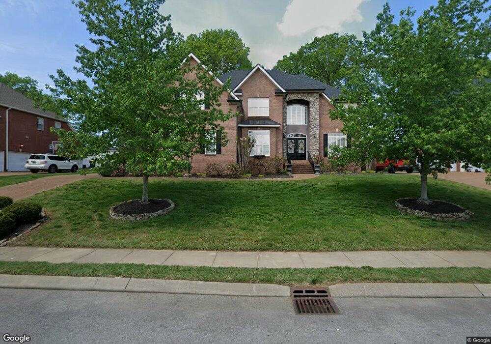
1050 Auldridge Dr Spring Hill, TN 37174
Estimated Value: $730,883 - $828,000
--
Bed
4
Baths
3,398
Sq Ft
$230/Sq Ft
Est. Value
About This Home
This home is located at 1050 Auldridge Dr, Spring Hill, TN 37174 and is currently estimated at $782,971, approximately $230 per square foot. 1050 Auldridge Dr is a home located in Williamson County with nearby schools including Primrose School of Spring Hill.
Ownership History
Date
Name
Owned For
Owner Type
Purchase Details
Closed on
Jul 17, 2006
Sold by
Renner David V and Miles Christina L
Bought by
Ford Raymond L and Ford Gayle H
Current Estimated Value
Home Financials for this Owner
Home Financials are based on the most recent Mortgage that was taken out on this home.
Original Mortgage
$302,750
Outstanding Balance
$178,641
Interest Rate
6.54%
Mortgage Type
Purchase Money Mortgage
Estimated Equity
$604,330
Purchase Details
Closed on
Sep 17, 2004
Sold by
C & C Homes Inc
Bought by
Renner David and Miles Christina L
Home Financials for this Owner
Home Financials are based on the most recent Mortgage that was taken out on this home.
Original Mortgage
$279,920
Interest Rate
5.71%
Mortgage Type
Purchase Money Mortgage
Create a Home Valuation Report for This Property
The Home Valuation Report is an in-depth analysis detailing your home's value as well as a comparison with similar homes in the area
Home Values in the Area
Average Home Value in this Area
Purchase History
| Date | Buyer | Sale Price | Title Company |
|---|---|---|---|
| Ford Raymond L | $432,500 | First National Financial Tit | |
| Renner David | $349,900 | Saturn & Mazer Title Service |
Source: Public Records
Mortgage History
| Date | Status | Borrower | Loan Amount |
|---|---|---|---|
| Open | Ford Raymond L | $302,750 | |
| Previous Owner | Renner David | $279,920 | |
| Closed | Renner David | $52,485 |
Source: Public Records
Tax History Compared to Growth
Tax History
| Year | Tax Paid | Tax Assessment Tax Assessment Total Assessment is a certain percentage of the fair market value that is determined by local assessors to be the total taxable value of land and additions on the property. | Land | Improvement |
|---|---|---|---|---|
| 2025 | $891 | $182,125 | $42,500 | $139,625 |
| 2024 | $891 | $120,550 | $22,500 | $98,050 |
| 2023 | $891 | $120,550 | $22,500 | $98,050 |
| 2022 | $2,206 | $120,550 | $22,500 | $98,050 |
| 2021 | $2,206 | $120,550 | $22,500 | $98,050 |
| 2020 | $2,054 | $95,100 | $16,250 | $78,850 |
| 2019 | $2,054 | $95,100 | $16,250 | $78,850 |
| 2018 | $1,988 | $95,100 | $16,250 | $78,850 |
| 2017 | $1,969 | $95,100 | $16,250 | $78,850 |
| 2016 | $1,940 | $95,100 | $16,250 | $78,850 |
| 2015 | -- | $79,125 | $15,000 | $64,125 |
| 2014 | -- | $79,125 | $15,000 | $64,125 |
Source: Public Records
Map
Nearby Homes
- 0 Campbell Station Pkwy
- 1083 Auldridge Dr
- 184 Mary Ann Cir
- 3024 Harrah Dr
- 403 Preakness Dr
- 0 O'Hallorn Dr
- 2165 Loudenslager Dr
- 2127 Loudenslager Dr
- 2641 Buckner Rd
- 2505 Preston Way
- 1009 Tanyard Springs Dr
- 319 Buckwood Ln N
- 323 Buckwood Ln N
- 470 Buckwood Ave W
- 315 Buckwood Ln N
- 448 Buckwood Ave W
- 313 Buckwood Ln W
- 468 Buckwood Ave W
- 460 Buckwood Ave W
- 2112 Loudenslager Dr
- 1048 Auldridge Dr
- 1052 Auldridge Dr
- 2229 Joann Dr
- 2227 Joann Dr
- 2231 Joann Dr
- 1051 Auldridge Dr
- 2000 Thurmond Ct
- 2225 Joann Dr
- 1054 Auldridge Dr
- 1046 Auldridge Dr
- 2233 Joann Dr
- 2223 Joann Dr
- 2235 Joann Dr
- 1047 Auldridge Dr
- 1049 Auldridge Dr
- 1056 Auldridge Dr
- 2221 Joann Dr
- 2002 Thurmond Ct
- 2228 Joann Dr
- 2001 Thurmond Ct