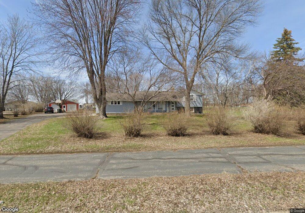
1050 Dale St SW Hutchinson, MN 55350
Estimated Value: $313,928 - $434,000
4
Beds
3
Baths
2,505
Sq Ft
$144/Sq Ft
Est. Value
About This Home
This home is located at 1050 Dale St SW, Hutchinson, MN 55350 and is currently estimated at $360,482, approximately $143 per square foot. 1050 Dale St SW is a home located in McLeod County with nearby schools including Hutchinson West Elementary School, Hutchinson Park Elementary School, and Hutchinson Middle School.
Ownership History
Date
Name
Owned For
Owner Type
Purchase Details
Closed on
May 23, 2022
Sold by
Walters Brian and Walters Casey
Bought by
Zimmermann Joshua and Zimmermann Amanda
Current Estimated Value
Home Financials for this Owner
Home Financials are based on the most recent Mortgage that was taken out on this home.
Original Mortgage
$230,000
Outstanding Balance
$217,423
Interest Rate
4.72%
Mortgage Type
New Conventional
Estimated Equity
$143,059
Create a Home Valuation Report for This Property
The Home Valuation Report is an in-depth analysis detailing your home's value as well as a comparison with similar homes in the area
Home Values in the Area
Average Home Value in this Area
Purchase History
| Date | Buyer | Sale Price | Title Company |
|---|---|---|---|
| Zimmermann Joshua | $320,000 | -- |
Source: Public Records
Mortgage History
| Date | Status | Borrower | Loan Amount |
|---|---|---|---|
| Open | Zimmermann Joshua | $230,000 |
Source: Public Records
Tax History Compared to Growth
Tax History
| Year | Tax Paid | Tax Assessment Tax Assessment Total Assessment is a certain percentage of the fair market value that is determined by local assessors to be the total taxable value of land and additions on the property. | Land | Improvement |
|---|---|---|---|---|
| 2024 | $4,100 | $297,700 | $79,200 | $218,500 |
| 2023 | $4,066 | $288,800 | $79,200 | $209,600 |
| 2022 | $3,630 | $275,100 | $75,300 | $199,800 |
| 2021 | $3,394 | $227,400 | $65,800 | $161,600 |
| 2020 | $3,332 | $204,900 | $59,900 | $145,000 |
| 2019 | $3,010 | $196,600 | $59,900 | $136,700 |
| 2018 | $2,792 | $0 | $0 | $0 |
| 2017 | $2,548 | $0 | $0 | $0 |
| 2016 | $2,426 | $0 | $0 | $0 |
| 2015 | $2,192 | $0 | $0 | $0 |
| 2014 | -- | $0 | $0 | $0 |
Source: Public Records
Map
Nearby Homes
- 1060 Dale St SW
- 1095 Blackbird Trail SW
- 735 Sunset St SW
- 702 Southview Ct SW
- 724 Southview Dr SW
- 1020 Roberts Rd SW
- XXX Airport Rd
- 966 Osgood Ave SW
- 667 Madson Ave SW
- 595 Milwaukee Ave SW
- 642 Juul Rd SW
- 1610 Mahogany Ct SW
- 570 Lynn Rd SW
- 250 Freemont Ave SE Unit 106
- 250 Freemont Ave SE Unit 113
- 250 Freemont Ave SE Unit 136
- 616 Brown St SW
- 660 Lakewood Dr SW
- 545 4th Ave SW
- 805 Franklin St SW
- 1050 Dale St SW
- 1060 Dale St SW
- 1020 Dale St SW
- 1065 Dale St SW
- 1110 1110 Bluejay SW
- 1110 Bluejay Dr SW
- 1085 Dale St SW Unit 132
- 1085 Dale St SW Unit 129
- 1085 Dale St SW Unit 127
- 1085 Dale St SW Unit 126
- 1085 Dale St SW Unit 124
- 1085 Dale St SW Unit 121
- 1085 Dale St SW Unit 117
- 1085 Dale St SW Unit 115
- 1085 Dale St SW Unit 113
- 1085 Dale St SW Unit 111
- 1085 Dale St SW Unit 110
- 1085 Dale St SW Unit 109
- 1085 Dale St SW Unit 106
- 1085 Dale St SW Unit 103