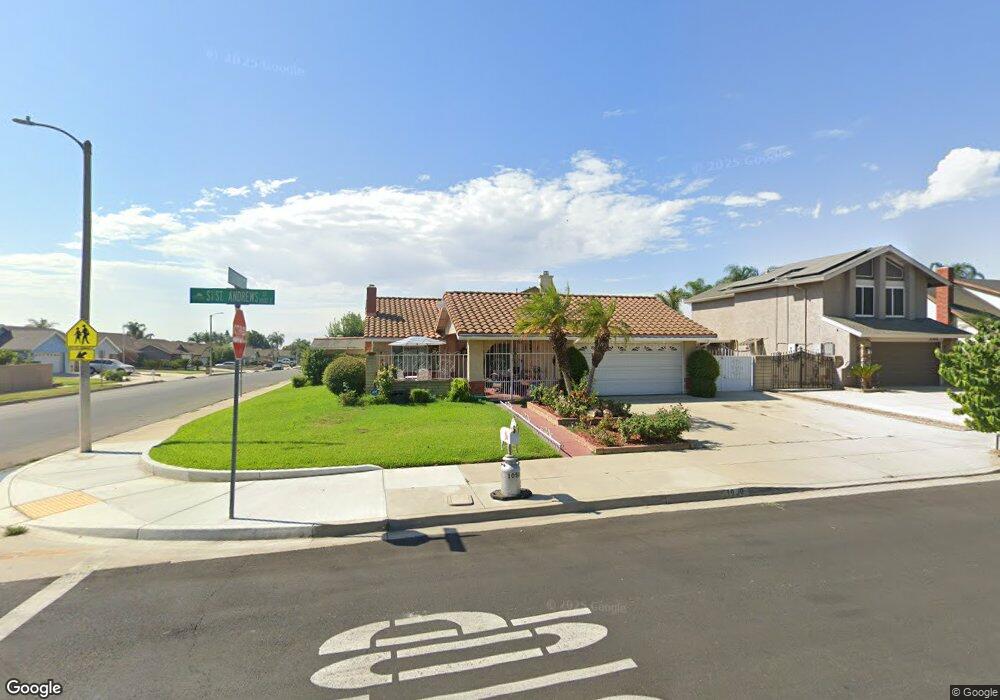
1050 E Saint Andrews St Ontario, CA 91761
Ontario Ranch NeighborhoodEstimated Value: $669,169 - $709,000
3
Beds
2
Baths
1,344
Sq Ft
$514/Sq Ft
Est. Value
About This Home
This home is located at 1050 E Saint Andrews St, Ontario, CA 91761 and is currently estimated at $691,292, approximately $514 per square foot. 1050 E Saint Andrews St is a home located in San Bernardino County with nearby schools including Liberty Elementary School, Woodcrest Junior High, and Chino High School.
Ownership History
Date
Name
Owned For
Owner Type
Purchase Details
Closed on
Feb 29, 2020
Sold by
Ruelas Alfredo and Ruelas Maria Teresa
Bought by
Ruelas Alfredo and Ruelas Maria T
Current Estimated Value
Purchase Details
Closed on
Aug 30, 1996
Sold by
Ann Solak Carrie A and Ann Carrie
Bought by
Ruelas Alfredo and Ruelas Maria Teresa
Home Financials for this Owner
Home Financials are based on the most recent Mortgage that was taken out on this home.
Original Mortgage
$124,961
Interest Rate
4.95%
Purchase Details
Closed on
Dec 7, 1995
Sold by
Solak John M and Solak Carrie A
Bought by
Solak Carrie Bastieri
Create a Home Valuation Report for This Property
The Home Valuation Report is an in-depth analysis detailing your home's value as well as a comparison with similar homes in the area
Home Values in the Area
Average Home Value in this Area
Purchase History
| Date | Buyer | Sale Price | Title Company |
|---|---|---|---|
| Ruelas Alfredo | -- | None Available | |
| Ruelas Alfredo | $139,000 | Fidelity National Title Ins | |
| Solak Carrie Bastieri | -- | Fidelity National Title Ins |
Source: Public Records
Mortgage History
| Date | Status | Borrower | Loan Amount |
|---|---|---|---|
| Previous Owner | Ruelas Alfredo | $124,961 |
Source: Public Records
Tax History
| Year | Tax Paid | Tax Assessment Tax Assessment Total Assessment is a certain percentage of the fair market value that is determined by local assessors to be the total taxable value of land and additions on the property. | Land | Improvement |
|---|---|---|---|---|
| 2025 | $2,505 | $226,387 | $56,678 | $169,709 |
| 2024 | $2,438 | $221,948 | $55,567 | $166,381 |
| 2023 | $2,371 | $217,596 | $54,477 | $163,119 |
| 2022 | $2,356 | $213,330 | $53,409 | $159,921 |
| 2021 | $2,309 | $209,147 | $52,362 | $156,785 |
| 2020 | $2,356 | $207,002 | $51,825 | $155,177 |
| 2019 | $2,316 | $202,943 | $50,809 | $152,134 |
| 2018 | $2,266 | $198,964 | $49,813 | $149,151 |
| 2017 | $2,227 | $195,062 | $48,836 | $146,226 |
| 2016 | $2,084 | $191,237 | $47,878 | $143,359 |
| 2015 | $2,044 | $188,365 | $47,159 | $141,206 |
| 2014 | $2,005 | $184,675 | $46,235 | $138,440 |
Source: Public Records
Map
Nearby Homes
- 2644 S Cucamonga Ave
- 683 E Joseph Privado
- 2431 S Marigold Place
- 665 E Riverside Dr Unit 3
- 619 E Joseph Privado
- 2408 S Taylor Place
- 4315 S Grasly Paseo
- 0 Vineyard Unit CV25067044
- 1528 1538 W Holt
- 1305 W North Pinecrest
- 1426 E Tam o Shanter St
- 1468 E Merion Ct
- 2413 S Parco Ave
- 2410 S Sandpiper Place
- 2424 S Lake Ave
- 513 E Fairfield Ct
- 1456 E Philadelphia St Unit 134
- 1456 E Philadelphia St Unit 378
- 1456 E Philadelphia St Unit 275
- 1456 E Philadelphia St Unit 359
- 1044 E Saint Andrews St
- 2808 S Cucamonga Ave
- 1038 E Saint Andrews St
- 1102 E Saint Andrews St
- 2818 S Cucamonga Ave
- 2744 S Cucamonga Ave
- 2803 S Cucamonga Ave
- 1032 E Saint Andrews St
- 1071 E Deerfield St
- 1108 E Saint Andrews St
- 2739 S Holmes Ave
- 2826 S Cucamonga Ave
- 2738 S Cucamonga Ave
- 2737 S Cucamonga Ave
- 2809 S Cucamonga Ave
- 1063 E Deerfield St
- 1026 E Saint Andrews St
- 1114 E Saint Andrews St
- 2733 S Holmes Ave
- 2815 S Cucamonga Ave
Your Personal Tour Guide
Ask me questions while you tour the home.