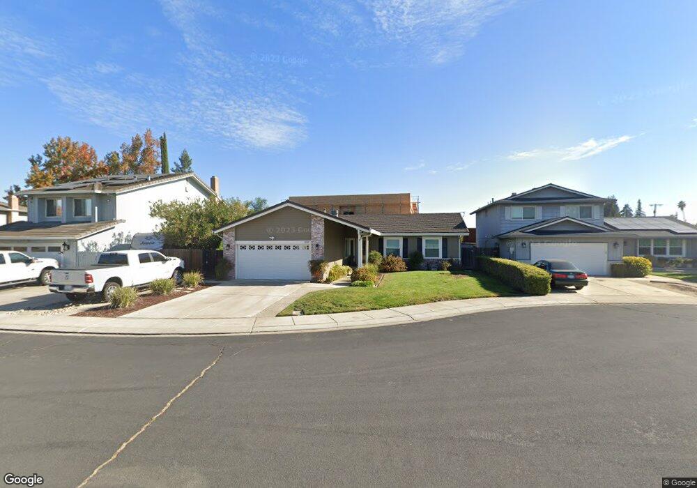
1050 Hatchcover Place Manteca, CA 95337
Estimated Value: $369,000 - $555,000
3
Beds
2
Baths
1,592
Sq Ft
$313/Sq Ft
Est. Value
About This Home
This home is located at 1050 Hatchcover Place, Manteca, CA 95337 and is currently estimated at $497,791, approximately $312 per square foot. 1050 Hatchcover Place is a home located in San Joaquin County with nearby schools including Brock Elliott Elementary School and Sierra High School.
Ownership History
Date
Name
Owned For
Owner Type
Purchase Details
Closed on
Mar 19, 2009
Sold by
Knowles Dennis Wayne and Knowles Krista Renee
Bought by
Knowles Dennis Wayne and Knowles Krista Renee
Current Estimated Value
Purchase Details
Closed on
Oct 27, 2002
Sold by
Haworth Larry
Bought by
Rankin Richard
Home Financials for this Owner
Home Financials are based on the most recent Mortgage that was taken out on this home.
Original Mortgage
$60,000
Outstanding Balance
$25,076
Interest Rate
5.99%
Estimated Equity
$472,715
Create a Home Valuation Report for This Property
The Home Valuation Report is an in-depth analysis detailing your home's value as well as a comparison with similar homes in the area
Home Values in the Area
Average Home Value in this Area
Purchase History
| Date | Buyer | Sale Price | Title Company |
|---|---|---|---|
| Knowles Dennis Wayne | -- | None Available | |
| Rankin Richard | -- | -- |
Source: Public Records
Mortgage History
| Date | Status | Borrower | Loan Amount |
|---|---|---|---|
| Open | Rankin Richard | $60,000 |
Source: Public Records
Tax History Compared to Growth
Tax History
| Year | Tax Paid | Tax Assessment Tax Assessment Total Assessment is a certain percentage of the fair market value that is determined by local assessors to be the total taxable value of land and additions on the property. | Land | Improvement |
|---|---|---|---|---|
| 2025 | $2,333 | $215,594 | $59,723 | $155,871 |
| 2024 | $2,266 | $211,367 | $58,552 | $152,815 |
| 2023 | $2,237 | $207,223 | $57,404 | $149,819 |
| 2022 | $2,202 | $203,161 | $56,279 | $146,882 |
| 2021 | $2,177 | $199,178 | $55,176 | $144,002 |
| 2020 | $2,088 | $197,137 | $54,611 | $142,526 |
| 2019 | $2,060 | $193,273 | $53,541 | $139,732 |
| 2018 | $2,031 | $189,485 | $52,492 | $136,993 |
| 2017 | $2,000 | $185,770 | $51,463 | $134,307 |
| 2016 | $1,951 | $182,129 | $50,454 | $131,675 |
| 2014 | $1,812 | $175,880 | $48,723 | $127,157 |
Source: Public Records
Map
Nearby Homes
- 1338 Alfa Romeo Ct
- 889 Magrath Ave
- 1121 Wawona St
- 1015 Tenaya Ct
- 1148 Silver Brook Place
- 1164 Marion St
- 1188 Merganser Place
- 883 El Dorado St
- 938 Snowgoose Ln
- 217 Grand Prix Ave
- 819 Wawona St
- 1833 Rail St
- 311 Teresa Place
- 1432 Meridian St
- 516 S Veach Ave
- 612 Martha St
- 660 Tahoe St
- 1676 Red Ribbons Ln
- 1602 Oleander Ave
- 516 Carrigane Way
- 1042 Hatchcover Place
- 1058 Hatchcover Place
- 1036 Hatchcover Place
- 1051 Hatchcover Place
- 1045 Hatchcover Place
- 1037 Magrath Place
- 1028 Hatchcover Place
- 1065 Hatchcover Place
- 1057 Hatchcover Place
- 1037 Hatchcover Place
- 1029 Magrath Place
- 1031 Hatchcover Place
- 1022 Hatchcover Place
- 1052 Compass Ln
- 1046 Compass Ln
- 1060 Compass Ln
- 1062 Suess Ct
- 1021 Magrath Place
- 1038 Magrath Place
- 1023 Hatchcover Place