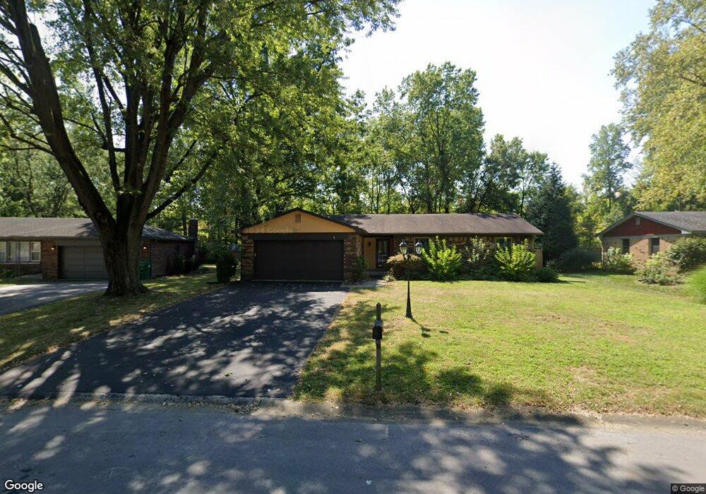
10505 Norman Rd Brownsburg, IN 46112
Estimated Value: $255,000 - $279,000
3
Beds
2
Baths
1,542
Sq Ft
$171/Sq Ft
Est. Value
About This Home
This home is located at 10505 Norman Rd, Brownsburg, IN 46112 and is currently estimated at $263,862, approximately $171 per square foot. 10505 Norman Rd is a home located in Hendricks County with nearby schools including Lincoln Elementary, Brownsburg East Middle School, and Brownsburg High School.
Ownership History
Date
Name
Owned For
Owner Type
Purchase Details
Closed on
May 31, 2017
Sold by
Estes Nino M and Estes Amy M
Bought by
Revis David and Revis Rebeka
Current Estimated Value
Home Financials for this Owner
Home Financials are based on the most recent Mortgage that was taken out on this home.
Original Mortgage
$137,700
Outstanding Balance
$114,381
Interest Rate
3.97%
Mortgage Type
New Conventional
Estimated Equity
$149,482
Create a Home Valuation Report for This Property
The Home Valuation Report is an in-depth analysis detailing your home's value as well as a comparison with similar homes in the area
Home Values in the Area
Average Home Value in this Area
Purchase History
| Date | Buyer | Sale Price | Title Company |
|---|---|---|---|
| Revis David | -- | -- |
Source: Public Records
Mortgage History
| Date | Status | Borrower | Loan Amount |
|---|---|---|---|
| Open | Revis David | $137,700 |
Source: Public Records
Tax History Compared to Growth
Tax History
| Year | Tax Paid | Tax Assessment Tax Assessment Total Assessment is a certain percentage of the fair market value that is determined by local assessors to be the total taxable value of land and additions on the property. | Land | Improvement |
|---|---|---|---|---|
| 2024 | $2,174 | $219,200 | $36,000 | $183,200 |
| 2023 | $1,828 | $195,600 | $32,100 | $163,500 |
| 2022 | $1,738 | $187,400 | $30,500 | $156,900 |
| 2021 | $1,466 | $163,300 | $28,500 | $134,800 |
| 2020 | $1,351 | $153,400 | $28,500 | $124,900 |
| 2019 | $1,215 | $143,500 | $27,300 | $116,200 |
| 2018 | $1,162 | $138,300 | $27,300 | $111,000 |
| 2017 | $1,152 | $136,100 | $26,400 | $109,700 |
| 2016 | $1,079 | $130,800 | $26,400 | $104,400 |
| 2014 | $905 | $115,400 | $25,100 | $90,300 |
Source: Public Records
Map
Nearby Homes
- 4369 Aspen Dr
- 4430 Chatham Dr
- 4285 Varner Rd
- 10270 E County Road 450 N
- 4375 Round Lake Bend
- 10925 E County Road 450 N
- 9250 Ratcliff Ct
- 4080 Tansel Rd
- 11000 E Us Highway 136
- 3951 Tansel Rd
- 8805 Railwood Dr
- 10611 Armstead Ave
- 10553 Virginia Ave
- 4858 Cedar Branch Ct
- 10145 Eagle Eye Way
- 3054 Tansel Rd
- 5594 Crump Ln
- 9062 W 30th St
- 5664 Crump Ln
- 1844 Creekside Dr
- 10495 Norman Rd
- 10519 Norman Rd
- 10477 Norman Rd
- 4318 Clifford Rd
- 4342 Clifford Rd
- 4320 Clifford Rd
- 10463 Norman Rd
- 4314 Clifford Rd
- 10478 Norman Rd
- 10494 Norman Rd
- 10466 Norman Rd
- 10447 Norman Rd
- 4310 Clifford Rd
- 4350 Clifford Rd
- 4331 Clifford Rd
- 4317 Clifford Rd
- 10444 Norman Rd
- 4305 Clifford Rd
- 10435 Norman Rd
- 4331 Clifford Rd