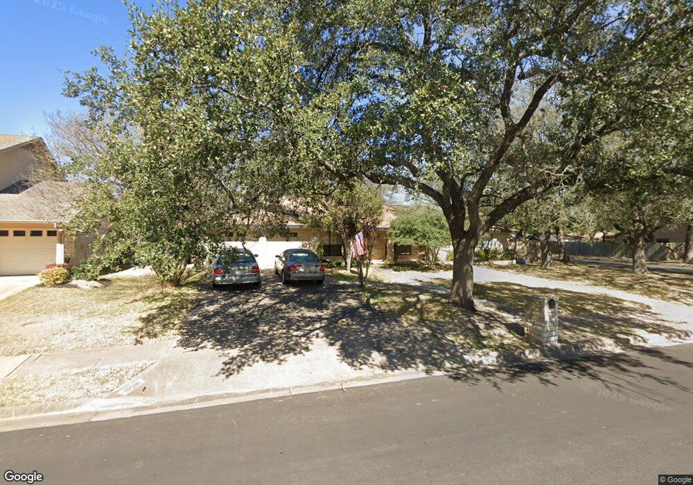
10506 Mourning Dove Dr Austin, TX 78750
Anderson Mill NeighborhoodEstimated Value: $504,000 - $579,000
--
Bed
2
Baths
2,308
Sq Ft
$228/Sq Ft
Est. Value
About This Home
This home is located at 10506 Mourning Dove Dr, Austin, TX 78750 and is currently estimated at $526,635, approximately $228 per square foot. 10506 Mourning Dove Dr is a home located in Williamson County with nearby schools including Anderson Mill Elementary School, Noel Grisham Middle, and Westwood High School.
Ownership History
Date
Name
Owned For
Owner Type
Purchase Details
Closed on
Oct 27, 2006
Sold by
Alexander Virginia Lee and Alexander Virginia L
Bought by
Ketterl Paula J
Current Estimated Value
Home Financials for this Owner
Home Financials are based on the most recent Mortgage that was taken out on this home.
Original Mortgage
$165,600
Outstanding Balance
$98,338
Interest Rate
6.28%
Mortgage Type
Purchase Money Mortgage
Estimated Equity
$428,297
Create a Home Valuation Report for This Property
The Home Valuation Report is an in-depth analysis detailing your home's value as well as a comparison with similar homes in the area
Home Values in the Area
Average Home Value in this Area
Purchase History
| Date | Buyer | Sale Price | Title Company |
|---|---|---|---|
| Ketterl Paula J | -- | Landamerica Commonwealth Tit |
Source: Public Records
Mortgage History
| Date | Status | Borrower | Loan Amount |
|---|---|---|---|
| Open | Ketterl Paula J | $165,600 |
Source: Public Records
Tax History Compared to Growth
Tax History
| Year | Tax Paid | Tax Assessment Tax Assessment Total Assessment is a certain percentage of the fair market value that is determined by local assessors to be the total taxable value of land and additions on the property. | Land | Improvement |
|---|---|---|---|---|
| 2025 | $4,691 | $475,762 | $88,500 | $387,262 |
| 2024 | $4,691 | $496,859 | -- | -- |
| 2023 | $4,422 | $451,690 | $92,000 | $359,690 |
| 2022 | $8,866 | $412,914 | $0 | $0 |
| 2021 | $9,222 | $375,376 | $72,000 | $336,672 |
| 2020 | $8,119 | $341,251 | $66,598 | $274,653 |
| 2019 | $8,220 | $336,064 | $60,700 | $275,364 |
| 2018 | $6,134 | $322,121 | $54,891 | $267,230 |
| 2017 | $7,462 | $298,944 | $51,300 | $289,556 |
| 2016 | $6,783 | $271,767 | $51,300 | $252,783 |
| 2015 | $5,460 | $247,061 | $42,100 | $208,480 |
| 2014 | $5,460 | $224,601 | $0 | $0 |
Source: Public Records
Map
Nearby Homes
- 10606 Mourning Dove Dr
- 10404 Mourning Dove Dr
- 11902 Millwright Pkwy
- 10401 Mourning Dove Dr
- 11905 Millwright Pkwy
- 10255 Missel Thrush Dr
- 10229 Missel Thrush Dr
- 11512 Tin Cup Dr Unit 309
- 11512 Tin Cup Dr Unit 205
- 11402 Pickfair Dr
- 11533 Sandy Loam Trail
- 11007 Opal Trail
- 11310 Spicewood Club Dr Unit 12
- 11310 Spicewood Club Dr Unit 21
- 1028 Verbena Dr
- 12114 Scissortail Dr
- 11000 Anderson Mill Rd Unit 96
- 11000 Anderson Mill Rd Unit 63
- 11302 Centennial Trail
- 11100 Alison Parke Trail
- 10508 Mourning Dove Dr
- 10509 Doering Ln
- 10511 Doering Ln
- 10502 Mourning Dove Dr
- 10507 Doering Ln
- 10513 Doering Ln
- 10507 Mourning Dove Dr
- 10510 Mourning Dove Dr
- 10509 Mourning Dove Dr
- 10505 Mourning Dove Dr
- 10500 Mourning Dove Dr
- 10601 Doering Ln
- 10505 Doering Ln
- 10511 Mourning Dove Dr
- 10503 Mourning Dove Dr
- 10600 Mourning Dove Dr
- 10506 Doering Ln
- 10508 Doering Ln
- 10601 Mourning Dove Dr
- 10603 Doering Ln