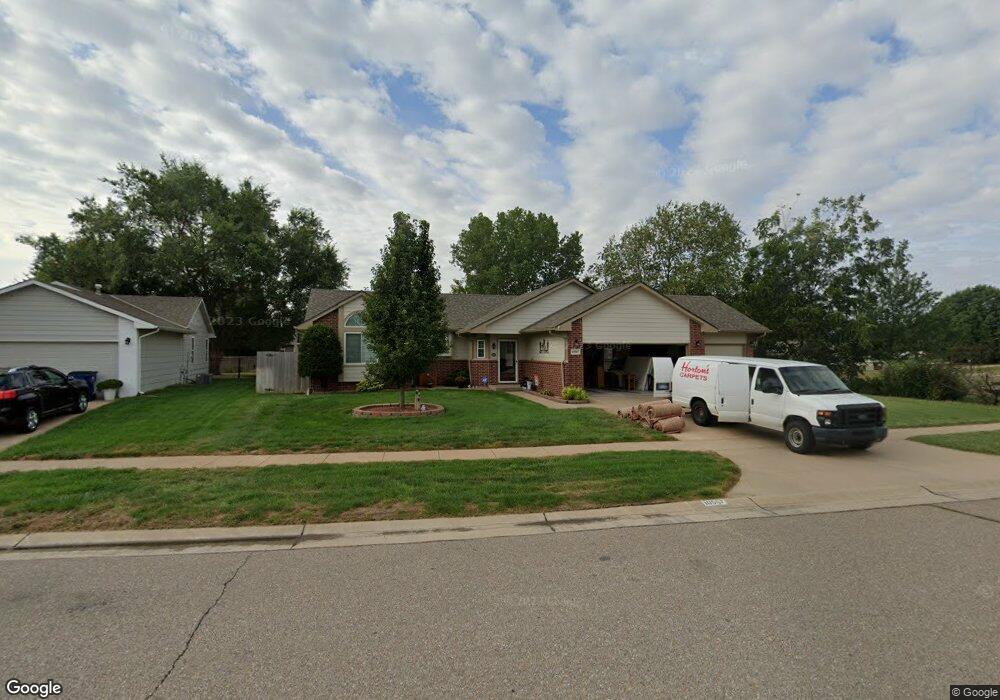
10507 W Haskell St Wichita, KS 67209
West Wichita NeighborhoodEstimated Value: $268,000 - $287,039
3
Beds
3
Baths
1,174
Sq Ft
$236/Sq Ft
Est. Value
About This Home
This home is located at 10507 W Haskell St, Wichita, KS 67209 and is currently estimated at $277,520, approximately $236 per square foot. 10507 W Haskell St is a home located in Sedgwick County with nearby schools including Clark Davidson Elementary School, Challenger Intermediate School, and Goddard Middle School.
Ownership History
Date
Name
Owned For
Owner Type
Purchase Details
Closed on
Dec 8, 2015
Sold by
Gallop Robert B and Gallop Diane S
Bought by
Robert B & Diane S Gallop Living Trust and Gallop Diane S
Current Estimated Value
Purchase Details
Closed on
Mar 5, 1999
Sold by
Builders Development Inc
Bought by
Waggoner Steven D and Waggoner Nicole D
Home Financials for this Owner
Home Financials are based on the most recent Mortgage that was taken out on this home.
Original Mortgage
$94,300
Outstanding Balance
$22,920
Interest Rate
6.8%
Estimated Equity
$254,600
Create a Home Valuation Report for This Property
The Home Valuation Report is an in-depth analysis detailing your home's value as well as a comparison with similar homes in the area
Home Values in the Area
Average Home Value in this Area
Purchase History
| Date | Buyer | Sale Price | Title Company |
|---|---|---|---|
| Robert B & Diane S Gallop Living Trust | -- | None Available | |
| Waggoner Steven D | -- | Columbian Natl Title Ins Co |
Source: Public Records
Mortgage History
| Date | Status | Borrower | Loan Amount |
|---|---|---|---|
| Open | Waggoner Steven D | $94,300 |
Source: Public Records
Tax History Compared to Growth
Tax History
| Year | Tax Paid | Tax Assessment Tax Assessment Total Assessment is a certain percentage of the fair market value that is determined by local assessors to be the total taxable value of land and additions on the property. | Land | Improvement |
|---|---|---|---|---|
| 2025 | $2,940 | $28,267 | $5,934 | $22,333 |
| 2023 | $2,940 | $24,461 | $4,554 | $19,907 |
| 2022 | $2,450 | $21,367 | $4,301 | $17,066 |
| 2021 | $2,300 | $19,781 | $2,818 | $16,963 |
| 2020 | $2,136 | $18,148 | $2,818 | $15,330 |
| 2019 | $1,970 | $16,653 | $2,818 | $13,835 |
| 2018 | $1,886 | $15,721 | $2,128 | $13,593 |
| 2017 | $1,816 | $0 | $0 | $0 |
| 2016 | $1,807 | $0 | $0 | $0 |
| 2015 | $1,983 | $0 | $0 | $0 |
| 2014 | $2,384 | $0 | $0 | $0 |
Source: Public Records
Map
Nearby Homes
- 2325 S Leecrest St
- 10214 W Prairie Woods St
- 10825 W Lotus St
- 10905 W Stafford St
- 10514 W Jewell St
- 10416 W Jewell Cir
- 2417 S Lark Ln
- 2053 S Crestline Ct
- 10616 W Jewell St
- 2021 S Crestline Ct
- 2068 S Fieldcrest St
- 11755 W Cherese Cir
- 2310 S Prescott St
- 2933 S Maize Ct
- 2917 S Maize Ct
- 2421 S Yellowstone St
- 2233 S Prescott Ct
- 10709 W Yosemite St
- 2715 S Crestline Ct
- 11009 W Hadden Cir
- 10503 W Haskell St
- 2306 S Stoney Point St
- 10510 W Haskell St
- 10506 W Haskell St
- 10414 W Stafford Ct
- 10514 W Haskell St
- 10504 W Stafford St
- 10508 W Stafford St
- 2310 S Stoney Point St
- 10414 W Haskell St
- 10518 W Haskell St
- 10418 W Stafford Ct
- 10512 W Stafford St
- 10410 W Stafford Ct
- 2303 S Stoney Point St
- 10410 W Haskell St
- 10602 W Haskell St
- 2314 S Stoney Point St
- 2307 S Stoney Point St
- 2313 S Leecrest St