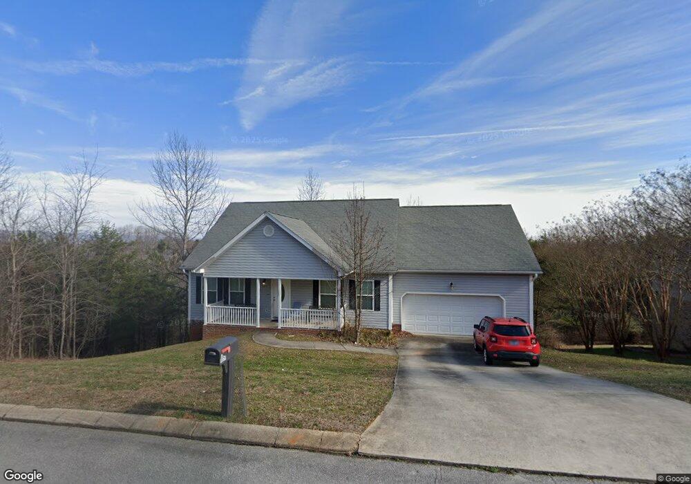
1051 Apollo Dr Soddy Daisy, TN 37379
Estimated Value: $384,000 - $438,000
3
Beds
3
Baths
2,132
Sq Ft
$193/Sq Ft
Est. Value
About This Home
This home is located at 1051 Apollo Dr, Soddy Daisy, TN 37379 and is currently estimated at $411,131, approximately $192 per square foot. 1051 Apollo Dr is a home located in Hamilton County.
Ownership History
Date
Name
Owned For
Owner Type
Purchase Details
Closed on
Apr 16, 2010
Sold by
Community National Bank Inc
Bought by
Williams Sherry L
Current Estimated Value
Purchase Details
Closed on
Feb 8, 2008
Sold by
Keyes Donald
Bought by
Community National Bank Inc
Purchase Details
Closed on
Feb 8, 2006
Sold by
Keyes Bobby
Bought by
Keyes Donald
Home Financials for this Owner
Home Financials are based on the most recent Mortgage that was taken out on this home.
Original Mortgage
$170,480
Interest Rate
6.08%
Mortgage Type
Purchase Money Mortgage
Create a Home Valuation Report for This Property
The Home Valuation Report is an in-depth analysis detailing your home's value as well as a comparison with similar homes in the area
Home Values in the Area
Average Home Value in this Area
Purchase History
| Date | Buyer | Sale Price | Title Company |
|---|---|---|---|
| Williams Sherry L | $175,500 | Title Ins Co Chattanooga | |
| Community National Bank Inc | $193,000 | None Available | |
| Keyes Donald | $25,000 | None Available |
Source: Public Records
Mortgage History
| Date | Status | Borrower | Loan Amount |
|---|---|---|---|
| Previous Owner | Keyes Donald | $170,480 |
Source: Public Records
Tax History Compared to Growth
Tax History
| Year | Tax Paid | Tax Assessment Tax Assessment Total Assessment is a certain percentage of the fair market value that is determined by local assessors to be the total taxable value of land and additions on the property. | Land | Improvement |
|---|---|---|---|---|
| 2024 | $1,397 | $62,425 | $0 | $0 |
| 2023 | $2,102 | $62,425 | $0 | $0 |
| 2022 | $2,102 | $62,425 | $0 | $0 |
| 2021 | $2,102 | $62,425 | $0 | $0 |
| 2020 | $2,146 | $51,900 | $0 | $0 |
| 2019 | $2,146 | $51,900 | $0 | $0 |
| 2018 | $2,146 | $51,900 | $0 | $0 |
| 2017 | $2,146 | $51,900 | $0 | $0 |
| 2016 | $2,102 | $0 | $0 | $0 |
| 2015 | $2,102 | $50,825 | $0 | $0 |
| 2014 | $2,102 | $0 | $0 | $0 |
Source: Public Records
Map
Nearby Homes
- 1055 Apollo Dr
- 1052 Trojan Run Dr
- 1008 Trojan Run Dr
- 10627 Jeneva Ln
- 10496 Sovereign Pointe Dr
- 10428 Jeneva Ln
- 11312 Hixson Pike
- 11008 Lovell Rd
- 1270 Jacob Dr
- 1383 Osage Dr
- 11734 Armstrong Rd
- 1230 Green Pond Rd
- 1524 Green Pond Rd
- 11213 Dayton Pike
- 11219 Dayton Pike
- 11036 High River Dr
- 11221 Dayton Pike
- 11652 Hixson Pike
- 10224 Tommys Ln
- 13212 Dayton Pike
- 1053 Apollo Dr
- 1049 Apollo Dr
- 1046 Apollo Dr
- 1044 Apollo Dr
- 1047 Apollo Dr
- 1048 Apollo Dr
- 1055 Apollo Dr Unit 66
- 1045 Apollo Dr
- 1050 Apollo Dr
- 1057 Apollo Dr Unit 65
- 1057 Apollo Dr
- 1040 Trojan Run Dr
- 1038 Trojan Run Dr
- 1043 Apollo Dr
- 1042 Trojan Run Dr
- 1054 Trojan Run Dr
- 1034 Trojan Run Dr
- 1059 Apollo Dr
- 1052 Apollo Dr
- 1056 Trojan Run Dr