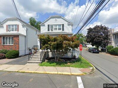
1051 Poplar St Secaucus, NJ 07094
Estimated Value: $548,444 - $749,000
--
Bed
--
Bath
1,560
Sq Ft
$420/Sq Ft
Est. Value
About This Home
This home is located at 1051 Poplar St, Secaucus, NJ 07094 and is currently estimated at $655,861, approximately $420 per square foot. 1051 Poplar St is a home located in Hudson County with nearby schools including Secaucus High School.
Ownership History
Date
Name
Owned For
Owner Type
Purchase Details
Closed on
Aug 16, 2016
Sold by
Alfonso Michael and Alfonso Anthony
Bought by
Lang William and Meicke Lisa
Current Estimated Value
Home Financials for this Owner
Home Financials are based on the most recent Mortgage that was taken out on this home.
Original Mortgage
$297,600
Interest Rate
3.46%
Mortgage Type
New Conventional
Purchase Details
Closed on
Jul 17, 2001
Sold by
Alfonso Helen P
Bought by
Alfonso Michael and Alfonso Donna
Create a Home Valuation Report for This Property
The Home Valuation Report is an in-depth analysis detailing your home's value as well as a comparison with similar homes in the area
Home Values in the Area
Average Home Value in this Area
Purchase History
| Date | Buyer | Sale Price | Title Company |
|---|---|---|---|
| Lang William | $372,000 | Westcor Land Title Ins Co | |
| Alfonso Michael | $250,000 | -- |
Source: Public Records
Mortgage History
| Date | Status | Borrower | Loan Amount |
|---|---|---|---|
| Previous Owner | Lang William | $297,600 | |
| Previous Owner | Alfonso Michael | $204,000 |
Source: Public Records
Tax History Compared to Growth
Tax History
| Year | Tax Paid | Tax Assessment Tax Assessment Total Assessment is a certain percentage of the fair market value that is determined by local assessors to be the total taxable value of land and additions on the property. | Land | Improvement |
|---|---|---|---|---|
| 2024 | $5,279 | $133,000 | $66,200 | $66,800 |
| 2023 | $5,279 | $133,000 | $66,200 | $66,800 |
| 2022 | $5,005 | $133,000 | $66,200 | $66,800 |
| 2021 | $5,014 | $133,000 | $66,200 | $66,800 |
| 2020 | $4,969 | $133,000 | $66,200 | $66,800 |
| 2019 | $4,937 | $133,000 | $66,200 | $66,800 |
| 2018 | $4,801 | $133,000 | $66,200 | $66,800 |
| 2017 | $4,807 | $133,000 | $66,200 | $66,800 |
| 2016 | $4,930 | $133,000 | $66,200 | $66,800 |
| 2015 | $4,924 | $133,000 | $66,200 | $66,800 |
| 2014 | $5,009 | $133,000 | $66,200 | $66,800 |
Source: Public Records
Map
Nearby Homes
- 240 Hagan Place
- 273 Julianne Terrace
- 36 N End Dr Unit 36
- 28 Riverview Ct
- 75 Riverview Ct Unit C0075
- 225 Grace Ave Unit B
- 1139 Farm Rd Unit 1139
- 202 Blue Heron Dr Unit 2712
- 92 Huber St
- 94 Osprey Ct
- 1026 Gillis Place
- 15 Millridge Rd
- 11 Gail Place
- 840 8th St
- 825 8th St
- 817 6th St
- 40 Valley Ct
- 774 8th St
- 232 Centre Ave
- 1051 Poplar St
- 1047 Poplar St
- 1045 Poplar St
- 2 Schmidts Place
- 1048 Fisher Ave
- 1046 Fisher Ave
- 1041 Poplar St
- 1059 Floral Terrace
- 1044 Fisher Ave
- 1050 Poplar St
- 4 Schmidts Place
- 1042 Fisher Ave
- 1046 Poplar St
- 1 Schmidts Place
- 1061 Floral Terrace
- 1040 Fisher Ave
- 369 Hops Ln
- 3 Schmidts Place
- 1040 Poplar St
- 6 Schmidts Place