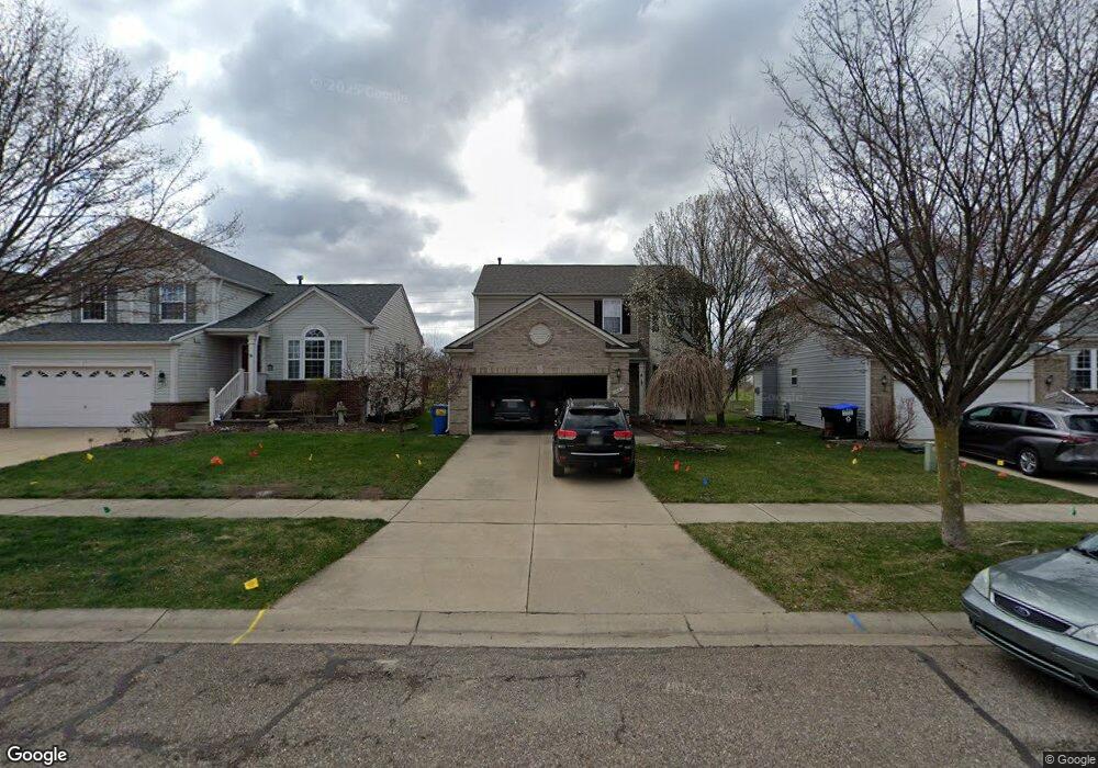
1051 Walcott Ln Unit 134 Howell, MI 48843
Estimated Value: $390,000 - $394,299
4
Beds
2
Baths
1,808
Sq Ft
$217/Sq Ft
Est. Value
About This Home
This home is located at 1051 Walcott Ln Unit 134, Howell, MI 48843 and is currently estimated at $392,075, approximately $216 per square foot. 1051 Walcott Ln Unit 134 is a home located in Livingston County with nearby schools including Ruahmah J. Hutchings Elementary, Parker Middle School, and Howell High School.
Ownership History
Date
Name
Owned For
Owner Type
Purchase Details
Closed on
Sep 20, 2024
Sold by
Pacheco Amy N and Bullock Bradford
Bought by
Bullock Bradford and Pacheco Amy N
Current Estimated Value
Home Financials for this Owner
Home Financials are based on the most recent Mortgage that was taken out on this home.
Original Mortgage
$300,499
Outstanding Balance
$297,134
Interest Rate
6.49%
Mortgage Type
VA
Estimated Equity
$94,941
Purchase Details
Closed on
Sep 27, 2004
Sold by
Pulte Land Co Llc
Bought by
Gillihan Timmy A and Gillihan Amy N
Create a Home Valuation Report for This Property
The Home Valuation Report is an in-depth analysis detailing your home's value as well as a comparison with similar homes in the area
Home Values in the Area
Average Home Value in this Area
Purchase History
| Date | Buyer | Sale Price | Title Company |
|---|---|---|---|
| Bullock Bradford | -- | Fidelity National Title | |
| Pacheco Amy N | -- | Fidelity National Title | |
| Gillihan Timmy A | $71,000 | Metropolitan Title Co |
Source: Public Records
Mortgage History
| Date | Status | Borrower | Loan Amount |
|---|---|---|---|
| Open | Bullock Bradford | $300,499 |
Source: Public Records
Tax History Compared to Growth
Tax History
| Year | Tax Paid | Tax Assessment Tax Assessment Total Assessment is a certain percentage of the fair market value that is determined by local assessors to be the total taxable value of land and additions on the property. | Land | Improvement |
|---|---|---|---|---|
| 2025 | $2,502 | $176,500 | $0 | $0 |
| 2024 | $1,607 | $162,200 | $0 | $0 |
| 2023 | $1,535 | $145,400 | $0 | $0 |
| 2022 | $706 | $123,400 | $0 | $0 |
| 2021 | $2,477 | $128,200 | $0 | $0 |
| 2020 | $2,484 | $123,400 | $0 | $0 |
| 2019 | $2,470 | $115,300 | $0 | $0 |
| 2018 | $2,461 | $108,700 | $0 | $0 |
| 2017 | $2,450 | $106,000 | $0 | $0 |
| 2016 | $3,022 | $100,500 | $0 | $0 |
| 2014 | $2,478 | $87,300 | $0 | $0 |
| 2012 | $2,478 | $80,000 | $0 | $0 |
Source: Public Records
Map
Nearby Homes
- 1282 Callaway Ct Unit 142
- 3991 Rainier Dr Unit 1
- 4059 Ash Tree Ln
- 3765 Silver Charm Ln
- 3905 Rainier Dr
- 636 Zion Ct
- 1815 Gulley Rd
- 458 Cannonade Loop
- 530 Cannonade Loop
- The Bloomington Plan at Broadmoor
- The Charlotte Plan at Broadmoor
- The Harrison Plan at Broadmoor
- The Austin Plan at Broadmoor
- The Columbia Plan at Broadmoor
- 607 Cannonade Loop
- 475 Cannonade Loop
- 559 Cannonade Loop
- 487 Cannonade Loop
- 507 Cannonade Loop
- 3224 Waverly Woods Ln
- 1059 Walcott Ln Unit 133
- 1045 Walcott Ln Unit 135
- 1033 Walcott Ln
- 1065 Walcott Ln Unit 132
- 1025 Walcott Ln Unit 137
- 1054 Walcott Ln Unit 131
- 1048 Walcott Ln
- 4214 Sonata Dr Unit 97
- 1042 Walcott Ln Unit 129
- 1060 Walcott Ln Unit 98
- 1030 Walcott Ln Unit 128
- 4206 Sonata Dr Unit 96
- 1240 Callaway Ct Unit 138
- 1024 Walcott Ln Unit 127
- 1248 Callaway Ct Unit 139
- 1254 Callaway Ct Unit 140
- 4198 Sonata Dr Unit 95
- 4230 Sonata Dr Unit 99
- 1260 Callaway Ct Unit 141
- 1033 Tudor Ln Unit 119