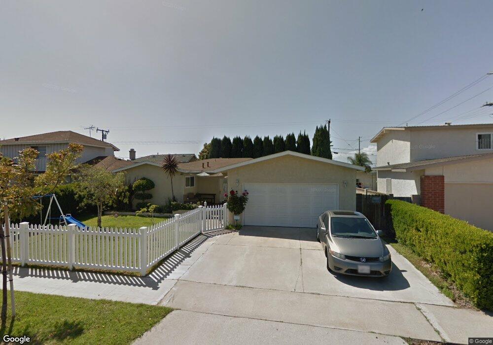
10511 Ritter St Cypress, CA 90630
Estimated Value: $969,000 - $1,153,000
3
Beds
2
Baths
1,394
Sq Ft
$764/Sq Ft
Est. Value
About This Home
This home is located at 10511 Ritter St, Cypress, CA 90630 and is currently estimated at $1,064,568, approximately $763 per square foot. 10511 Ritter St is a home located in Orange County with nearby schools including Cerritos Elementary School, Orangeview Junior High, and Western High School.
Ownership History
Date
Name
Owned For
Owner Type
Purchase Details
Closed on
Jun 24, 2010
Sold by
Ferguson Peter D and Ferguson Gail L
Bought by
Crostic Anthony C and Crostic Melanie A
Current Estimated Value
Home Financials for this Owner
Home Financials are based on the most recent Mortgage that was taken out on this home.
Original Mortgage
$384,000
Outstanding Balance
$254,053
Interest Rate
4.71%
Mortgage Type
New Conventional
Estimated Equity
$810,515
Purchase Details
Closed on
Sep 18, 2007
Sold by
Barsell Daniel R and Barsell Jill E
Bought by
Ferguson Peter D and Ferguson Gail L
Home Financials for this Owner
Home Financials are based on the most recent Mortgage that was taken out on this home.
Original Mortgage
$367,920
Interest Rate
6.42%
Mortgage Type
Purchase Money Mortgage
Purchase Details
Closed on
Oct 17, 2003
Sold by
Barsell Daniel R
Bought by
Barsell Daniel R and Barsell Jill E
Home Financials for this Owner
Home Financials are based on the most recent Mortgage that was taken out on this home.
Original Mortgage
$275,000
Interest Rate
5.98%
Mortgage Type
Purchase Money Mortgage
Purchase Details
Closed on
Jun 8, 2001
Sold by
Barsell Daniel R and Barsell Jill E
Bought by
Barsell Daniel R
Home Financials for this Owner
Home Financials are based on the most recent Mortgage that was taken out on this home.
Original Mortgage
$238,500
Interest Rate
7.14%
Purchase Details
Closed on
Apr 3, 1997
Sold by
Barsell Daniel R
Bought by
Barsell Daniel R and Barsell Jill E
Purchase Details
Closed on
Feb 26, 1997
Sold by
Daniel Barsell and Daniel Jill
Bought by
Barsell Daniel R
Purchase Details
Closed on
Jul 7, 1994
Sold by
Cook Stuart W and Cook Alexa L
Bought by
Barsell Daniel R and Barsell Jill E
Home Financials for this Owner
Home Financials are based on the most recent Mortgage that was taken out on this home.
Original Mortgage
$153,000
Interest Rate
8.57%
Create a Home Valuation Report for This Property
The Home Valuation Report is an in-depth analysis detailing your home's value as well as a comparison with similar homes in the area
Home Values in the Area
Average Home Value in this Area
Purchase History
| Date | Buyer | Sale Price | Title Company |
|---|---|---|---|
| Crostic Anthony C | $480,000 | Western Resources Title Co | |
| Ferguson Peter D | $459,000 | Chicago Title Co | |
| Barsell Daniel R | -- | Gateway Title Company | |
| Barsell Daniel R | -- | Old Republic Title Company | |
| Barsell Daniel R | -- | Southland Title Corporation | |
| Barsell Daniel R | -- | Southland Title Corporation | |
| Barsell Daniel R | $180,000 | Commonwealth Land Title Co |
Source: Public Records
Mortgage History
| Date | Status | Borrower | Loan Amount |
|---|---|---|---|
| Open | Crostic Anthony C | $384,000 | |
| Previous Owner | Ferguson Peter D | $367,920 | |
| Previous Owner | Barsell Daniel R | $275,000 | |
| Previous Owner | Barsell Daniel R | $238,500 | |
| Previous Owner | Barsell Daniel R | $153,000 |
Source: Public Records
Tax History
| Year | Tax Paid | Tax Assessment Tax Assessment Total Assessment is a certain percentage of the fair market value that is determined by local assessors to be the total taxable value of land and additions on the property. | Land | Improvement |
|---|---|---|---|---|
| 2025 | $7,031 | $614,960 | $509,173 | $105,787 |
| 2024 | $7,031 | $602,902 | $499,189 | $103,713 |
| 2023 | $6,850 | $591,081 | $489,401 | $101,680 |
| 2022 | $6,715 | $579,492 | $479,805 | $99,687 |
| 2021 | $6,781 | $568,130 | $470,397 | $97,733 |
| 2020 | $6,689 | $562,305 | $465,574 | $96,731 |
| 2019 | $6,501 | $551,280 | $456,445 | $94,835 |
| 2018 | $6,410 | $540,471 | $447,495 | $92,976 |
| 2017 | $6,185 | $529,874 | $438,721 | $91,153 |
| 2016 | $6,159 | $519,485 | $430,119 | $89,366 |
| 2015 | $6,085 | $511,682 | $423,658 | $88,024 |
| 2014 | $5,770 | $501,659 | $415,359 | $86,300 |
Source: Public Records
Map
Nearby Homes
- 6490 Carolina Cir
- 3580 W Sweetbay Ct Unit B
- 10700 Knott Ave
- 7100 Cerritos Ave Unit 86
- 7100 Cerritos Ave Unit 85
- 7129 Cerritos Ave Unit 7
- 10756 Knott Ave
- 10720 Knott Ave
- 10748 Knott Ave
- 10684 Bell St
- 3532 W Stonepine Ln Unit B
- 3515 W Stonepine Ln Unit D
- 10860 Jasmine Ln
- 10305 Eudora Ave
- 10452 Courson Dr
- 10041 Elizabeth Ln
- 7081 Fulton Way
- 7401 Grandoaks Dr
- 7271 Katella Ave Unit 101
- 7271 Katella Ave Unit 99
- 10521 Ritter St
- 10501 Ritter St
- 10502 Chestnut St
- 10512 Chestnut St
- 10541 Ritter St
- 6711 Forest St
- 10522 Chestnut St
- 10502 Ritter St
- 10512 Ritter St
- 10551 Ritter St
- 10522 Ritter St
- 10532 Chestnut St
- 6701 Forest St
- 10561 Ritter St
- 6802 Cerritos Ave
- 10552 Chestnut St
- 6702 Forest St
- 6803 Elm Ave
- 6691 Forest St
- 10562 Ritter St
Your Personal Tour Guide
Ask me questions while you tour the home.