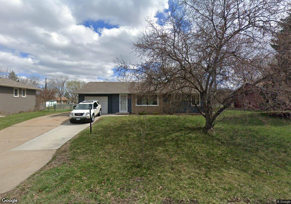
10517 Zion St NW Coon Rapids, MN 55433
Estimated Value: $292,000 - $332,000
3
Beds
1
Bath
976
Sq Ft
$321/Sq Ft
Est. Value
About This Home
This home is located at 10517 Zion St NW, Coon Rapids, MN 55433 and is currently estimated at $313,626, approximately $321 per square foot. 10517 Zion St NW is a home located in Anoka County with nearby schools including Lucile Bruner Elementary School, Mississippi Elementary School, and Laughlin Junior/Senior High School.
Ownership History
Date
Name
Owned For
Owner Type
Purchase Details
Closed on
Jul 5, 2018
Sold by
Noyes Jeremy and Noyes Sara
Bought by
Walsh Tawny and Nelson Jacob
Current Estimated Value
Home Financials for this Owner
Home Financials are based on the most recent Mortgage that was taken out on this home.
Original Mortgage
$213,400
Interest Rate
3.87%
Mortgage Type
Adjustable Rate Mortgage/ARM
Purchase Details
Closed on
Jun 20, 2005
Sold by
Wojcik Jeanna K
Bought by
Nystul Sara and Noyes Jeremy
Purchase Details
Closed on
Jul 1, 2002
Sold by
Pieri Kyle F and Pieri Sarah Jane
Bought by
Wojcik Jeanna K
Create a Home Valuation Report for This Property
The Home Valuation Report is an in-depth analysis detailing your home's value as well as a comparison with similar homes in the area
Home Values in the Area
Average Home Value in this Area
Purchase History
| Date | Buyer | Sale Price | Title Company |
|---|---|---|---|
| Walsh Tawny | $220,000 | Burnet Title | |
| Nystul Sara | $193,500 | -- | |
| Wojcik Jeanna K | $155,000 | -- |
Source: Public Records
Mortgage History
| Date | Status | Borrower | Loan Amount |
|---|---|---|---|
| Previous Owner | Walsh Tawny | $213,400 |
Source: Public Records
Tax History Compared to Growth
Tax History
| Year | Tax Paid | Tax Assessment Tax Assessment Total Assessment is a certain percentage of the fair market value that is determined by local assessors to be the total taxable value of land and additions on the property. | Land | Improvement |
|---|---|---|---|---|
| 2025 | $4,043 | $278,300 | $90,000 | $188,300 |
| 2024 | $4,043 | $271,600 | $87,000 | $184,600 |
| 2023 | $3,432 | $268,200 | $83,000 | $185,200 |
| 2022 | $2,823 | $259,500 | $67,000 | $192,500 |
| 2021 | $2,660 | $220,800 | $67,000 | $153,800 |
| 2020 | $2,247 | $210,600 | $65,000 | $145,600 |
| 2019 | $2,024 | $200,400 | $62,000 | $138,400 |
| 2018 | $2,127 | $178,100 | $0 | $0 |
| 2017 | $2,023 | $163,800 | $0 | $0 |
| 2016 | $2,069 | $140,700 | $0 | $0 |
| 2015 | -- | $140,700 | $46,000 | $94,700 |
| 2014 | -- | $117,300 | $35,200 | $82,100 |
Source: Public Records
Map
Nearby Homes
- 10616 Arrowhead St NW
- 10648 Wren St NW
- 10309 Yukon St NW
- 2633 103rd Ave NW
- 10200 Mississippi Blvd NW
- 10239 Raven St NW
- 2721 109th Ave NW
- 2400 108th Ave NW
- 10136 Uplander St NW
- 2201 108th Ave NW
- 2728 109th Ln NW
- 2965 108th Ln NW
- 2001 103rd Ln NW
- 11000 Swallow St NW
- 1900 Coon Rapids Blvd NW Unit 1
- 11333 Welcome Ave N
- 11036 Hanson Blvd NW Unit 20
- 11476 W River Rd
- 5111 109th Ave N
- 11208 Welcome Ave N
- 10525 Zion St NW
- 10509 Zion St NW
- 10524 Zion St NW
- 10456 Yukon St NW
- 10516 Zion St NW
- 10533 Zion St NW
- 10464 Yukon St NW
- 10532 Zion St NW
- 10501 Zion St NW
- 10448 Yukon St NW
- 10508 Zion St NW
- 10540 Zion St NW
- 10508 Xavis St NW
- 10500 Zion St NW
- 10516 Xavis St NW
- 10500 Xavis St NW
- 10548 Zion St NW
- 10441 Zion St NW
- 10440 Yukon St NW
- 10441 Yukon St NW