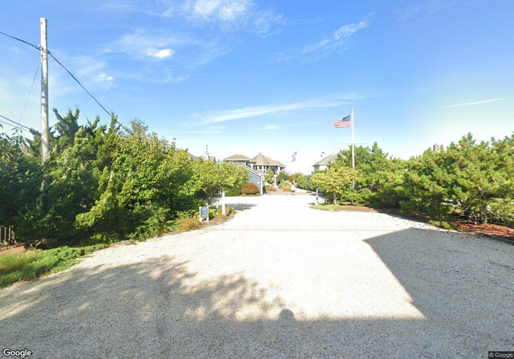
1052 Barnegat Ln Mantoloking, NJ 08738
Estimated Value: $5,299,000 - $7,105,000
6
Beds
6
Baths
5,062
Sq Ft
$1,192/Sq Ft
Est. Value
About This Home
This home is located at 1052 Barnegat Ln, Mantoloking, NJ 08738 and is currently estimated at $6,036,430, approximately $1,192 per square foot. 1052 Barnegat Ln is a home located in Ocean County with nearby schools including G Harold Antrim Elementary School, Point Pleasant Beach High School, and St. Peter School.
Ownership History
Date
Name
Owned For
Owner Type
Purchase Details
Closed on
Jul 15, 2020
Sold by
Barber Meredith and Ring Alexis
Bought by
Ring Property Ventures Llc
Current Estimated Value
Purchase Details
Closed on
May 20, 2020
Sold by
Ring Carl E and Ring Marian W
Bought by
Barber Meredith and Miller Alexis
Purchase Details
Closed on
May 22, 2018
Sold by
Ring Jr 5 Year Qualified Personal Reside
Bought by
Barber Meredith and Ring Alexis
Purchase Details
Closed on
Dec 20, 2012
Sold by
Ring Carl E and Ring Marian W
Bought by
Ring Carl E and Ring Marian W
Purchase Details
Closed on
Jun 15, 2006
Sold by
Byer Ronald C and Byer Winifred M
Bought by
Ring Carl E and Ring Marian W
Purchase Details
Closed on
Feb 8, 1994
Sold by
Roberts Joan Pilling
Bought by
Byer Ronald C and Byer Winifred N
Create a Home Valuation Report for This Property
The Home Valuation Report is an in-depth analysis detailing your home's value as well as a comparison with similar homes in the area
Home Values in the Area
Average Home Value in this Area
Purchase History
| Date | Buyer | Sale Price | Title Company |
|---|---|---|---|
| Ring Property Ventures Llc | -- | None Available | |
| Barber Meredith | -- | None Available | |
| Barber Meredith | -- | -- | |
| Ring Carl E | -- | None Available | |
| Ring Carl E | $5,300,000 | Chicago Title Insurance Co | |
| Byer Ronald C | $775,000 | -- |
Source: Public Records
Tax History Compared to Growth
Tax History
| Year | Tax Paid | Tax Assessment Tax Assessment Total Assessment is a certain percentage of the fair market value that is determined by local assessors to be the total taxable value of land and additions on the property. | Land | Improvement |
|---|---|---|---|---|
| 2025 | $33,497 | $3,904,100 | $1,925,400 | $1,978,700 |
| 2024 | $31,857 | $3,904,100 | $1,925,400 | $1,978,700 |
| 2023 | $27,329 | $3,904,100 | $1,925,400 | $1,978,700 |
| 2022 | $27,329 | $3,904,100 | $1,925,400 | $1,978,700 |
| 2021 | $27,485 | $3,904,100 | $1,925,400 | $1,978,700 |
| 2020 | $27,797 | $3,904,100 | $1,925,400 | $1,978,700 |
| 2019 | $27,407 | $3,904,100 | $1,925,400 | $1,978,700 |
| 2018 | $27,016 | $3,904,100 | $1,925,400 | $1,978,700 |
| 2017 | $27,212 | $3,904,100 | $1,925,400 | $1,978,700 |
| 2016 | $26,933 | $3,880,800 | $1,925,400 | $1,955,400 |
| 2015 | $26,506 | $3,880,800 | $1,925,400 | $1,955,400 |
| 2014 | $24,333 | $3,880,800 | $1,925,400 | $1,955,400 |
Source: Public Records
Map
Nearby Homes
- 1050 Barnegat Ln
- 1054 Barnegat Ln
- 1048 Barnegat Ln
- 1058 Barnegat Ln
- 1046 Barnegat Ln
- 1053 Barnegat Ln
- 1051 Barnegat Ln
- 1055 Barnegat Ln
- 1049 Barnegat Ln
- 1060 Barnegat Ln
- 1057 Barnegat Ln
- 1044 Barnegat Ln
- 1045 Barnegat Ln
- 1062 Barnegat Ln
- 1067 Barnegat Ln
- 1083 Ocean Ave
- 1040 Barnegat Ln
- 1064 Barnegat Ln
- 1049 Ocean Ave
- 1049 Ocean Ave Unit 1/2