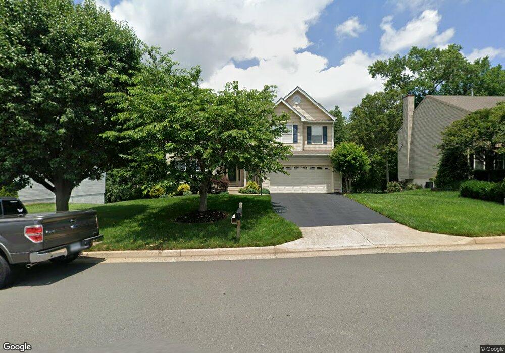
10529 Winged Elm Cir Manassas, VA 20110
Estimated Value: $692,988 - $741,000
4
Beds
4
Baths
2,360
Sq Ft
$300/Sq Ft
Est. Value
About This Home
This home is located at 10529 Winged Elm Cir, Manassas, VA 20110 and is currently estimated at $707,497, approximately $299 per square foot. 10529 Winged Elm Cir is a home located in Prince William County with nearby schools including Bennett Elementary School, Parkside Middle School, and Brentsville District High School.
Ownership History
Date
Name
Owned For
Owner Type
Purchase Details
Closed on
Dec 27, 1993
Sold by
Richmond Am Home
Bought by
Dicks Richard D
Current Estimated Value
Home Financials for this Owner
Home Financials are based on the most recent Mortgage that was taken out on this home.
Original Mortgage
$173,900
Interest Rate
7%
Create a Home Valuation Report for This Property
The Home Valuation Report is an in-depth analysis detailing your home's value as well as a comparison with similar homes in the area
Home Values in the Area
Average Home Value in this Area
Purchase History
| Date | Buyer | Sale Price | Title Company |
|---|---|---|---|
| Dicks Richard D | $193,250 | -- |
Source: Public Records
Mortgage History
| Date | Status | Borrower | Loan Amount |
|---|---|---|---|
| Closed | Dicks Richard D | $173,900 |
Source: Public Records
Tax History Compared to Growth
Tax History
| Year | Tax Paid | Tax Assessment Tax Assessment Total Assessment is a certain percentage of the fair market value that is determined by local assessors to be the total taxable value of land and additions on the property. | Land | Improvement |
|---|---|---|---|---|
| 2025 | $5,776 | $621,500 | $189,000 | $432,500 |
| 2024 | $5,776 | $580,800 | $180,000 | $400,800 |
| 2023 | $5,705 | $548,300 | $164,700 | $383,600 |
| 2022 | $5,729 | $517,300 | $153,500 | $363,800 |
| 2021 | $5,560 | $455,200 | $129,800 | $325,400 |
| 2020 | $6,662 | $429,800 | $119,000 | $310,800 |
| 2019 | $6,645 | $428,700 | $119,000 | $309,700 |
| 2018 | $4,908 | $406,500 | $113,300 | $293,200 |
| 2017 | $4,869 | $394,400 | $113,300 | $281,100 |
| 2016 | $4,652 | $380,100 | $113,300 | $266,800 |
| 2015 | $4,509 | $376,700 | $113,300 | $263,400 |
| 2014 | $4,509 | $360,400 | $109,900 | $250,500 |
Source: Public Records
Map
Nearby Homes
- 10576 Coral Berry Dr
- 10073 Loblolly Trail
- 10385 Lime Tree Ct
- 10269 Cedar Ridge Dr
- 10244 Winged Elm Cir
- 10177 Queens Way
- 10170 Queens Way
- 10173 Queens Way
- 10165 Queens Way
- 10161 Queens Way
- 10157 Queens Way
- 10153 Queens Way
- BALMORAL Plan at Kings Landing
- HIGHGROVE Plan at Kings Landing
- 10102 Queens Way
- 10106 Queens Way
- 10114 Queens Way
- 10118 Queens Way
- 10130 Queens Way
- 10902 Pennycress St
- 10533 Winged Elm Cir
- 10525 Winged Elm Cir
- 10522 Aspen Wood Ct
- 10537 Winged Elm Cir
- 10518 Aspen Wood Ct
- 10449 Coral Berry Dr
- 10532 Winged Elm Cir
- 10528 Winged Elm Cir
- 10000 Cypress Branch Ln
- 10514 Aspen Wood Ct
- 10524 Winged Elm Cir
- 10526 Aspen Wood Ct
- 10545 Winged Elm Cir
- 10520 Winged Elm Cir
- 10004 Cypress Branch Ln
- 10510 Aspen Wood Ct
- 10513 Winged Elm Cir
- 10523 Aspen Wood Ct
- 10544 Winged Elm Cir
- 10516 Winged Elm Cir