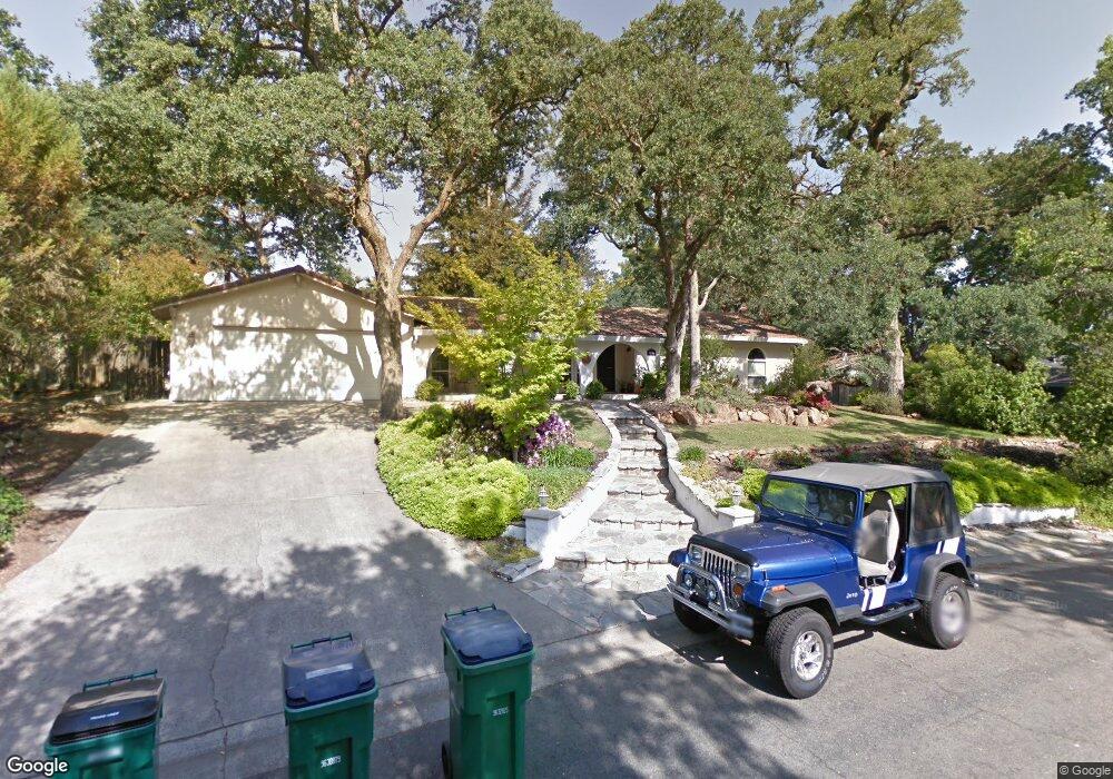
1053 Brookline Cir El Dorado Hills, CA 95762
Estimated Value: $236,000 - $788,000
3
Beds
2
Baths
1,922
Sq Ft
$318/Sq Ft
Est. Value
About This Home
This home is located at 1053 Brookline Cir, El Dorado Hills, CA 95762 and is currently estimated at $611,585, approximately $318 per square foot. 1053 Brookline Cir is a home located in El Dorado County with nearby schools including Silva Valley Elementary School, Rolling Hills Middle School, and Oak Ridge High School.
Ownership History
Date
Name
Owned For
Owner Type
Purchase Details
Closed on
Sep 12, 2011
Sold by
Buerki Steven C and Buerki Natalie L
Bought by
Brenner Paul D and Cords Heather
Current Estimated Value
Home Financials for this Owner
Home Financials are based on the most recent Mortgage that was taken out on this home.
Original Mortgage
$300,192
Outstanding Balance
$205,471
Interest Rate
4.25%
Mortgage Type
FHA
Estimated Equity
$406,114
Purchase Details
Closed on
May 25, 2007
Sold by
Buerki Natalie L and Buerki Steven C
Bought by
Buerki Steven C and Buerki Natalie L
Home Financials for this Owner
Home Financials are based on the most recent Mortgage that was taken out on this home.
Original Mortgage
$400,000
Interest Rate
6.12%
Mortgage Type
New Conventional
Purchase Details
Closed on
Jun 28, 1999
Sold by
Maguire Thomas
Bought by
Buerki Steven C and Buerki Natalie L
Home Financials for this Owner
Home Financials are based on the most recent Mortgage that was taken out on this home.
Original Mortgage
$209,000
Interest Rate
7.05%
Purchase Details
Closed on
Aug 25, 1998
Sold by
Federal National Mortgage Association
Bought by
Maguire Thomas
Home Financials for this Owner
Home Financials are based on the most recent Mortgage that was taken out on this home.
Original Mortgage
$140,000
Interest Rate
6.91%
Purchase Details
Closed on
Mar 13, 1998
Sold by
Xirouhakis Mary
Bought by
Federal National Mortgage Association
Purchase Details
Closed on
Jul 8, 1996
Sold by
Xirouhakis Tony D
Bought by
Xirouhakis Mary
Home Financials for this Owner
Home Financials are based on the most recent Mortgage that was taken out on this home.
Original Mortgage
$193,500
Interest Rate
8.03%
Mortgage Type
Balloon
Purchase Details
Closed on
Sep 29, 1995
Sold by
Hobbs Claudia
Bought by
Hobbs Peter
Home Financials for this Owner
Home Financials are based on the most recent Mortgage that was taken out on this home.
Original Mortgage
$193,450
Interest Rate
7.5%
Create a Home Valuation Report for This Property
The Home Valuation Report is an in-depth analysis detailing your home's value as well as a comparison with similar homes in the area
Home Values in the Area
Average Home Value in this Area
Purchase History
| Date | Buyer | Sale Price | Title Company |
|---|---|---|---|
| Brenner Paul D | $308,000 | Fidelity Natl Title Co Of Ca | |
| Buerki Steven C | -- | Alliance Title Company | |
| Buerki Steven C | $220,000 | Placer Title Company | |
| Maguire Thomas | $193,000 | Chicago Title Co | |
| Federal National Mortgage Association | $180,700 | Fidelity National Title Ins | |
| Xirouhakis Mary | -- | First American Title Co | |
| Hobbs Peter | -- | First American Title Co |
Source: Public Records
Mortgage History
| Date | Status | Borrower | Loan Amount |
|---|---|---|---|
| Open | Brenner Paul D | $300,192 | |
| Previous Owner | Buerki Steven C | $400,000 | |
| Previous Owner | Buerki Steven C | $209,000 | |
| Previous Owner | Maguire Thomas | $140,000 | |
| Previous Owner | Xirouhakis Mary | $193,500 | |
| Previous Owner | Hobbs Peter | $193,450 |
Source: Public Records
Tax History Compared to Growth
Tax History
| Year | Tax Paid | Tax Assessment Tax Assessment Total Assessment is a certain percentage of the fair market value that is determined by local assessors to be the total taxable value of land and additions on the property. | Land | Improvement |
|---|---|---|---|---|
| 2025 | $2,105 | $190,793 | $74,029 | $116,764 |
| 2024 | $2,105 | $190,793 | $74,029 | $116,764 |
| 2023 | $2,078 | $190,793 | $74,029 | $116,764 |
| 2022 | $2,117 | $190,793 | $74,029 | $116,764 |
| 2021 | $3,892 | $357,393 | $98,629 | $258,764 |
| 2020 | $3,841 | $353,729 | $97,618 | $256,111 |
| 2019 | $3,782 | $346,794 | $95,704 | $251,090 |
| 2018 | $3,650 | $339,995 | $93,828 | $246,167 |
| 2017 | $3,586 | $333,330 | $91,989 | $241,341 |
| 2016 | $3,539 | $326,795 | $90,186 | $236,609 |
| 2015 | $3,449 | $321,888 | $88,832 | $233,056 |
| 2014 | $3,449 | $315,585 | $87,093 | $228,492 |
Source: Public Records
Map
Nearby Homes
- 921 Stoneman Way
- 1780 Darwin Way
- 2846 Stephens Ln
- 2668 Tam o Shanter Dr
- 4251 Hensley Cir
- 2703 King Richard Dr
- 2628 Tam o Shanter Dr
- 3197 Warren Ln
- 1041 Elmwood Ct
- 3566 Stockwood Way
- 4165 Brisbane Cir
- 952 King Henry Way
- 6041 Toscana Loop
- 949 King Henry Way
- 954 King Richard Ct
- 4304 Brisbane Cir
- 5192 Piazza Place
- 5200 Piazza Place
- 5155 Breese Cir
- 2498 Starmount Way
- 1047 Brookline Cir
- 1069 Brookline Cir
- 2795 Tam o Shanter Dr
- 2801 Tam o Shanter Dr
- 2801 Tam Oshanter Dr
- 2815 Tam o Shanter Dr
- 1054 Brookline Cir
- 1079 Brookline Cir
- 2821 Tam o Shanter Dr
- 1070 Brookline Cir
- 1111 Brookline Cir
- 1031 Brookline Cir
- 1046 Brookline Cir
- 1095 Brookline Cir
- 2800 Tam o Shanter Dr
- 2798 Canterbury Cir
- 2810 Tam o Shanter Dr
- 2816 Tam o Shanter Dr
- 2820 Tam o Shanter Dr
- 1040 Brookline Cir