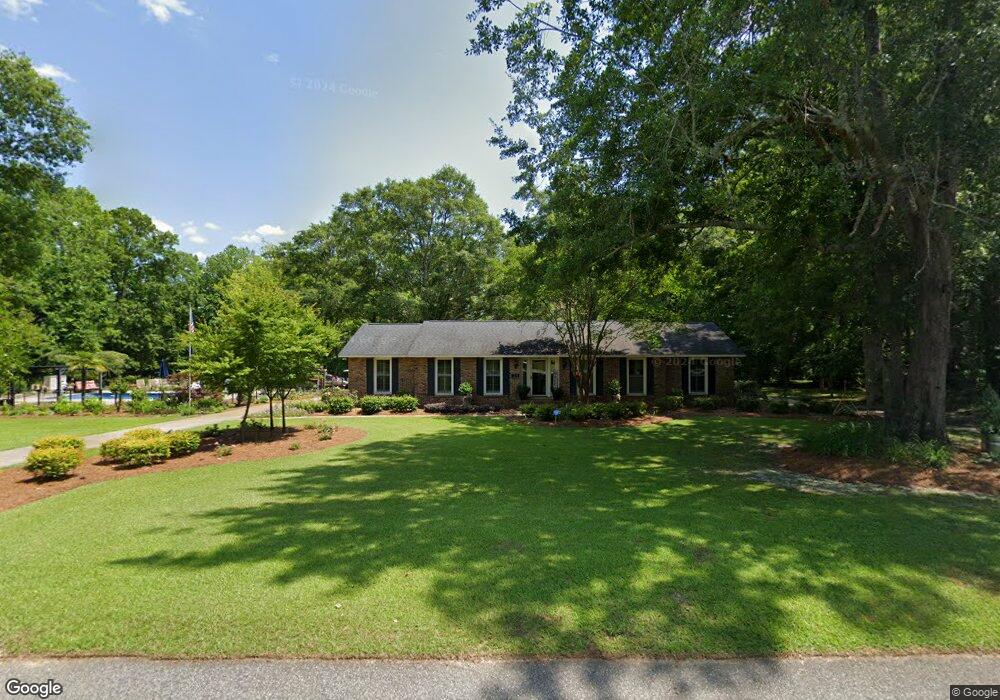
1053 Buckhorn Dr Manning, SC 29102
Estimated Value: $282,000 - $385,000
--
Bed
--
Bath
2,662
Sq Ft
$126/Sq Ft
Est. Value
About This Home
This home is located at 1053 Buckhorn Dr, Manning, SC 29102 and is currently estimated at $336,701, approximately $126 per square foot. 1053 Buckhorn Dr is a home with nearby schools including Manning Early Childhood Center, Manning Primary School, and Manning Elementary School.
Ownership History
Date
Name
Owned For
Owner Type
Purchase Details
Closed on
May 23, 2013
Sold by
Taylor Paul M and Taylor Brenda F
Bought by
Taylor Paul M and Taylor Brenda F
Current Estimated Value
Purchase Details
Closed on
May 1, 2013
Sold by
Mcnair Mary M and Horton Frances M
Bought by
Taylor Paul M and Taylor Brenda F
Create a Home Valuation Report for This Property
The Home Valuation Report is an in-depth analysis detailing your home's value as well as a comparison with similar homes in the area
Home Values in the Area
Average Home Value in this Area
Purchase History
| Date | Buyer | Sale Price | Title Company |
|---|---|---|---|
| Taylor Paul M | -- | None Available | |
| Taylor Paul M | -- | None Available |
Source: Public Records
Tax History Compared to Growth
Tax History
| Year | Tax Paid | Tax Assessment Tax Assessment Total Assessment is a certain percentage of the fair market value that is determined by local assessors to be the total taxable value of land and additions on the property. | Land | Improvement |
|---|---|---|---|---|
| 2024 | -- | $9,856 | $0 | $0 |
| 2023 | $0 | $9,856 | $2,700 | $7,156 |
| 2022 | $1,553 | $9,856 | $2,700 | $7,156 |
| 2021 | $1,709 | $8,964 | $2,160 | $6,804 |
| 2020 | $1,709 | $8,964 | $2,160 | $6,804 |
| 2019 | $1,583 | $8,964 | $2,160 | $6,804 |
| 2018 | $1,487 | $8,964 | $0 | $0 |
| 2017 | $1,488 | $8,964 | $0 | $0 |
| 2016 | $1,146 | $7,133 | $0 | $0 |
| 2015 | $1,115 | $6,836 | $1,600 | $5,236 |
| 2014 | $1,098 | $6,836 | $1,600 | $5,236 |
| 2013 | -- | $6,836 | $1,600 | $5,236 |
Source: Public Records
Map
Nearby Homes
- 1356 Mckenzie Rd
- 1111 Nicole Dr
- 1441 Bojo Cir Unit Lot 29
- 1038 Jonte Ln
- 1012 Jonte Dr
- 1023 Shortleaf Dr
- 1054 Hickory Ridge Cir
- 1107 Long Leaf Dr
- 1513 Loblolly Dr
- TBD White Oak Dr
- 1868 Haseldon Dr
- 2985 Hwy 260
- 623 Pickwood Dr
- 617 Pickwood Dr
- 605 Gib Dr
- 0000 Sylvan Dr
- 1026 Jamie Ct
- 633 Sykes St
- 22 W End St
- TBD S Carolina 260
- 1096 Buckhorn Dr
- 1044 Buckhorn Dr
- 1018 Frances Ln
- 1150 Buckhorn Dr
- 1022 Plummer Cir
- 1110 Alayna Dr
- 1128 Alayna Dr
- 1188 Buckhorn Dr
- 1084 Alayna Dr
- 1146 Alayna Dr
- 1068 Plummer Cir
- 1045 Pebble Ln
- 1021 Pebble Ln
- 1052 Alayna Dr
- 1047 Alayna Dr
- 00 Alayna Dr
- 39 Alayna Dr
- 44 Alayna Dr
- 35 Alayna Dr
- 34 Alayna Dr