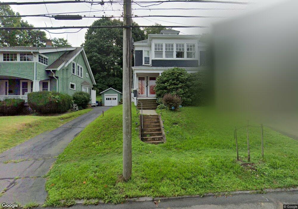
1053 Townsend Ave New Haven, CT 06512
Annex NeighborhoodEstimated Value: $452,567 - $577,000
4
Beds
2
Baths
2,496
Sq Ft
$200/Sq Ft
Est. Value
About This Home
This home is located at 1053 Townsend Ave, New Haven, CT 06512 and is currently estimated at $498,642, approximately $199 per square foot. 1053 Townsend Ave is a home located in New Haven County with nearby schools including Cold Spring School, St Francis & St Rose Of Lima School, and Pathway School.
Ownership History
Date
Name
Owned For
Owner Type
Purchase Details
Closed on
May 10, 2010
Sold by
Perrelli Michael
Bought by
Watts Lacretia
Current Estimated Value
Home Financials for this Owner
Home Financials are based on the most recent Mortgage that was taken out on this home.
Original Mortgage
$245,300
Outstanding Balance
$156,750
Interest Rate
4.12%
Mortgage Type
FHA
Estimated Equity
$341,892
Purchase Details
Closed on
Nov 9, 2009
Sold by
Est Procopio Josephine and Procopio Fortunato
Bought by
Perrelli Michael
Create a Home Valuation Report for This Property
The Home Valuation Report is an in-depth analysis detailing your home's value as well as a comparison with similar homes in the area
Home Values in the Area
Average Home Value in this Area
Purchase History
| Date | Buyer | Sale Price | Title Company |
|---|---|---|---|
| Watts Lacretia | $249,900 | -- | |
| Perrelli Michael | $155,000 | -- |
Source: Public Records
Mortgage History
| Date | Status | Borrower | Loan Amount |
|---|---|---|---|
| Open | Perrelli Michael | $245,300 | |
| Closed | Perrelli Michael | $10,900 |
Source: Public Records
Tax History Compared to Growth
Tax History
| Year | Tax Paid | Tax Assessment Tax Assessment Total Assessment is a certain percentage of the fair market value that is determined by local assessors to be the total taxable value of land and additions on the property. | Land | Improvement |
|---|---|---|---|---|
| 2025 | $9,642 | $244,720 | $55,300 | $189,420 |
| 2024 | $9,422 | $244,720 | $55,300 | $189,420 |
| 2023 | $9,104 | $244,720 | $55,300 | $189,420 |
| 2022 | $9,728 | $244,720 | $55,300 | $189,420 |
| 2021 | $6,960 | $158,620 | $31,570 | $127,050 |
| 2020 | $6,960 | $158,620 | $31,570 | $127,050 |
| 2019 | $6,817 | $158,620 | $31,570 | $127,050 |
| 2018 | $6,817 | $158,620 | $31,570 | $127,050 |
| 2017 | $6,135 | $158,620 | $31,570 | $127,050 |
| 2016 | $5,736 | $138,040 | $31,570 | $106,470 |
| 2015 | $5,736 | $138,040 | $31,570 | $106,470 |
| 2014 | $5,736 | $138,040 | $31,570 | $106,470 |
Source: Public Records
Map
Nearby Homes
- 1090 Townsend Ave
- 1117 Townsend Ave
- 666 Woodward Ave Unit 666
- 44 Huntington Ave
- 32 Huntington Ave
- 45 Huntington Ave
- 334 Prospect Ave Unit 334
- 112 Harrington Ave
- 120 Harrington Ave
- 516 Woodward Ave
- 20 Ashland Place
- 30 Upson Terrace
- 62 Huntington Rd Unit 7
- 18 Lenox St
- 66 Elizabeth Ann Dr
- 34 Hughes St
- 133 Charter Oak Ave
- 745 Townsend Ave Unit Lot 1
- 745 Townsend Ave Unit Lot 2
- 745 Townsend Ave Unit Lot 4
- 1047 Townsend Ave
- 1059 Townsend Ave
- 1041 Townsend Ave
- 1065 Townsend Ave
- 1037 Townsend Ave
- 1073 Townsend Ave
- 19 Frost St
- 1035 Townsend Ave
- 1060 Townsend Ave
- 1060 Townsend Ave Unit 1
- 1058 Townsend Ave
- 1052 Townsend Ave
- 1042 Townsend Ave
- 1050 Townsend Ave
- 1029 Townsend Ave
- 1068 Townsend Ave
- 1081 Townsend Ave
- 1072 Townsend Ave
- 95 Beacon Ave
- 1078 Townsend Ave