Estimated Value: $190,000 - $237,000
3
Beds
2
Baths
1,248
Sq Ft
$164/Sq Ft
Est. Value
About This Home
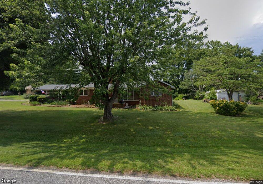
This home is located at 1054 Flynt Rd, King, NC 27021 and is currently estimated at $204,316, approximately $163 per square foot. 1054 Flynt Rd is a home located in Stokes County with nearby schools including Mount Olive Elementary School, Chestnut Grove Middle, and West Stokes High.
Ownership History
Date
Name
Owned For
Owner Type
Purchase Details
Closed on
Jun 3, 2022
Sold by
Annie Mabe
Bought by
Baker Samuel Charles and Baker Leisa K
Current Estimated Value
Home Financials for this Owner
Home Financials are based on the most recent Mortgage that was taken out on this home.
Original Mortgage
$51,200
Outstanding Balance
$48,640
Interest Rate
5.09%
Mortgage Type
New Conventional
Estimated Equity
$155,676
Create a Home Valuation Report for This Property
The Home Valuation Report is an in-depth analysis detailing your home's value as well as a comparison with similar homes in the area
Home Values in the Area
Average Home Value in this Area
Purchase History
| Date | Buyer | Sale Price | Title Company |
|---|---|---|---|
| Baker Samuel Charles | $60,500 | Oneal Elizabeth M |
Source: Public Records
Mortgage History
| Date | Status | Borrower | Loan Amount |
|---|---|---|---|
| Open | Baker Samuel Charles | $51,200 |
Source: Public Records
Tax History
| Year | Tax Paid | Tax Assessment Tax Assessment Total Assessment is a certain percentage of the fair market value that is determined by local assessors to be the total taxable value of land and additions on the property. | Land | Improvement |
|---|---|---|---|---|
| 2025 | $948 | $132,600 | $30,500 | $102,100 |
| 2024 | $948 | $97,800 | $23,500 | $74,300 |
| 2023 | $792 | $97,800 | $23,500 | $74,300 |
| 2022 | $362 | $97,800 | $23,500 | $74,300 |
| 2021 | $362 | $97,800 | $23,500 | $74,300 |
| 2020 | $323 | $87,200 | $22,500 | $64,700 |
| 2019 | $323 | $87,200 | $22,500 | $64,700 |
| 2018 | $323 | $87,200 | $22,500 | $64,700 |
| 2017 | $329 | $87,200 | $22,500 | $64,700 |
| 2016 | $312 | $84,900 | $22,500 | $62,400 |
| 2015 | $310 | $84,900 | $22,500 | $62,400 |
| 2014 | $625 | $84,900 | $22,500 | $62,400 |
Source: Public Records
Map
Nearby Homes
- 4581 N Carolina 66
- 0 Nance Rd
- 1233 Kentland Dr
- 1034 Kentland Dr
- 3125 YMcA Camp Rd
- 1461 Chestnut Grove Rd
- 2186 Covington Rd
- 1250 Badgett Rd
- 113 Ravenwood Ct
- 2889 Mountain View Church Rd
- 101 Ravenwood Ct
- 1739 Denny Rd
- 100 Ridgecrest Dr
- 1065 Reid Rd
- 0 Reid Rd
- 1880 Chestnut Grove Rd
- Lot 10 Brown Rd
- 1041 Tom East Rd
- Lot 9 Brown Rd
- 310 Cedardale Ln
- 1059 Flynt Rd
- 1078 Flynt Rd
- 1089 Flynt Rd
- 1118 Flynt Rd
- 0 Flynt Rd Unit 1088285
- 1097 Flynt Rd
- 4562 Nc 66 Hwy S
- 4658 Nc 66 Hwy S
- 1012 Ralph Boyles Rd
- 4581 Nc 66 Hwy S
- 1121 Flynt Rd
- 4647 Nc 66 Hwy S
- 4676 Nc 66 Hwy S
- 4540 Nc 66 Hwy S
- 4547 Nc 66 Hwy S
- 4530 Nc 66 Hwy S
- 1133 Flynt Rd
- 1126 Flynt Rd
- 4555 Nc 66 Hwy S
- 4690 Nc 66 Hwy S
Your Personal Tour Guide
Ask me questions while you tour the home.