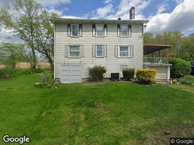
1054 Learn Rd Avonmore, PA 15618
Bell Township NeighborhoodEstimated Value: $233,000
--
Bed
4
Baths
2,312
Sq Ft
$101/Sq Ft
Est. Value
About This Home
This home is located at 1054 Learn Rd, Avonmore, PA 15618 and is currently estimated at $233,000, approximately $100 per square foot. 1054 Learn Rd is a home located in Westmoreland County with nearby schools including Kiski Area High School and The Kiski School.
Ownership History
Date
Name
Owned For
Owner Type
Purchase Details
Closed on
Jul 2, 2021
Sold by
Whitsell Family Farm Llc
Bought by
Waldenville Curtis W and Waldenville Loraine A
Current Estimated Value
Home Financials for this Owner
Home Financials are based on the most recent Mortgage that was taken out on this home.
Original Mortgage
$134,518
Outstanding Balance
$123,420
Interest Rate
2.93%
Mortgage Type
FHA
Estimated Equity
$109,580
Purchase Details
Closed on
Sep 23, 2020
Sold by
Whitesell Family Farm Llc
Bought by
Beech Jayson E
Home Financials for this Owner
Home Financials are based on the most recent Mortgage that was taken out on this home.
Original Mortgage
$0
Interest Rate
3%
Mortgage Type
Purchase Money Mortgage
Purchase Details
Closed on
Oct 9, 2013
Sold by
Shock Ruth
Bought by
Whitesell Family Farm Llc
Purchase Details
Closed on
Feb 1, 2013
Sold by
Atkinson Robert and Getty Wallace
Bought by
Whitesell Family Farm Llc
Create a Home Valuation Report for This Property
The Home Valuation Report is an in-depth analysis detailing your home's value as well as a comparison with similar homes in the area
Home Values in the Area
Average Home Value in this Area
Purchase History
| Date | Buyer | Sale Price | Title Company |
|---|---|---|---|
| Waldenville Curtis W | $137,000 | None Available | |
| Beech Jayson E | $15,300 | None Available | |
| Whitesell Family Farm Llc | -- | None Available | |
| Whitesell Family Farm Llc | -- | None Available |
Source: Public Records
Mortgage History
| Date | Status | Borrower | Loan Amount |
|---|---|---|---|
| Open | Waldenville Curtis W | $134,518 | |
| Previous Owner | Cnx Gas Compnay Llc | $0 |
Source: Public Records
Tax History Compared to Growth
Tax History
| Year | Tax Paid | Tax Assessment Tax Assessment Total Assessment is a certain percentage of the fair market value that is determined by local assessors to be the total taxable value of land and additions on the property. | Land | Improvement |
|---|---|---|---|---|
| 2025 | $2,429 | $17,390 | $4,980 | $12,410 |
| 2024 | $2,294 | $17,390 | $4,980 | $12,410 |
| 2023 | $2,079 | $17,390 | $4,980 | $12,410 |
| 2022 | $2,028 | $17,390 | $4,980 | $12,410 |
| 2021 | $2,028 | $17,390 | $4,980 | $12,410 |
| 2020 | $5,775 | $49,670 | $37,260 | $12,410 |
| 2019 | $5,750 | $49,670 | $37,260 | $12,410 |
| 2018 | $5,650 | $49,670 | $37,260 | $12,410 |
| 2017 | $5,502 | $49,670 | $37,260 | $12,410 |
| 2016 | $5,411 | $49,670 | $37,260 | $12,410 |
| 2015 | $5,411 | $49,670 | $37,260 | $12,410 |
| 2014 | $5,380 | $49,670 | $37,260 | $12,410 |
Source: Public Records
Map
Nearby Homes
- 3049 Bell Plan Dr
- 309 Whitesell St
- 233 Washington Street (Rte 286)
- 216 Stewart St
- 15 Indiana Ave
- 33 Indiana Ave
- 126 Westmoreland Ave
- 213 Indiana Ave
- 204 Pauline Dr
- 140 High St
- 315 Phyllis Dr
- 407 Cathedral St
- 722 Indiana Ave
- 828 Pine St R
- 3954 Pennsylvania 819
- 604 Loyalhanna Dam Rd
- Lot 6 Horrell Rd
- Lot A Guthrie Rd
- 4416 State Route 819
- 166 Saw Mill Run Rd