1054 Main St Wrightstown, WI 54180
Estimated Value: $281,354 - $329,000
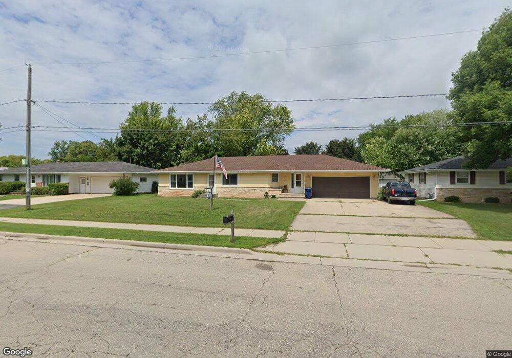
About This Home
This home is located at 1054 Main St, Wrightstown, WI 54180 and is currently estimated at $299,089. 1054 Main St is a home located in Brown County with nearby schools including Wrightstown Elementary School, Wrightstown Middle School, and Wrightstown High School.
Ownership History
We collect this data history from publicly available records. To have your information removed, we recommend requesting removal directly through your county’s website.
Purchase Details
Home Values in the Area
Average Home Value in this Area
Purchase History
We collect this data history from publicly available records. To have your information removed, we recommend requesting removal directly through your county’s website.
| Date | Buyer | Sale Price | Title Company |
|---|---|---|---|
| -- | -- |
Mortgage History
We collect this data history from publicly available records. To have your information removed, we recommend requesting removal directly through your county’s website.
| Date | Status | Borrower | Loan Amount |
|---|---|---|---|
| Closed | $20,000 | ||
| Closed | $55,065 | ||
| Closed | $36,847 | ||
| Closed | $11,011 | ||
| Closed | $76,858 | ||
| Closed | $88,000 | ||
| Closed | $82,763 | ||
| Closed | $73,399 |
Tax History
We collect this data history from publicly available records. To have your information removed, we recommend requesting removal directly through your county’s website.
| Year | Tax Paid | Tax Assessment Tax Assessment Total Assessment is a certain percentage of the fair market value that is determined by local assessors to be the total taxable value of land and additions on the property. | Land | Improvement |
|---|---|---|---|---|
| 2025 | $3,234 | $207,300 | $29,700 | $177,600 |
| 2024 | $2,828 | $207,300 | $29,700 | $177,600 |
| 2023 | $3,042 | $207,300 | $29,700 | $177,600 |
| 2022 | $2,936 | $131,300 | $22,300 | $109,000 |
| 2021 | $2,841 | $131,300 | $22,300 | $109,000 |
| 2020 | $2,811 | $131,300 | $22,300 | $109,000 |
| 2019 | $2,641 | $131,300 | $22,300 | $109,000 |
| 2018 | $2,475 | $131,300 | $22,300 | $109,000 |
| 2017 | $2,513 | $125,800 | $18,100 | $107,700 |
| 2016 | $2,610 | $125,800 | $18,100 | $107,700 |
| 2015 | $2,742 | $125,800 | $18,100 | $107,700 |
| 2014 | $2,589 | $125,800 | $18,100 | $107,700 |
| 2013 | $2,589 | $125,800 | $18,100 | $107,700 |
Map
- 910 Park St
- 739 Park St
- 222 Pine St
- 227 Peterlynn Dr
- 262 Paddy Ct
- 248 Kerrigan Dr
- 278 Kerrigan Dr
- 272 Kerrigan Dr
- 308 Kerrigan Dr
- 420 Prairie Way
- 264 Kerrigan Dr
- 581 Royal Saint Pats Dr
- 758 Royal Saint Pats Dr
- 728 Royal Saint Pats Dr
- 550 Royal Saint Pats Dr
- 354 Longwood Ln
- 532 Royal Saint Pats Dr
- 618 Linksview Ct
- 221 Kerrigan Dr
- 575 Emerald Isle Ct
- 1052 Main St
- 1050 Main St
- 1051 Debra St
- 1049 Debra St
- 1053 Debra St
- 1048 Main St
- 1064 Main St
- 228 Crestview Cir
- 1047 Debra St
- 1061 Debra St
- 1051 Main St Unit 1053
- 1047 Main St Unit 1049
- 302 Nancy St
- 1044 Main St
- 229 Crestview Cir
- 1043 Debra St
- 1065 Debra St
- 1050 Debra St
- 300 Nancy St Unit BLOCK
- 1105 Main St
Ask me questions while you tour the home.