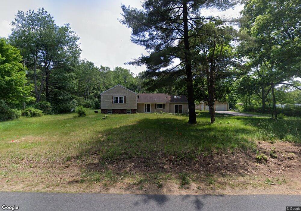
10543 Ab Ave Otsego, MI 49078
Estimated Value: $137,000 - $375,000
3
Beds
1
Bath
1,192
Sq Ft
$202/Sq Ft
Est. Value
About This Home
This home is located at 10543 Ab Ave, Otsego, MI 49078 and is currently estimated at $240,289, approximately $201 per square foot. 10543 Ab Ave is a home located in Kalamazoo County with nearby schools including Otsego High School.
Ownership History
Date
Name
Owned For
Owner Type
Purchase Details
Closed on
Dec 13, 2022
Sold by
Dowd Amy
Bought by
Ullrich Lee
Current Estimated Value
Home Financials for this Owner
Home Financials are based on the most recent Mortgage that was taken out on this home.
Original Mortgage
$228,000
Outstanding Balance
$220,721
Interest Rate
6.61%
Mortgage Type
New Conventional
Estimated Equity
$19,568
Purchase Details
Closed on
Sep 23, 2021
Sold by
Ullrich Karen L and Ullrich Albert L
Bought by
Dowd Amy and Ullrich Lee
Home Financials for this Owner
Home Financials are based on the most recent Mortgage that was taken out on this home.
Original Mortgage
$128,250
Interest Rate
2.8%
Mortgage Type
New Conventional
Create a Home Valuation Report for This Property
The Home Valuation Report is an in-depth analysis detailing your home's value as well as a comparison with similar homes in the area
Home Values in the Area
Average Home Value in this Area
Purchase History
| Date | Buyer | Sale Price | Title Company |
|---|---|---|---|
| Ullrich Lee | -- | -- | |
| Dowd Amy | $135,000 | Star Title Agency Llc |
Source: Public Records
Mortgage History
| Date | Status | Borrower | Loan Amount |
|---|---|---|---|
| Open | Ullrich Lee | $228,000 | |
| Previous Owner | Dowd Amy | $128,250 |
Source: Public Records
Tax History Compared to Growth
Tax History
| Year | Tax Paid | Tax Assessment Tax Assessment Total Assessment is a certain percentage of the fair market value that is determined by local assessors to be the total taxable value of land and additions on the property. | Land | Improvement |
|---|---|---|---|---|
| 2025 | $3,064 | $142,500 | $0 | $0 |
| 2024 | $928 | $142,700 | $0 | $0 |
| 2023 | $928 | $118,600 | $0 | $0 |
| 2022 | $928 | $105,700 | $0 | $0 |
| 2021 | $928 | $103,100 | $0 | $0 |
| 2020 | $1,680 | $101,500 | $0 | $0 |
| 2019 | $2,496 | $99,200 | $0 | $0 |
| 2018 | $0 | $96,800 | $0 | $0 |
| 2017 | $0 | $96,800 | $0 | $0 |
| 2016 | -- | $86,700 | $0 | $0 |
| 2015 | -- | $78,900 | $0 | $0 |
| 2014 | -- | $83,200 | $0 | $0 |
Source: Public Records
Map
Nearby Homes
- 10700 1st St
- 2222 101st Ave
- 2116 Westfield Ln
- VL W Ab Ave
- 24486 6th Ave
- 09222 23 1 2 St
- 7752 W B Ave
- 26651 6th Ave
- 0 Cr-388
- 1651 Aspen Trail
- 7131 W B Ave
- 1647 Aspen Trail
- 1635 Aspen Trail
- 0 Briarwood St Unit 25002251
- Elements 1870 Plan at Southpointe Trails
- Integrity 1605 Plan at Southpointe Trails
- Elements 2070 Plan at Southpointe Trails
- Integrity 2000 Plan at Southpointe Trails
- Elements 1680 Plan at Southpointe Trails
- integrity 2280 Plan at Southpointe Trails