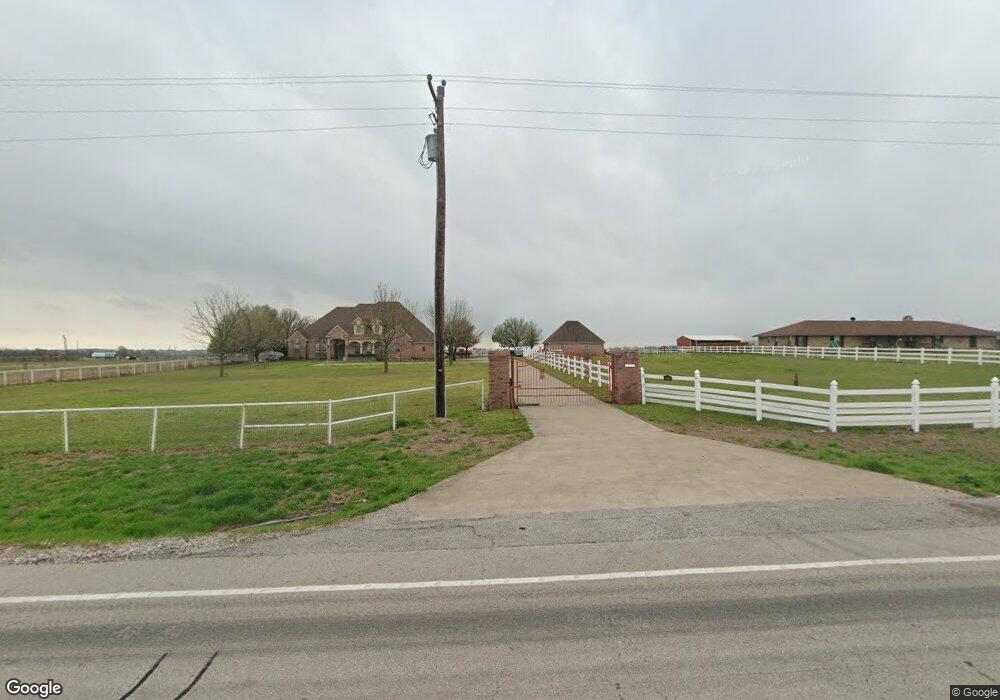
10543 Fm 455 W Sanger, TX 76266
Estimated Value: $791,000 - $809,000
3
Beds
3
Baths
2,562
Sq Ft
$313/Sq Ft
Est. Value
About This Home
This home is located at 10543 Fm 455 W, Sanger, TX 76266 and is currently estimated at $800,690, approximately $312 per square foot. 10543 Fm 455 W is a home located in Denton County with nearby schools including Chisholm Trail Elementary School, Clear Creek Intermediate School, and Sanger Sixth Grade Campus.
Ownership History
Date
Name
Owned For
Owner Type
Purchase Details
Closed on
Apr 14, 2014
Sold by
Austin Sammy Ray
Bought by
Bono William K and Bono Sherri
Current Estimated Value
Home Financials for this Owner
Home Financials are based on the most recent Mortgage that was taken out on this home.
Original Mortgage
$307,200
Outstanding Balance
$88,090
Interest Rate
3.38%
Mortgage Type
New Conventional
Estimated Equity
$712,600
Purchase Details
Closed on
Nov 13, 2000
Sold by
Preas Danny
Bought by
Marnell Austin Louis and Marnell Austin
Create a Home Valuation Report for This Property
The Home Valuation Report is an in-depth analysis detailing your home's value as well as a comparison with similar homes in the area
Home Values in the Area
Average Home Value in this Area
Purchase History
| Date | Buyer | Sale Price | Title Company |
|---|---|---|---|
| Bono William K | -- | None Available | |
| Marnell Austin Louis | -- | -- |
Source: Public Records
Mortgage History
| Date | Status | Borrower | Loan Amount |
|---|---|---|---|
| Open | Bono William K | $307,200 |
Source: Public Records
Tax History Compared to Growth
Tax History
| Year | Tax Paid | Tax Assessment Tax Assessment Total Assessment is a certain percentage of the fair market value that is determined by local assessors to be the total taxable value of land and additions on the property. | Land | Improvement |
|---|---|---|---|---|
| 2025 | $9,574 | $783,453 | $369,816 | $413,637 |
| 2024 | $10,727 | $790,348 | $0 | $0 |
| 2023 | $8,939 | $739,720 | $369,816 | $446,458 |
| 2022 | $9,788 | $590,147 | $230,210 | $407,841 |
| 2021 | $7,298 | $500,173 | $120,100 | $380,073 |
| 2020 | $6,863 | $436,828 | $120,100 | $316,728 |
| 2019 | $7,321 | $447,329 | $120,100 | $327,229 |
| 2018 | $7,023 | $425,945 | $120,100 | $305,845 |
| 2017 | $7,096 | $427,318 | $120,100 | $307,218 |
| 2016 | $7,264 | $437,490 | $120,100 | $317,390 |
| 2015 | -- | $4,181 | $1,201 | $2,980 |
Source: Public Records
Map
Nearby Homes
- 10543 Fm 455 W
- 10455 Fm 455 W
- 10901 Fm 455 W
- TBD Dyer Rd
- 10350 W Clear Creek Rd
- 10902 Clear Creek Rd W
- 9494 Waide Rd
- 13257 W Fm 455
- 11007 Farm To Market Road 2450
- 9725 Atcheson Rd
- 12880 Pruett Rd
- 12890 Pruett Rd
- 9191 Lamar St
- 16384 Farm To Market Road 1173
- 12480 Doyle Rd
- 7221 Christina Ct
- 12142 Fm 2450
- 7239 Christina Ct
- 7220 Christina Ct
- 10916 Fm 2450
- 10571 Fm 455 W
- 10713 Fm 455 W
- 10455 Fm 455 W Unit LAND
- 10300 Farm To Market 455 W
- 10314 Fm 455 W
- 10300 Fm 455 W
- 10035 Forester Rd
- 10200 Fm 455 W
- 10130 Forester Rd
- 10340 Dyer Rd
- 10164 Dyer Rd
- 10133 Dyer Rd
- 11129 Fm 455 W
- 10240 Freeman Rd
- 17336 Forester Rd
- 9968 Freeman Rd
- 10493 Dyer Rd
- 10689 Dyer Rd
- 10400 Dyer Rd
- 10614 Forester Rd