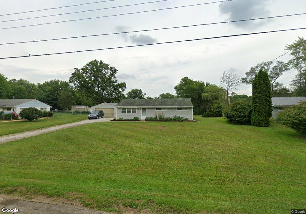
10544 Dot Ave NE Alliance, OH 44601
Estimated Value: $164,981 - $222,000
3
Beds
1
Bath
1,092
Sq Ft
$170/Sq Ft
Est. Value
About This Home
This home is located at 10544 Dot Ave NE, Alliance, OH 44601 and is currently estimated at $185,495, approximately $169 per square foot. 10544 Dot Ave NE is a home located in Stark County with nearby schools including Marlington High School and Regina Coeli/St Joseph School.
Ownership History
Date
Name
Owned For
Owner Type
Purchase Details
Closed on
May 29, 1997
Sold by
Dillon Lois A
Bought by
Burger Jerry B
Current Estimated Value
Home Financials for this Owner
Home Financials are based on the most recent Mortgage that was taken out on this home.
Original Mortgage
$58,565
Outstanding Balance
$8,591
Interest Rate
8.27%
Mortgage Type
New Conventional
Estimated Equity
$176,904
Create a Home Valuation Report for This Property
The Home Valuation Report is an in-depth analysis detailing your home's value as well as a comparison with similar homes in the area
Purchase History
| Date | Buyer | Sale Price | Title Company |
|---|---|---|---|
| Burger Jerry B | $68,900 | -- |
Source: Public Records
Mortgage History
| Date | Status | Borrower | Loan Amount |
|---|---|---|---|
| Open | Burger Jerry B | $58,565 |
Source: Public Records
Tax History
| Year | Tax Paid | Tax Assessment Tax Assessment Total Assessment is a certain percentage of the fair market value that is determined by local assessors to be the total taxable value of land and additions on the property. | Land | Improvement |
|---|---|---|---|---|
| 2025 | -- | $42,530 | $21,880 | $20,650 |
| 2024 | -- | $42,530 | $21,880 | $20,650 |
| 2023 | $1,086 | $30,840 | $11,620 | $19,220 |
| 2022 | $1,090 | $30,840 | $11,620 | $19,220 |
| 2021 | $1,093 | $30,840 | $11,620 | $19,220 |
| 2020 | $1,066 | $26,780 | $10,010 | $16,770 |
| 2019 | $1,058 | $26,780 | $10,010 | $16,770 |
Source: Public Records
Map
Nearby Homes
- 10684 Dot Ave NE
- 10645 Wilma Ave NE
- 10666 Wilma Ave NE
- 10580 Heltman Ave NE
- 0 Meadow St NE
- 0 W Main St Unit 5090123
- 13004 Edison St NE
- 0 Westwood St
- 13109 Edison St NE
- 1235 Spring Ridge Cir Unit 17A
- 1601 Raywood Rd
- 347 Buckeye Ave
- 550 Johnson Ave
- 1114 Briarcliff Ave
- 432 Johnson Ave
- 1310 Overlook Dr
- 8539 Schubert Ave NE
- 664 Fairview Place
- 160 Bonnieview Ave
- 1156 Parkside Dr
- 10530 Dot Ave NE
- 10570 Dot Ave NE
- 10545 Barcus Ave NE
- 10588 Dot Ave NE
- 10567 Barcus Ave NE
- 10533 Barcus Ave NE
- 10545 Dot Ave NE
- 10533 Dot Ave NE
- 10567 Dot Ave NE
- 10585 Barcus Ave NE
- 12414 Beeson St NE
- 10606 Dot Ave NE
- 10585 Dot Ave NE
- 12390 Beeson St NE
- 10605 Barcus Ave NE
- 12464 Beeson St NE
- 10605 Dot Ave NE
- 10530 Barcus Ave NE
- 10626 Dot Ave NE
- 12380 Beeson St NE
Your Personal Tour Guide
Ask me questions while you tour the home.