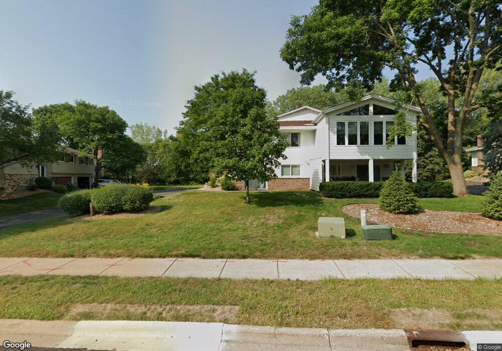
10546 Decatur Ave S Bloomington, MN 55438
West Bloomington NeighborhoodEstimated Value: $224,000 - $241,000
2
Beds
1
Bath
1,065
Sq Ft
$217/Sq Ft
Est. Value
About This Home
This home is located at 10546 Decatur Ave S, Bloomington, MN 55438 and is currently estimated at $230,724, approximately $216 per square foot. 10546 Decatur Ave S is a home located in Hennepin County with nearby schools including Normandale Hills Elementary School, Olson Middle School, and Jefferson Senior High School.
Ownership History
Date
Name
Owned For
Owner Type
Purchase Details
Closed on
Aug 9, 2019
Sold by
Eason Tess Elizabeth and Eason Aaron P
Bought by
Galovich Cassie
Current Estimated Value
Home Financials for this Owner
Home Financials are based on the most recent Mortgage that was taken out on this home.
Original Mortgage
$166,250
Outstanding Balance
$145,604
Interest Rate
3.7%
Mortgage Type
New Conventional
Estimated Equity
$85,120
Purchase Details
Closed on
Aug 31, 2005
Sold by
Torres Jose Contreras and Rubio Leticia
Bought by
Schmerler Nicholas and Schmerler Tess
Purchase Details
Closed on
May 30, 2003
Sold by
Beeman Cheryl
Bought by
Rubio Leticia and Torres Jose Contreras
Create a Home Valuation Report for This Property
The Home Valuation Report is an in-depth analysis detailing your home's value as well as a comparison with similar homes in the area
Home Values in the Area
Average Home Value in this Area
Purchase History
| Date | Buyer | Sale Price | Title Company |
|---|---|---|---|
| Galovich Cassie | $175,000 | Partners Title Llc | |
| Schmerler Nicholas | $170,000 | -- | |
| Rubio Leticia | $164,500 | -- |
Source: Public Records
Mortgage History
| Date | Status | Borrower | Loan Amount |
|---|---|---|---|
| Open | Galovich Cassie | $166,250 |
Source: Public Records
Tax History Compared to Growth
Tax History
| Year | Tax Paid | Tax Assessment Tax Assessment Total Assessment is a certain percentage of the fair market value that is determined by local assessors to be the total taxable value of land and additions on the property. | Land | Improvement |
|---|---|---|---|---|
| 2024 | $2,570 | $219,600 | $63,200 | $156,400 |
| 2023 | $2,616 | $229,600 | $63,200 | $166,400 |
| 2022 | $2,237 | $218,200 | $63,200 | $155,000 |
| 2021 | $2,118 | $190,200 | $59,200 | $131,000 |
| 2020 | $2,099 | $182,900 | $57,600 | $125,300 |
| 2019 | $2,221 | $177,100 | $57,400 | $119,700 |
| 2018 | $1,992 | $165,000 | $57,800 | $107,200 |
| 2017 | $1,778 | $129,700 | $50,200 | $79,500 |
| 2016 | $1,888 | $130,600 | $46,000 | $84,600 |
| 2015 | $1,878 | $124,800 | $44,400 | $80,400 |
| 2014 | -- | $115,900 | $43,200 | $72,700 |
Source: Public Records
Map
Nearby Homes
- 10462 Decatur Ave S
- 9579 Falcons Way
- 10434 Decatur Ave S
- 10405 Decatur Ave S
- 10417 Fawns Way
- 10707 Yukon Ave S
- 7920 W 107th Street Cir
- 10127 Trotters Path
- 10181 Wild Duck Pass
- 8149 W 103rd St
- 10433 Utah Rd
- 7534 Landau Dr
- 8022 W 111th St Unit 8022
- 10170 Utah Ave S
- 10281 Arrowwood Dr
- 10509 Purdey Rd
- 10675 Cavallo Ridge
- 10246 Lee Dr
- 7518 W 110th St
- 10907 Rhode Island Ave S
- 10548 Decatur Ave S
- 10540 Decatur Ave S
- 10544 Decatur Ave S
- 10554 Decatur Ave S
- 10542 Decatur Ave S
- 10538 Decatur Ave S
- 10550 Decatur Ave S
- 10536 Decatur Ave S
- 10555 Decatur Ave S
- 10556 Decatur Ave S
- 10557 Decatur Ave S
- 10552 Decatur Ave S
- 10532 Decatur Ave S
- 10549 Decatur Ave S
- 10534 Decatur Ave S
- 10558 Decatur Ave S
- 10562 Decatur Ave S
- 10559 Decatur Ave S
- 10547 Decatur Ave S
- 10530 Decatur Ave S