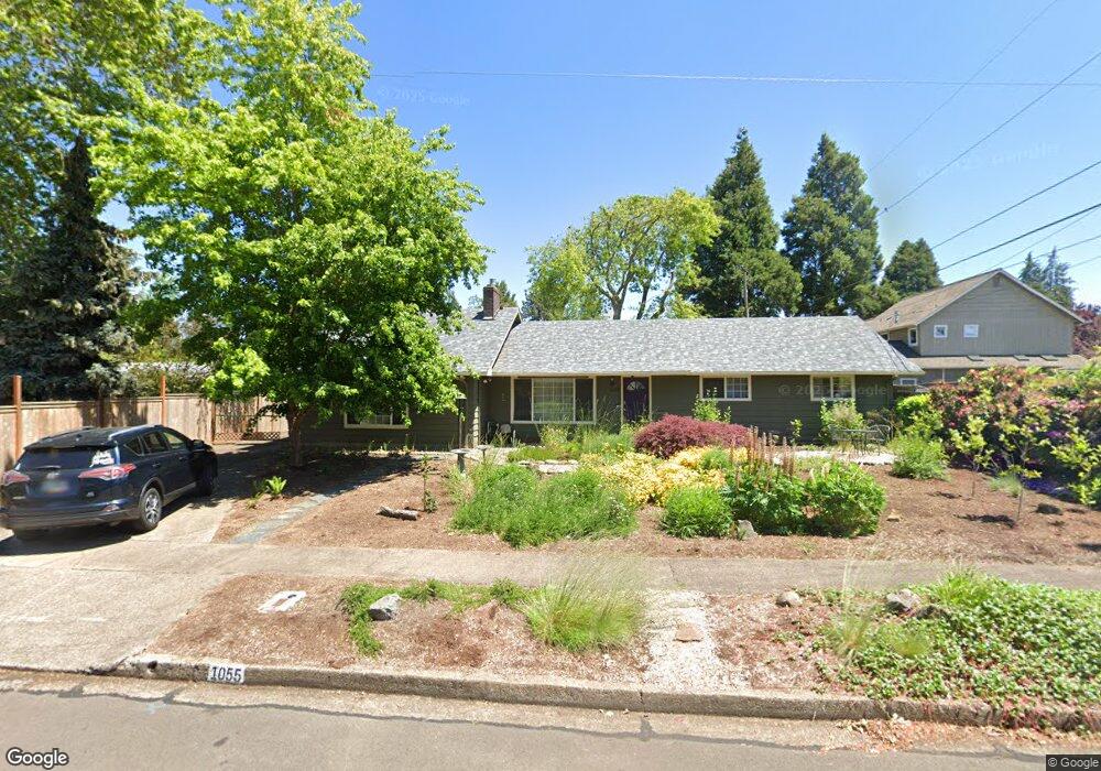
1055 Corydon St Eugene, OR 97401
Cal Young NeighborhoodEstimated Value: $535,000 - $603,000
4
Beds
2
Baths
2,068
Sq Ft
$279/Sq Ft
Est. Value
About This Home
This home is located at 1055 Corydon St, Eugene, OR 97401 and is currently estimated at $577,397, approximately $279 per square foot. 1055 Corydon St is a home located in Lane County with nearby schools including Willagillespie Elementary School, Monroe Middle School, and Sheldon High School.
Ownership History
Date
Name
Owned For
Owner Type
Purchase Details
Closed on
Oct 10, 2025
Sold by
Borella Paul and Borella Deborah
Bought by
Borella Joint Trust and Borella
Current Estimated Value
Purchase Details
Closed on
Nov 16, 2005
Sold by
Holfert Max C
Bought by
Borella Paul and Borella Deborah
Home Financials for this Owner
Home Financials are based on the most recent Mortgage that was taken out on this home.
Original Mortgage
$230,320
Interest Rate
5.93%
Mortgage Type
Fannie Mae Freddie Mac
Purchase Details
Closed on
Mar 25, 2005
Sold by
Harrison Richard B and Harrison Cynthia J
Bought by
Holfert Max C
Home Financials for this Owner
Home Financials are based on the most recent Mortgage that was taken out on this home.
Original Mortgage
$179,200
Interest Rate
5.87%
Mortgage Type
New Conventional
Create a Home Valuation Report for This Property
The Home Valuation Report is an in-depth analysis detailing your home's value as well as a comparison with similar homes in the area
Home Values in the Area
Average Home Value in this Area
Purchase History
| Date | Buyer | Sale Price | Title Company |
|---|---|---|---|
| Borella Joint Trust | -- | None Listed On Document | |
| Borella Paul | $287,900 | Fidelity National Title Insu | |
| Holfert Max C | $224,000 | Fidelity National Title Insu |
Source: Public Records
Mortgage History
| Date | Status | Borrower | Loan Amount |
|---|---|---|---|
| Previous Owner | Borella Paul | $230,320 | |
| Previous Owner | Holfert Max C | $179,200 |
Source: Public Records
Tax History
| Year | Tax Paid | Tax Assessment Tax Assessment Total Assessment is a certain percentage of the fair market value that is determined by local assessors to be the total taxable value of land and additions on the property. | Land | Improvement |
|---|---|---|---|---|
| 2025 | $5,656 | $290,310 | -- | -- |
| 2024 | $5,586 | $281,855 | -- | -- |
| 2023 | $5,586 | $273,646 | -- | -- |
| 2022 | $5,233 | $265,676 | $0 | $0 |
| 2021 | $4,915 | $257,938 | $0 | $0 |
| 2020 | $4,933 | $250,426 | $0 | $0 |
| 2019 | $4,764 | $243,133 | $0 | $0 |
| 2018 | $4,484 | $229,177 | $0 | $0 |
| 2017 | $4,249 | $229,177 | $0 | $0 |
| 2016 | $4,044 | $222,502 | $0 | $0 |
| 2015 | $3,906 | $216,021 | $0 | $0 |
| 2014 | $3,821 | $209,729 | $0 | $0 |
Source: Public Records
Map
Nearby Homes
- 950 Coburg Rd
- 820 Lariat Dr
- 2355 Pioneer Pike
- 2872 Suffolk Ct
- 600 Cherry Dr Unit 8
- 2250 Turnberry Ct
- 2746 Harlow Rd
- 347 Rustic Place Unit 14
- 3025 Bailey Ln
- 2150 Greenview St
- 2994 Dapple Way
- 860 N van Duyn St
- 280 Regal Ct
- 0 Sprig Ln Unit Lot 3
- 0 Sprig Ln Unit Lot 3 766109892
- 0 Cal Young Rd Unit Lot 4
- 1943 Monterey Ln
- 825 Waverly St
- 1038 President St
- 3090 Willakenzie Rd
- 2645 Tandy Turn
- 2610 Forrester Way
- 2630 Forrester Way
- 2615 Tandy Turn
- 2651 Tandy Turn
- 2640 Forrester Way
- 2659 Tandy Turn
- 2635 Tandy Turn
- 1090 Corydon St
- 1050 Corydon St
- 1040 Corydon St
- 2668 Forrester Way
- 2665 Tandy Turn
- 2585 Tandy Turn
- 2520 Forrester Way
- 2613 Forrester Way
- 2637 Forrester Way
- 2685 Tandy Turn
- 1030 Coburg Rd
- 2603 Forrester Way
Your Personal Tour Guide
Ask me questions while you tour the home.